After Saturday’s storms, and then the blustery cold front, Houston will see a lot of sunshine. Then we’ll see another front Thursday, which should hopefully set us up for a mostly sunny holiday weekend. We can be pretty confident in this point in a rain-free Easter, at least as confident as one can be six days out.
Monday
Today should be a rather pleasant day for the region, with sunny skies, and highs around 80 degrees. South winds will pick up a bit today, so the drier air we saw this weekend will give way to rising humidity. Lows tonight will be down around 60 degrees—warmer along the coast and a bit cooler inland. One concern: Today is an ozone action day for Houston, when high levels of ozone pollution are possible.
Tuesday
As southerly winds return, we’ll see an increase in clouds on Tuesday, although the sunshine won’t go away entirely. Southerly winds will be noticeable, likely picking up to 15 to 20mph, and this increasing moisture will set the stage for some rain showers later in the week. Highs Tuesday will depend upon the extent of sunshine over your location, but probably will be in the vicinity of 80 degrees. Lows Tuesday night, as clouds build and with the influx of warmer air, are unlikely to fall much below 70.

Wednesday and Thursday
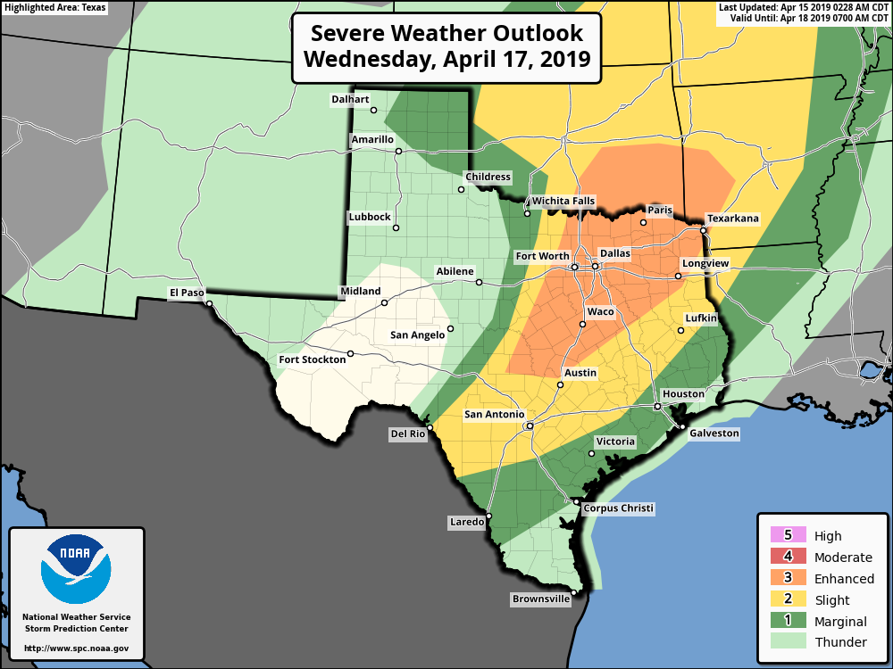
The region’s next cold front will approach the region on Wednesday, and bring with it the potential for severe weather. At this point, it looks like the best dynamics for stronger storms will occur to the north and northwest of Houston, particularly along the I-35 corridor from the Dallas-Fort Worth area south to Austin. We’ll continue to monitor the potential for more local storms, however.
For Houston, our best guess at this point is lower rain totals of about 0.5 inch along the coast, rising to 1.0 or 1.5 inches for inland areas such as The Woodlands and points north. In terms of timing, the best chance for showers will likely come from Wednesday afternoon through Thursday morning, with highs in the low 80s Wednesday, and mid-70s on Thursday.
Easter weekend
Thursday’s front should set up a fine weekend for the region. Sunny skies will reign on Friday and Saturday, and we should see at least partly sunny skies on Sunday. Look for highs in the 70s Friday, low 80s on Saturday, and then perhaps low-to-mid 80s on Sunday. The key for Easter will be the timing of moisture return—the later it occurs after Thursday’s front, the more sunnier and less humid Sunday will be. At this point, I think, we can be reasonably confident that it will not rain on the holiday.