Good morning. Today’s likely our last day as warm as the mid-70s for quite some time, as we should see a couple of fronts over the next week that will limit our high temperatures. We’re not going to see any temperatures too cold either, so there should be no concerns about freezes.
Tuesday
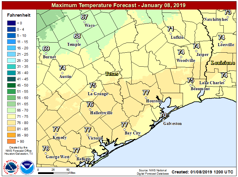
The warmer temperatures this morning—upper 50s to low 60s across most of the region—are contributing to the development of some fog over inland areas. This should clear before 9am. Partly sunny skies should help temperatures reach the mid- or even upper-70s this afternoon before a cold front pushes through the region later this afternoon and early evening.
This is likely to be a dry frontal passage due to a capping inversion, or warmer air aloft that limits the ability of air at the surface to rise. Cooler and drier air will follow the front, with lows tonight in the low 50s for most of Houston.
Wednesday and Thursday
Winter-like temperatures return. Look for highs in the 60s and lows in the 40s, with mostly sunny skies on Wednesday and some returning clouds on Thursday.

Friday
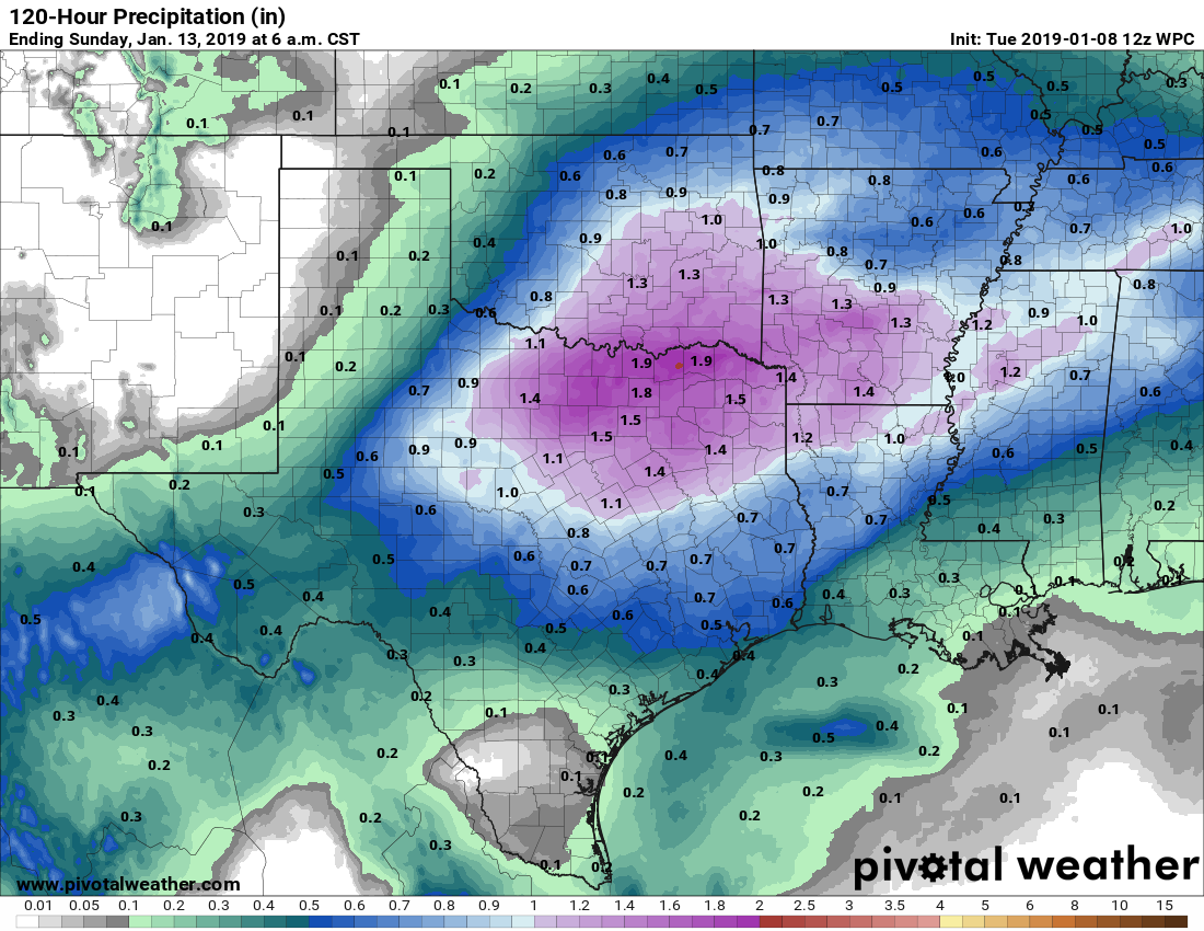
The next cold front approaches the area on Friday, and this one will have a better chance of generating some rainfall. Again, we don’t see anything too extreme with this front, perhaps one-half inch of rain or so for most people. The chance for severe weather appears low at this time. The best chance for showers should come Friday afternoon, evening, and during the overnight hours.
Saturday and Sunday
After the rains end, Saturday should be a nice day, with partly to mostly sunny skies, and highs in the mid-60s. After a cold night in the 40s, Sunday should be similar, although we can’t rule out some clouds returning later in the day, with some showers Sunday night.
Next week and the Houston Marathon
The early part of next week looks fairly cool, with a few days of highs in the 50s, before a warm-up into the 60s or low 70s beginning on Wednesday or so. Right now there is no clear model consensus on conditions for the weekend of the Houston Marathon, which takes place on Sunday, Jan. 20. The ensemble solutions are all over the place—for example, the European model’s temperature range from the 10th to 90th percentile for the morning of the marathon ranges from 40 degrees to 64 degrees, with an ensemble mean of 50 degrees. Not particularly helpful, yet.
🙂 “Winter-like temperatures” of highs in 60’s and lows in 40’s . . . . 🙂 So much better than 10 below and snow blizzards up north!
My reaction too. To me, 60 degree highs and 40 degree lows IS spring!
To me, 60 highs and 40 lows is well nigh perfect.
It almost hit 80 yesterday!
When will we see more really cold weather?
In maybe 5 or 10 years.
love this winter type…lived in NY for 15 years, boy i couldn’t do the long freezing winters anymore!!