In the wake of Tuesday evening’s front, it’s a fairly quiet forecast for Houston over the next several days with no real extreme weather ahead—just some sunshine, a little bit of rain, and mostly cooler but not particularly cold temperatures over the next seven days. We’re also continuing to track the forecast for Houston Marathon, which has the potential to be pretty great, but also a steamy mess.
Wednesday
With high pressure moving into place over Houston, we’ll see a pleasant day, with mostly sunny skies and high temperatures in the mid-60s. Light northeasterly winds will be bringing additional dry air into the region today, and with partly cloudy skies tonight we should see temperatures drop down to near 40 degrees in most of the city.
Thursday
Winds will shift to come from the east on Thursday, and the mixing in of some clouds should help to limit high temperatures to about 60 degrees. This will probably be a day when you want a light jacket. Overnight temperatures Thursday will be a bit warmer, with mostly cloudy skies keeping most of the region in the mid- to upper-40s.

Friday
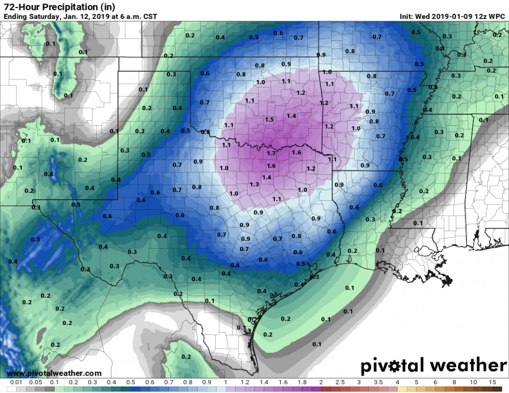
The next cold front and associated storm system will work its way through Texas on Friday, and toward Houston by Friday evening or so. As we’ve been suggesting, the better dynamics for heavy rain with this system will be north of Houston, and we’re not anticipating more than a few tenths of an inch for most people—a few areas may see as much as 1 inch of rain—from Friday evening through Saturday. Highs Friday will be in the mid-60s.
Saturday and Sunday
Any lingering rains should end by or before noon on Saturday, and we should see some clearing skies after that point. Highs likely will be in the low or mid-60s depending on the extent of sunshine. After a cool night in the 40s, Sunday should see highs of around 60 degrees with partly to mostly sunny skies. We can’t entirely rule out some scattered showers on Sunday as another upper-level disturbance passes the area. Any rains from this would likely be brief.
Next week and the Houston Marathon
The early part of next week will be chilly, with high temperatures in the 50s, but after this point we should see a fairly robust warming trend into the lower 70s by Friday or so. Winter will turn to spring.
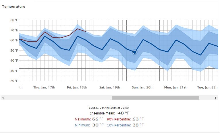
At this point, if you’re running the Houston Marathon, you’d better be hoping that a front makes it through before Sunday, otherwise it’s going to be a fairly warm affair. Climatology would suggest that we get a front sometime in the Thursday through Saturday period of next week, and a fair number of ensemble members of the GFS and European models indicate the same. But it is by no means a slam dunk at this point. The GFS ensembles for the morning of Sunday, Jan. 20th show a probable range of temperatures from 33 degrees to 55 degrees. The European ensemble, shown below, shows a most probable range from 38 degrees to 63 degrees.
There is also the scenario in which a front moves through on Sunday morning, during the race itself, which could make for a wet and windy affair. I’d love to be able to offer you more certainty, but until there’s a modicum of agreement in the global model ensembles, it’s hard to have too much confidence in a forecast. Lord help us all if it is 63 degrees and humid that morning.
Sedate is great.
Is there a winter this year?