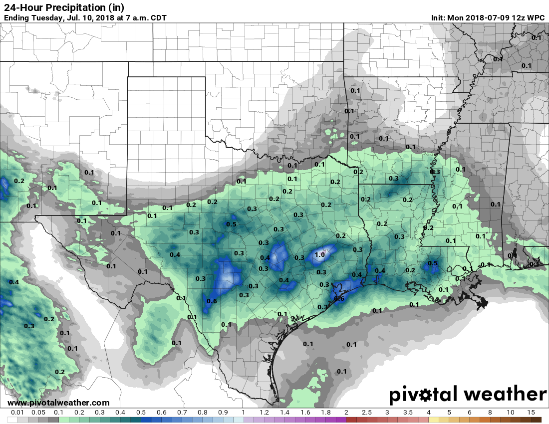
As expected, Sunday saw a burst of heavier rain showers across the area, with a few parts southern and eastern parts of the region (such as League City) picking up 3 inches. Fortunately these heavier rains moved on, because in some cases the rainfall rates exceeded 5 inches/hour over 15-minute periods. We’ll see the potential for more of the same today before our weather pattern takes a turn toward drier (although still very humid) conditions.
Monday
Plenty of atmospheric moisture remains spread across the Houston area today, but there’s not as much impetus for it to rise in the atmosphere. For this reason, I think we’ll see the potential for heavy showers on Monday, but they probably won’t be quite so widespread as we saw on Sunday. Nevertheless, where strong storms do develop, they will certainly be capable of causing some temporary street flooding. For this reason, beginning around noon today, it’s probably best to check the radar before making a trip across town. Mostly cloudy skies should help keep daytime temperatures at 90 degrees, or just below.
Tuesday and Wednesday
Atmospheric moisture levels (presently at about the 99th percentile for this time of year) should fall beginning Tuesday. With less moisture to work with, and high pressure moving in from the north, we expect to see a gradually diminished rain chances beginning Tuesday and Wednesday—probably only a 30 to 40 percent chance of moderate showers. With sunnier skies, we can correspondingly expect highs to nudge back up into the steamy lower- or mid-90s.

Thursday and Friday
By the end of the work week, I expect rain chances to be pretty slim, although non-zero, as mostly sunny skies come to dominate Houston’s weather. Expect highs in the mid-90s.
Saturday and Sunday
Unlike the pattern we sometimes see during the summer, however, at this time I don’t expect high pressure to build completely over the region. This means the forecast for this weekend remains somewhat in question, and we can’t rule out the return of some scattered showers for Saturday and Sunday. I feel pretty confident in predicting heat in the mid-90s, however.
Tropics
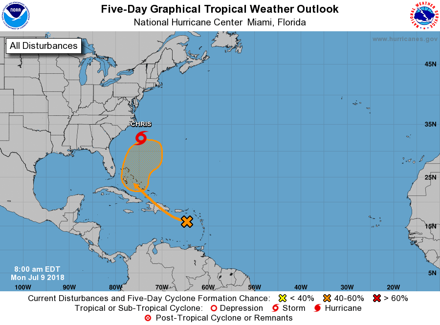
The Atlantic tropics have seen a burst of early July activity, but nothing that resembles any kind of a threat to Texas. Hurricane Beryl flared up on Friday, and then died out as it reached the Caribbean Sea. Tropical Storm Chris remained well off the mid-Atlantic coast of the United States.
As a reminder, the peak of hurricane season for Texas begins in about three weeks.
I’ve been looking at various statistics and have been trying to boil down: after what week (in September?) do we see a drop in the chance of heavy tropical weather along the TX gulf coast?
Another way of putting the question: it looks like late August thru mid September is the peak time, how steep is the drop off of tropical activity after that?
I believe the NHC’s data shows Sept 10-12 as the peak of landfalls. But while the probability or activity drops, that doesn’t mean we’re safe from a “Big One” just because of the date. Personally, I stay prepared with all the suggested supplies until mid-October, including 20 gal of gasoline in case we need to “leave town.” We live in The Woodlands, some 80 miles from the coast, but had trees knocked down by Ike in 2008.
And remember everyone, if you have a tank water heater, you have 30-50 gallons of safe drinking water in the event of a “boil order” or complete loss of water supply. Turn off the heater, close the inlet valve to keep it safe. Fill bathtubs before a storm for toilet and bathing purposes. Even that bath tub water can be made safe by adding 8-12 drops of plain, unscented chlorine bleach per gallon. So keep an eye dropper in your safety kit.
On or around Sept. 24th is when the chances of a Texas hurricane strike fall dramatically.
Thanks Eric that’s the answer I was looking for.
I’m looking at scheduling a surgery that will leave me at home for a while with reduced mobility, so it’s nice to have a statistical date to plan around.
Of course it can flood any day around here LOL.
Eric, quick question about the Saharan dust plume that hit. A couple days after, I felt like spring hay fever season, nasal drip, sneezing, etc. Any plausibility that this plume brought in some weird pollen from Africa?
I would guess that the dust itself might be the irritant.
Thanks. I knew that could be the case as well, forgot to note it.
Eric…first, thanks again for your and Matt’s continued dedication to countering “fake-news” weather info…different subject…I found this quite interesting on today’s Chronicle weather page…for this date in 1939 the record high was 105 with a record low of 70…that had to have been a spectacular front!
Neat watching these storms pop up on the GOES-East loop.
Mazel Tov to Matt on his mention in the Washington Post today! Here’s a link for other folks:
Record heat put thousands of Californians in the dark Friday. Scientists predicted this from climate change.
https://wapo.st/2m6dfAw