The overall pattern remains more or less the same. We’re going to have one more potentially wet day—although as we saw Tuesday, these showers are most definitely hit or miss—before things begin to dry out on the Fourth of July and then remain that way for awhile.
Wednesday
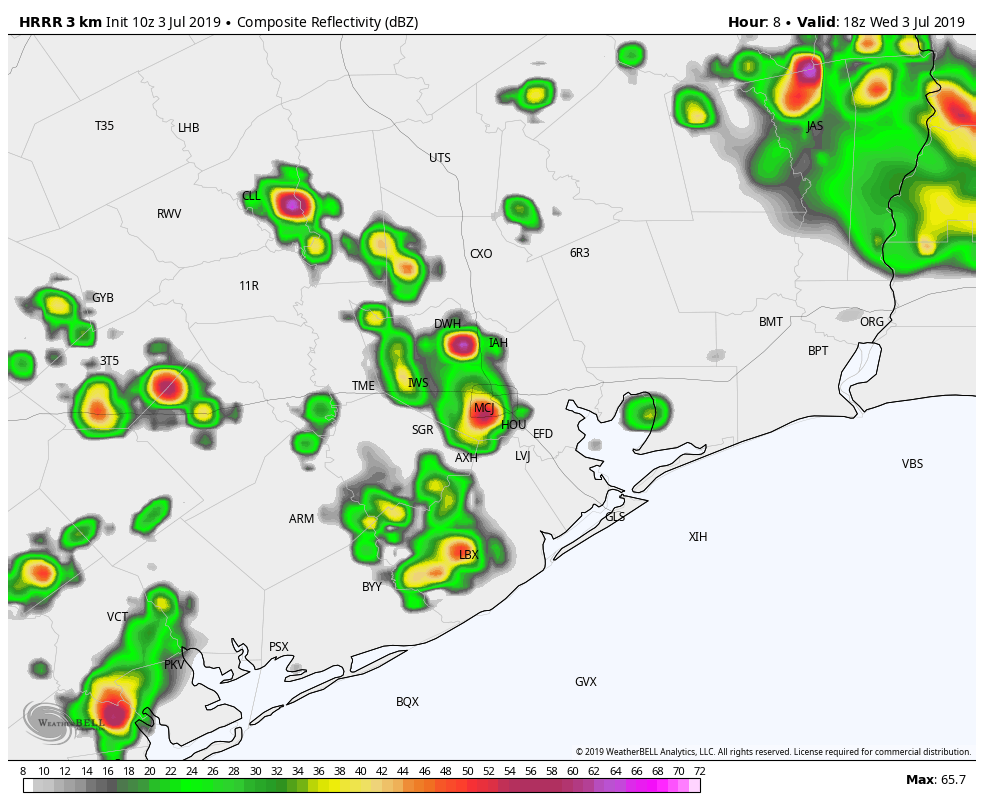
We’re still feeling the effects of tropical moisture pushing in from the Gulf of Mexico, and some of the high-resolution models are fairly bullish on rain totals for today. But at the same time, there’s no significant forcing to really generate sustained, heavy rainfall. So I think like we saw Tuesday, there may be a few isolated areas that see 3 inches of rain, but for the most part, most of the city should see 1 inch of rain or less. In any case, the biggest threat is probably some brief street flooding. We’ve got one more day with potential highs in the 80s before Houston begins to experience more typical summertime heat.
Fourth of July
Rain chances for Houston will fall down to below 20 percent, but we can’t entirely rule out some daytime showers. An atmospheric disturbance will linger north of the region, so areas along and north of Texas 105 may see better rain chances during the daytime. With partly sunny skies, highs probably will get into the low 90s for most of Houston. Almost everyone should see partly cloudy skies, temperatures in the 80s, and no rain for fireworks.

Friday
High pressure really begins to take control of Houston’s weather on Friday, with mostly sunny skies and high temperatures in the low 90s. Overnight lows probably will fall into the mid-70s for inland areas, but be closer to 80 degrees along the coast. Hello, July!
Saturday and Sunday
The story will be more or less the same for the weekend, with high temperatures creeping up into the mid-90s with mostly to completely sunny skies.
Early next week
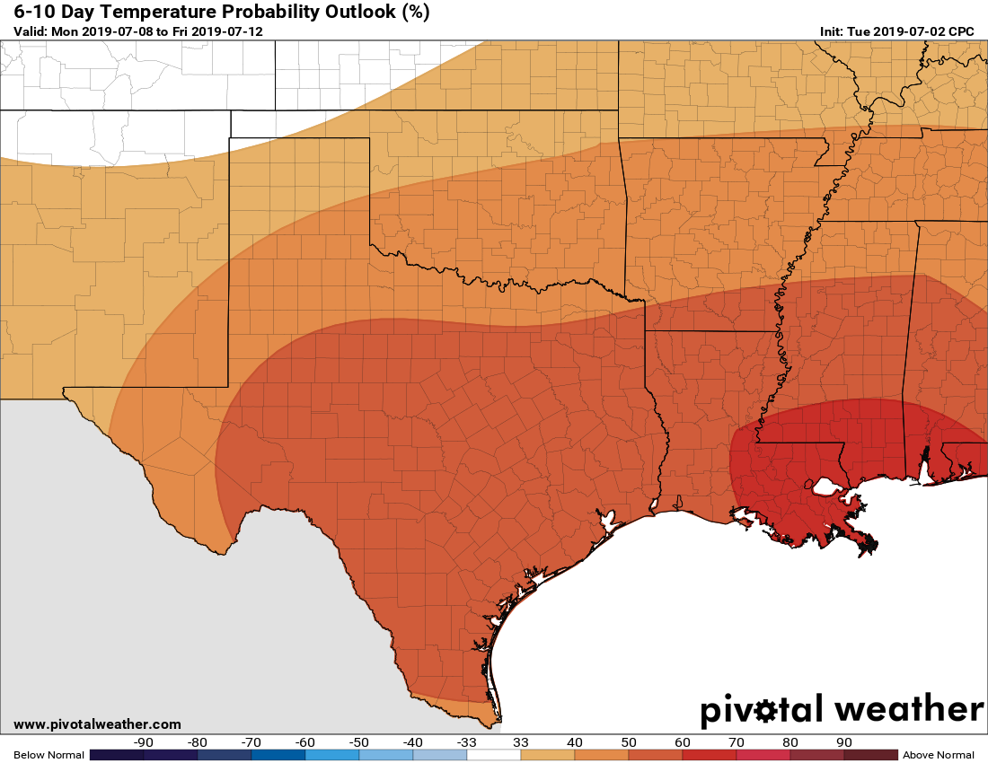
High pressure looks most likely to retain control over our weather through at least Tuesday or Wednesday of next week, so any rain showers we see will be brief, and mainly driven by the seabreeze pushing inland during the afternoon hours. But probably, almost no one will see rain. Highs will remain in the mid-90s.
Next rain chances?
Both the European and GFS model show a slight uptick in rain chances by Friday or so of next week, but the signal is not exactly strong, and because its nine days away it’s hard to have too much confidence.
Unless the forecast varies dramatically, Matt and I will be taking the Fourth of July holiday off, and we’ll be back on Friday.
Thanks guys. Have a great Independence Day!!
Thank you. Hope you and your families have a wonderful 4th of July!!!!
No! Go away high pressure, and stay away (unless there’s a hurricane coming)
Eric & Matt…have a pleasant and safe 4th…wake up on the 5th with 8 fingers and 2 thumbs!
Thank you for your consistent and non alarming weather reporting! You guys are the best! Happy Independence Day! Blessings to you both!