As promised, things quieted down nicely on the Fourth after some morning fireworks. This time of year, it’s always difficult to say whether it’s good news or bad news to have “nice” weather for an extended stretch. Those cooling showers can be welcome in midsummer, but we will be void of them almost completely through the weekend. Stick with us til the end of today’s post as we will discuss some possible tropical mischief in the Gulf for late next week.
Today & weekend
Basically, if you have outdoor plans this weekend, your only concern will be heat. Expect sunshine in heaping quantities today, tomorrow, and Sunday. A shower is always possible in summer, but almost all of us should be dry through the weekend. We will see high temperatures in the mid-90s and lows bottoming out in the mid-70s the next few days. Humidity, as it always is in summer, will be high across the region. So, just take it easy and stay hydrated this weekend.
Monday & Tuesday
We will probably see an extension of this dry, sunny, hot pattern into early next week. Expect ample sunshine and only very, very minor shower chances Monday and Tuesday. We will call it more mid-90s both days with mid- to upper-70s for lows.
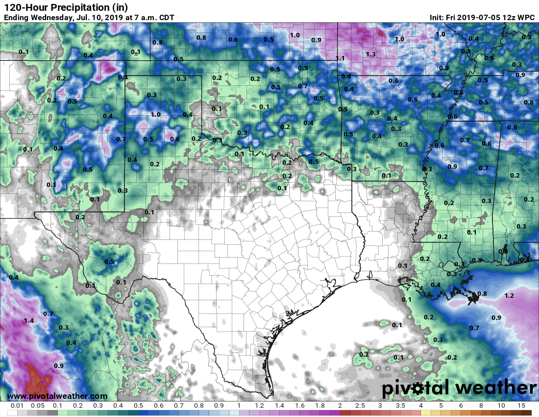
Yeah, it looks pretty dry the next 5 days.

Later next week
The forecast gets a little trickier after Tuesday or Wednesday of next week, and it will likely involve our first legitimate area of interest in the Gulf this hurricane season. At this time, the good news for Houston is that most reliable modeling shows this possible system staying mostly an issue for Louisiana and points east. So for now, it’s a curiosity more than a concern. But let’s dive in a little deeper on what’s happening here.
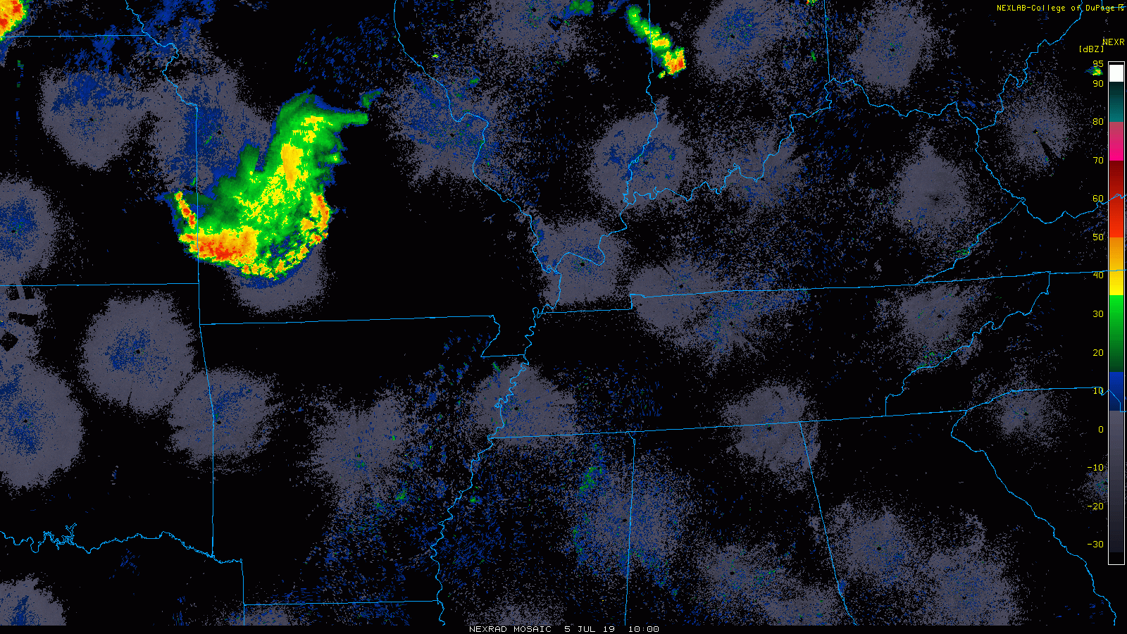
An area of thunderstorms over Missouri this morning is tied to a disturbance in the upper atmosphere. Over the next several days, this disturbance is going to migrate southeast toward the Gulf. I’ve taken the upper map on the European operational model below, and I’ve annotated it to show you where this particular model is tracking that disturbance.
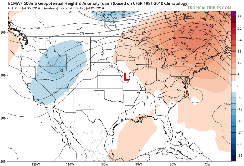
Bear in mind that this is one solution from one deterministic model, and unlikely to be the answer key. I am just doing this to show you how a disturbance over Missouri could lead to a tropical system off Florida one week from today. There will be other players involved here as well, so I would probably call this a “hybrid” type system. But whatever happens under the hood here, a disturbance is a disturbance.
So, in general, a disturbance should arrive by Wednesday or Thursday of next week in or near the Eastern Gulf. From there, models diverge a good bit as to where things may go. A very small minority of ensemble members (~10-15%) bring this west along the Gulf Coast to western Louisiana or Eastern Texas, meaning our chances are not zero. Most, however, keep it between Mississippi and the Big Bend of Florida. It’s also important to note that many ensemble members don’t develop this system at all. Uncertainty is high regarding if we get a system and what it would be.
Meteorologically though, if you look at the animation I shared above, there are two keys to what happens if we get an organized Gulf disturbance. First, we can see high pressure in the upper atmosphere, dominating Texas through Monday and Tuesday. It begins to erode and shift westward on Wednesday and Thursday. The key for us is how quickly and how strong that high pressure is when this occurs. High pressure acts as a “shield” to protect us from any tropical systems. If that shifts west too fast or weakens too much, the odds increase that at least some moisture would work west into our area late next week. The second area is the “blue” you see over the Midwest at the end of the animation. This represents a trough in the upper atmosphere. If that is strong enough, it could capture the Gulf disturbance and force it north into Florida or the Central Gulf, keeping us on the sidelines here. The timing, placement, and intensity of these two features will be equally as important to track as the disturbance itself over the next four to five days.
So to summarize, here is what we know:
- A hybrid tropical disturbance is becoming increasingly possible in the northeastern Gulf of Mexico late next week.
- As of today, only about 10-15% of reliable modeling brings it far enough west to impact us in Texas; it would most likely be a Central or Eastern Gulf problem if it even develops at all.
- These ideas can and will change between now and then.
Here is what we don’t know:
- Where will this primary disturbance over Missouri exactly track over the next few days; will it emerge in the Gulf off of Florida? Or will that be elsewhere? Alternatively, could it not happen at all?
- Will conditions be right for the disturbance to organize into a depression or storm? Or will it just remain a disorganized, but significant area of rainfall?
- How quickly will high pressure break down over Texas and shift west next week? And how strong will it be when it does so?
- How quickly and how strong will a Midwest disturbance move and be next week? Will it be enough to “capture” the Gulf disturbance and carry it northeast away from the region, or it will it leave it behind?
We will need a few days to sort things out, so look for us to take this weekend to follow model data and hopefully have better answers to these questions on Monday morning.
Is it common to have a low from the middle of the country turn into a tropical storm? I don’t recall this happening before, but I have a short meteorological memory.
It happens more often than folks realize…disturbances or dying cold fronts that lurch into the Gulf and can sort of pull together out of the blue. I would say at least every season or two we see this happen.
Thank you Matt!
At least I can finally wash my car and enjoy it for a few days