In brief: Houston’s overall pattern appears to be set for the next 10 days. We’ll be breezy, warm, and humid for the rest of this week, with the potential for some thunderstorms on Saturday as a strong front rumbles through. Then, next week looks quite a bit cooler with the potential for some nights in the 40s. Also, we’re introducing an exciting new product for younger readers. Check that out at the end of today’s post.
Tuesday
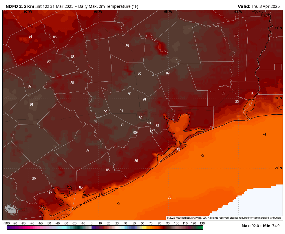
We are seeing patchy fog this morning, and that’s an indication that conditions are fairly muggy outside. It also means that winds are fairly light, but that will soon change. Beginning this afternoon winds will pick up from the south at 15 to 20 mph, with gusts up to 30 mph or so. We’re going to see fairly gusty conditions over the region for the rest of the week as a fairly tight gradient sets up. As for temperatures, we’re probably going to hold in the low- to mid-80s today, depending on the extent of cloud cover. Lows tonight will only drop into the lower 70s, so very muggy for early April.
Wednesday, Thursday, and Friday
The second half of the work week will bring similar, but still warmer conditions. Each day will see a mixture of sunshine and clouds, with high temperatures ranging from the mid-80s to around 90 degrees. Nights will be warm and muggy. As noted above, each day will be feature a pronounced southerly wind. We cannot rule out some scattered showers on Friday afternoon or evening, but at this point it appears likely that rain will hold off until Saturday.
Saturday
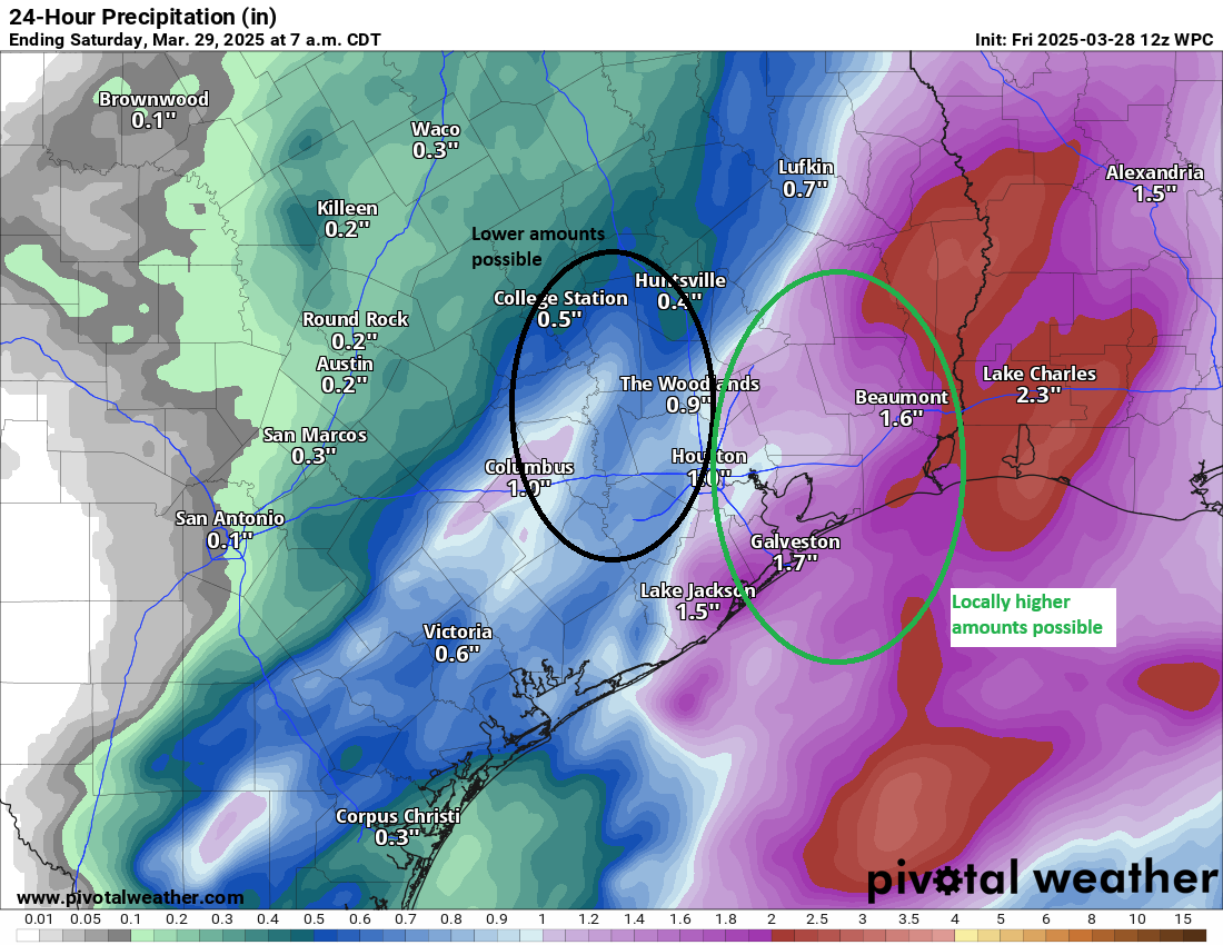
Speaking of Saturday, there’s the possibility of some strong thunderstorms to go along with a frontal passage. This will be a rather strong front for April, so the setup for severe weather will be in place, but at this point we cannot have too much confidence in the details. In any case, know there is the potential for some storms on Saturday, with details to come. Highs likely will reach the mid-80s, but again this is dependent upon the timing of the front. Some showers may linger into Saturday night, when lows drop into the 50s.
Sunday
I expect some clouds to linger on Sunday, and the combination of overcast skies and the influx of cooler air my limit high temperatures in the 60s. Lows on Sunday night will likely drop into the upper 40s for inland areas, and lower 50s closer to the coast.
Next week
Much of next week looks sunny and cooler, with highs in the upper 60s to 70s, and nights in the 40s and 50s. We’ll probably be back in the 80s by Thursday or so, but humidity levels should remain relatively low. Enjoy the dry air, as it is not clear how much more we’re going to see this spring.
Introducing Hype+
Today I’m excited to announce a new product from Space City Weather that we’re calling Hype+. Although anyone may become a member of the Hype+ community, we’re targeting this service at younger readers who want a faster-paced forecast. We are well aware that many people in their teens and twenties are far less accustomed to reading longer stories and posts online. We typically write 500 to 1,000 words per update. Matt, bless his heart, sometimes writes half a novel.
That’s why we’re introducing Hype+ today. This is a version of Space City Weather available exclusively in select apps, including Roblox, TikTok, Snapchat, and Bumble. Through a partnership with OpenAI, a special WeatherBot will summarize each post in an anime video that is 30 seconds or less.
Because younger people generally appreciate controversial or visually stimulating content, this Bot will be trained to sensationalize our posts with explosions, hurricanes, and derechos of every shape and size. Updates will automatically be inserted into your feed. Subscribers will recognize it as a post from Space City Weather because each update will be preceded by the word BREAKING with lots of exclamation points and emojis.
If you’re interested in Hype+, the service can be purchased for $4.01 a month, and at that price you’d be a fool not to take us up on it!