In brief: In this afternoon’s post we recap our rains so far and look ahead to the rest of the week. We also answer the question on everyone’s mind: Is this gonna be another Hurricane Harvey?
The situation so far
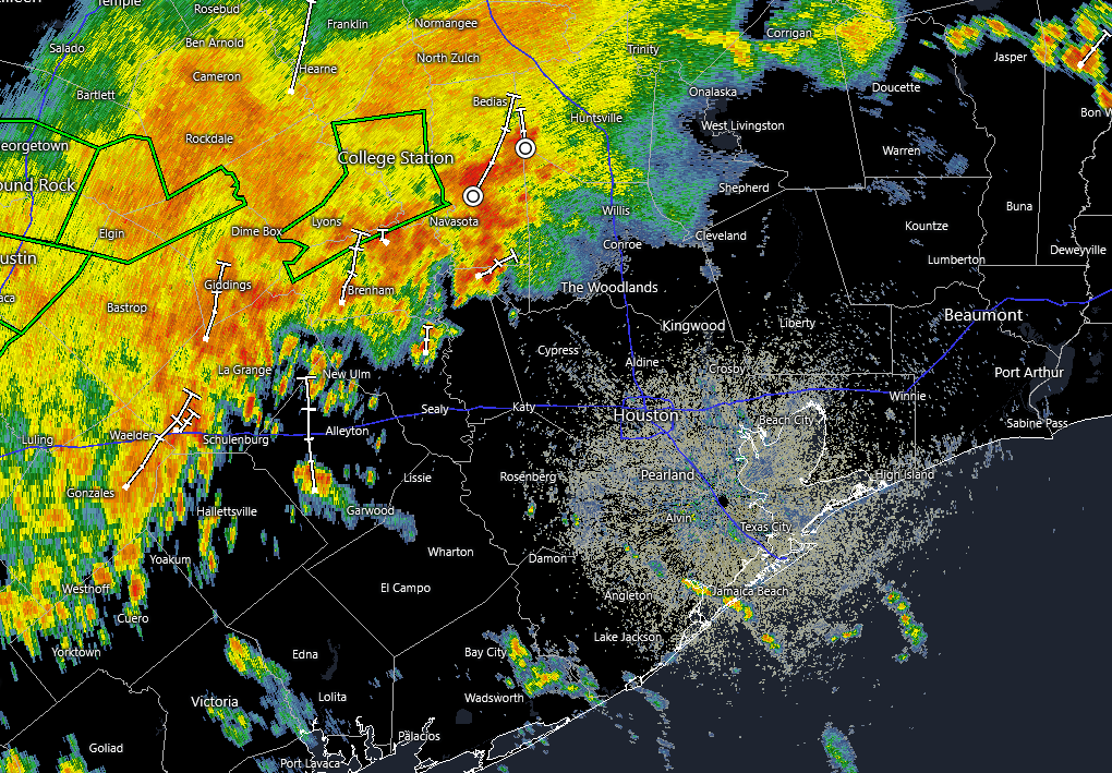
Our rains today have been well within the bounds of expectations, with most locations picking up 1 to 2 inches of rainfall. Some high water marks (pun intended) were located just northwest of central Houston, where a few spots near Inwood Forest picked up 4 inches. It has made for some messy driving, but overall there have been no major issues beyond inconveniences. Our radar is mostly quiet as of later Monday afternoon, and I’m hopeful it will remain so through the evening hours and into early Tuesday.
What happens on Tuesday?
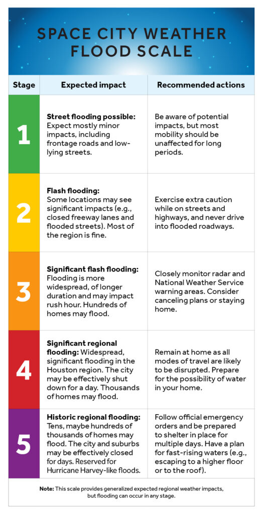
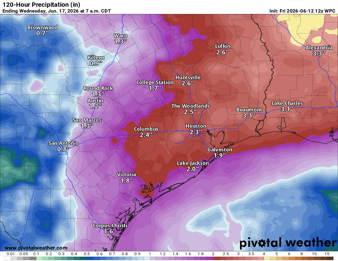
My baseline expectations are that conditions will be similar on Tuesday. We’ll probably see increasing showers and thunderstorms during the morning hours and then build to a crescendo during the middle of the day, before waning during the afternoon or evening hours. I think most areas will see an additional 1 to 2 inches with some higher bullseyes. Our Stage 2 flood alert covers this period well. That’s if things behave according to expectations and, in this atmospheric environment, we’re just going to have to wait an see.
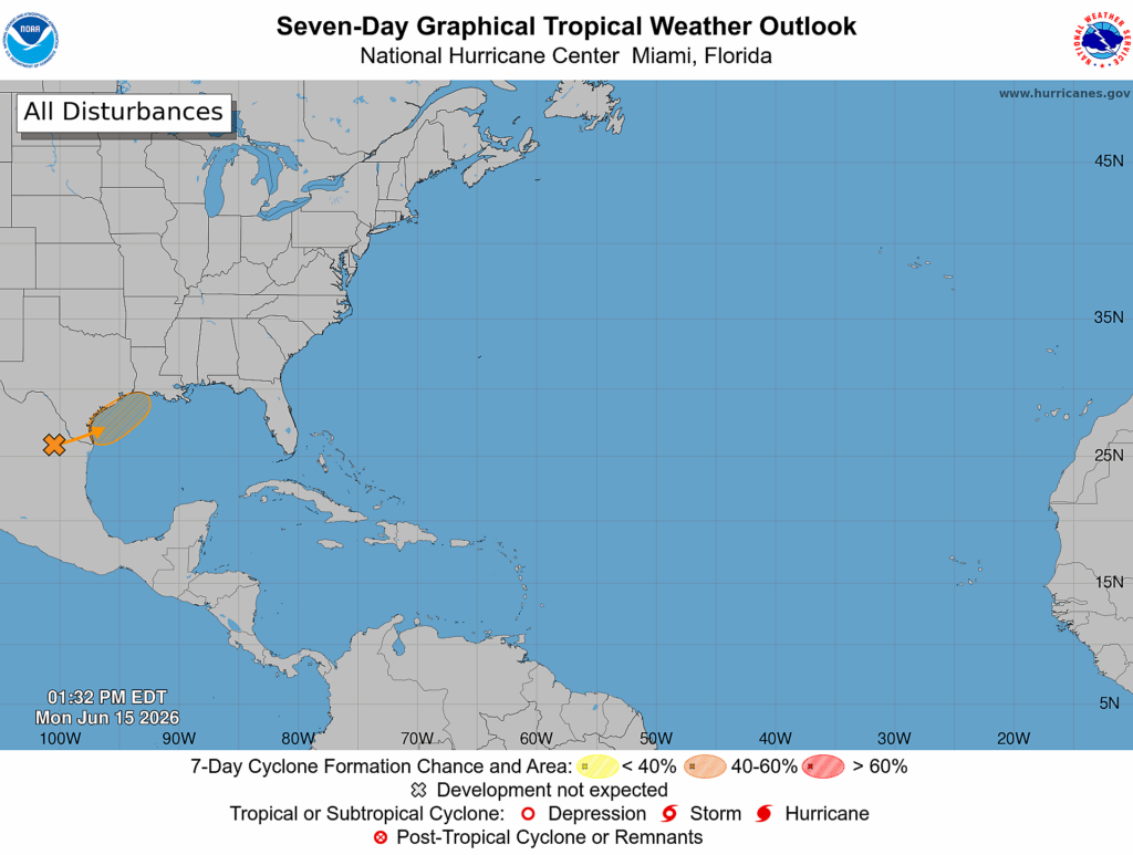
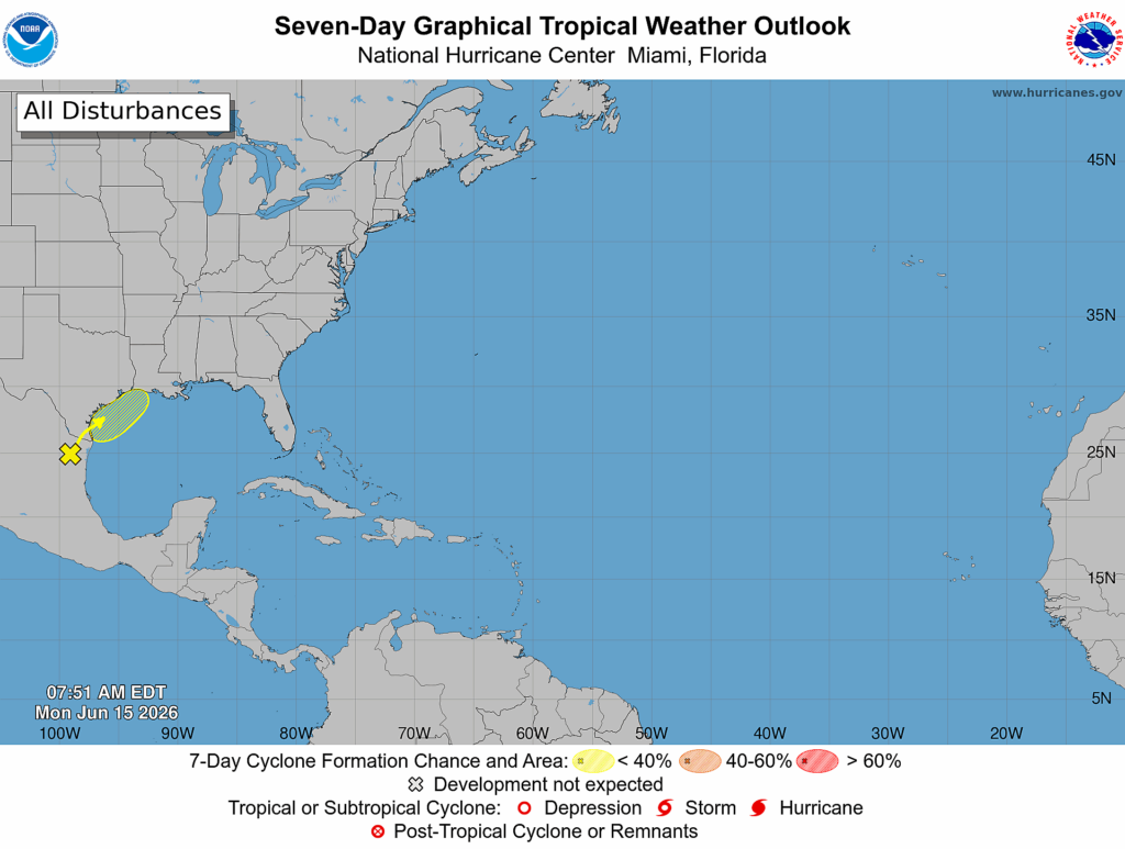
That blob in the Gulf is now orange
Yeah, we saw that too. The National Hurricane Center is now forecasting a 50 percent chance that a low pressure system will become a tropical depression or storm later this week after it moves back over the Gulf late Tuesday night or Wednesday morning. I would not focus too much on that because the impacts from this system (heavy rainfall, mostly) are going to be similar regardless of development. And it’s not like this is going to suddenly blow up into a hurricane.
Is this going to be another Hurricane Harvey?
No.
Umm, could you expand on that a little more?
Sure. Hurricane Harvey brought five days of very heavy rainfall to Houston. What we experienced today was not at all Harvey-like, and at this point I don’t expect that Tuesday will be as well. We’re seeing 2 inches of rain on the daily, not 10 inches.
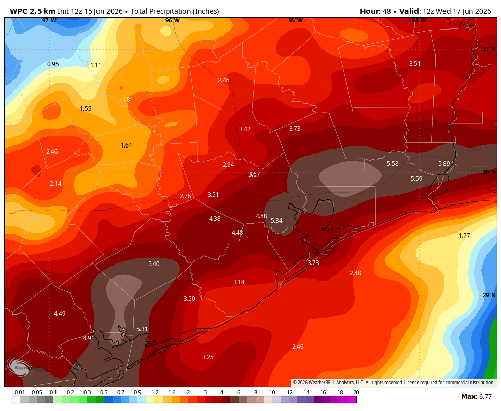
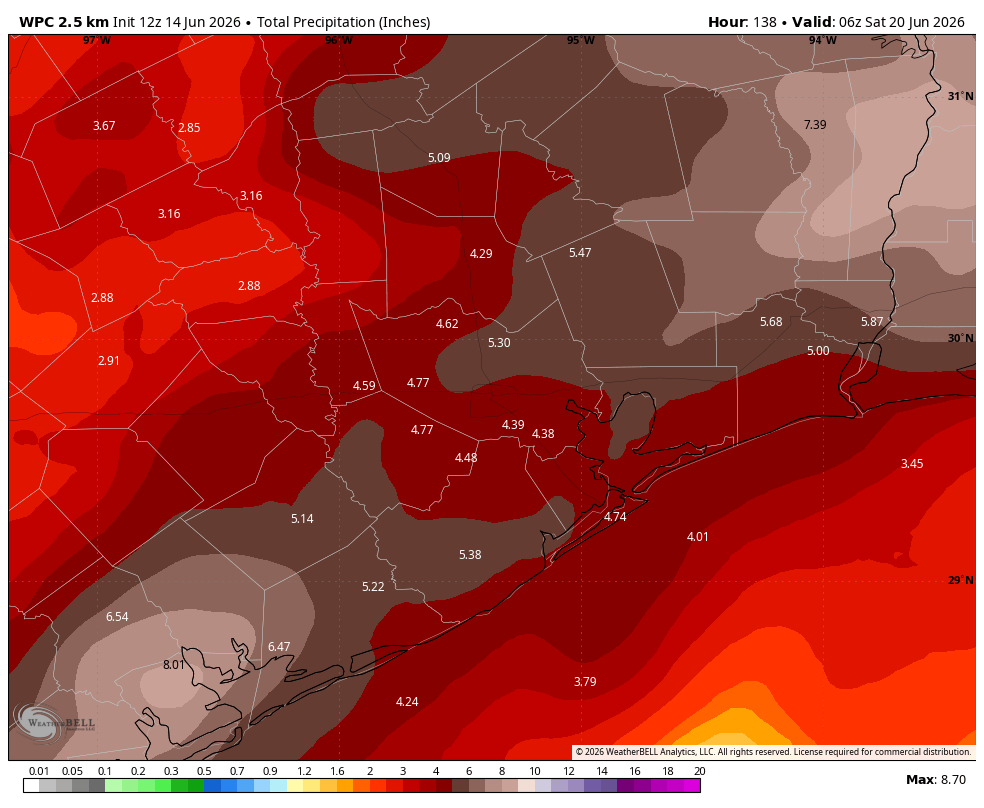
With that said we do have some concerns about Wednesday and potentially Thursday. Some of our modeling is showing 20-inch bullseyes (in terms of accumulated rainfall through Thursday) and we cannot ignore this possibility. To be clear not all of the modeling data shows this. That’s because there is not great confidence yet in the evolution of the aforementioned tropical system as to where it will go, and specifically where its hardest rains will fall. The difference between the GFS model rainfall output at 11 am today (left) and 5 pm (right) highlights this inconsistency.
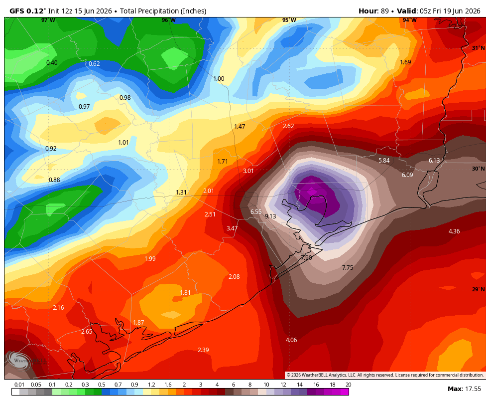
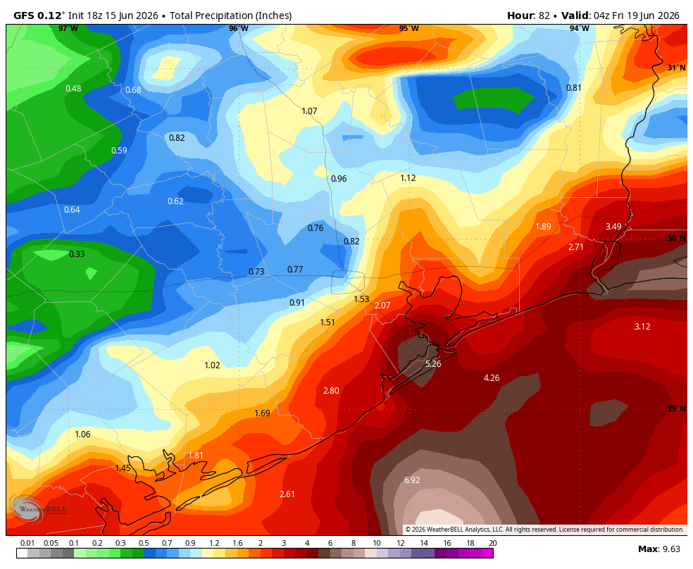
This is why we said this morning that we are monitoring trends closely for the second half of the week, and we may feel the need to escalate to a Stage 3 flood alert. But we’re not there yet. And it’s quite possible that the heavy rain misses the Houston metro area on Wednesday and Thursday, leaving us with more pedestrian-type showers. So we’re working hard to set expectations here: Yes, it could be really quite gnarly, or maybe it won’t be bad at all.
The bottom line is that this is not like Harvey when we knew some really bad stuff was coming, that it would last for several days, and that it would cover a large area. This is very unlikely to be that. Anyway, that’s what we know right now. I’m hoping to have some more clarity about the Wednesday-Thursday forecast in tomorrow morning’s post, which is when we’ll be back with you. As always, thanks for your trust and readership.