In brief: In today’s post we explain why June in Houston is about to turn sunnier and a bit hotter, and look ahead to conditions this weekend. Also, did you know there was a fairly large earthquake in the Gulf on Monday?
June so far
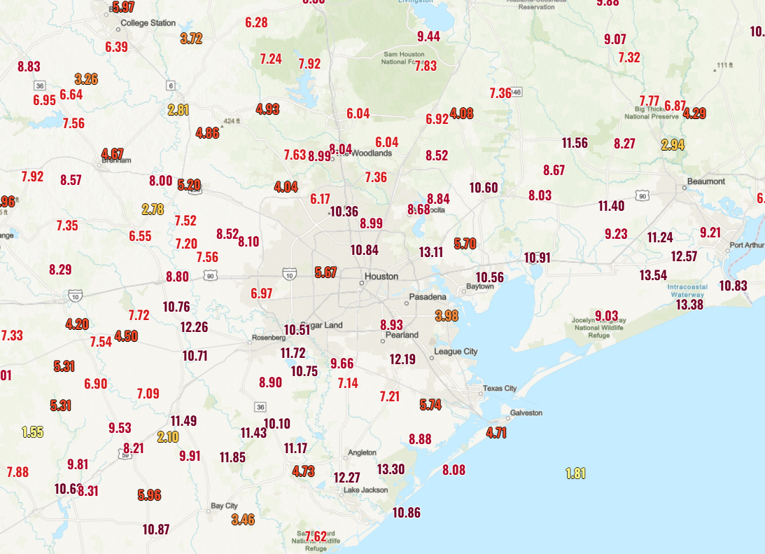
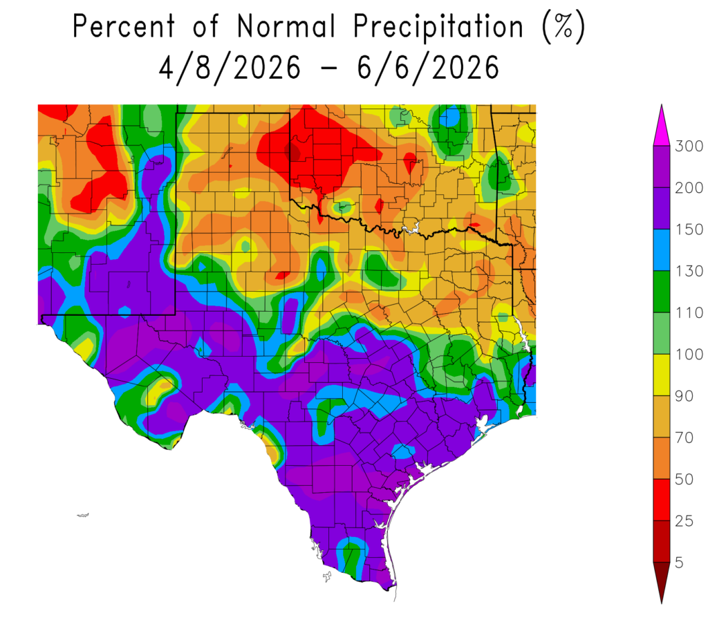
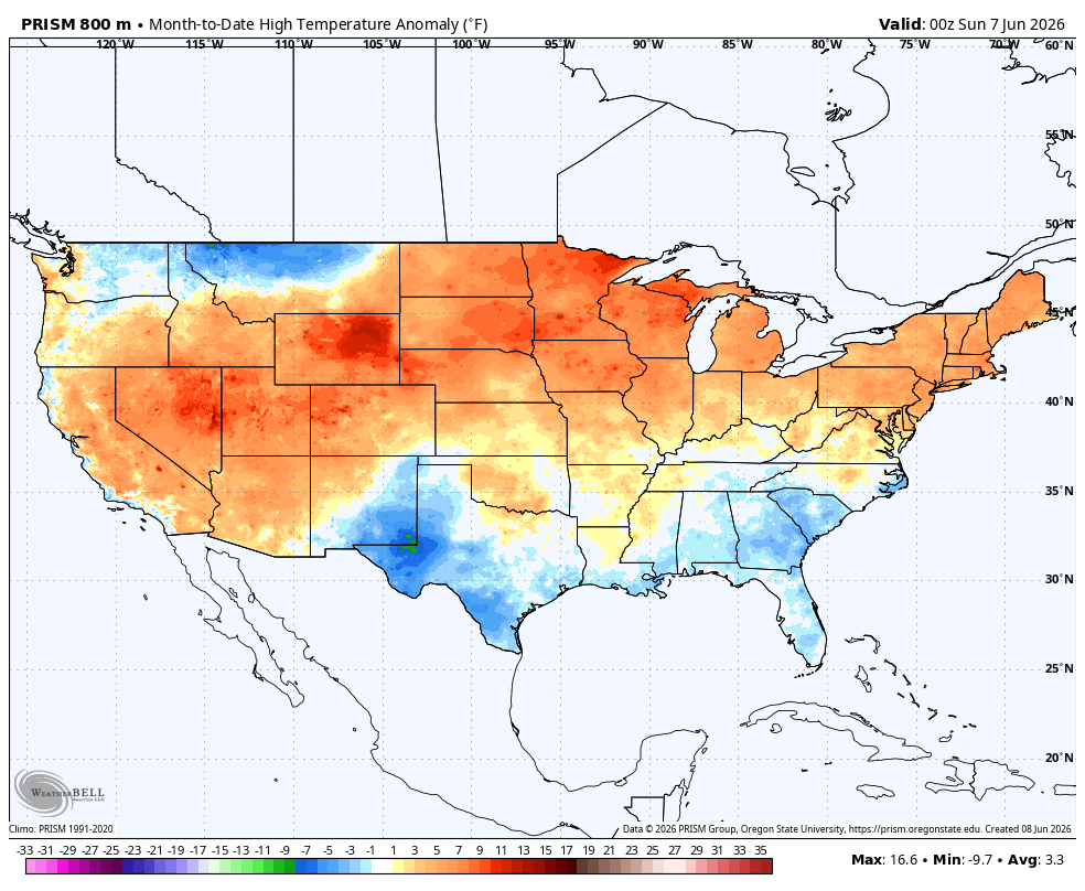
This month, to date, has seen somewhat cooler than normal weather, especially during the day. More than half of the days have not see high temperatures rise above the mid-80s in the city, and every June day so far has recorded at least a trace of rain in most parts of the area. This has kept conditions feeling slightly spring-like rather that more summer-like.
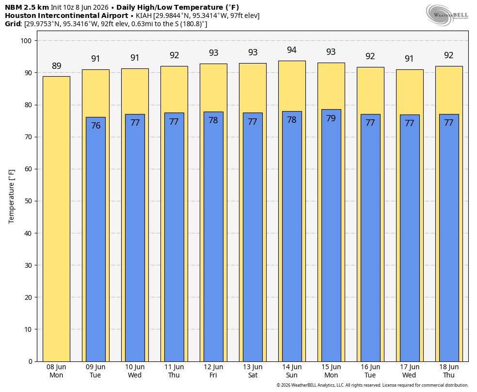
But beginning today, and probably well into the weekend, we are going to see more typical June-like weather with more daytime sunshine and somewhat hotter temperatures. Each day going forward, away from the coast, is likely to see highs ranging from 90 degrees to the lower 90s, with a smattering of afternoon showers driven by the sea breeze. In short, June weather is going to be doing what June weather does in Houston.
Tuesday
Although atmospheric moisture levels remain high, increasing high pressure will influence our weather in the days to come. It won’t entirely clamp down on rain chances, but it should diminish coverage to fairly isolated to scattered showers this afternoon along the sea breeze. Overall rain chances are likely about 20 percent. Highs will reach about 90 degrees this afternoon for most of Houston, with mostly sunny skies. Winds will be fairly light from the south before increasing a little this afternoon. Skies should be clear tonight, but lows likely will only briefly reach down into the upper 70s.
Wednesday, Thursday, and Friday
Not a whole lot changes for the rest of the work week. Highs may tick up a degree or two, but inland areas should still be in the vicinity of the low 90s, with plenty of humidity and sunshine. We will continue to see a low-end chance of rain, primarily during the afternoon hours, driven by the sea breeze. Nights will remain warm and muggy.
Saturday and Sunday
The weekend, at least to start, is likely to see a continuation of this warm pattern, with scattered to isolated showers during the afternoon. However most of our model guidance indicates that high pressure may back off somewhat by next Sunday or Monday. For now I expect mostly sunny conditions on Sunday with scattered rain showers, but that could change to slightly more rain coverage depending on the timing of high pressure easing away. Temperatures will continue to be warm and humid, regardless.
Next week
At this vantage point, at least, the first half of next week appears likely to bring better rain chances. Whether this is 40 percent each day or 70 percent is something that we’ll have to iron out as we get closer. It’s June so you can expect continued muggy weather regardless.

Eye on the Gulf
Hah, I bet you thought I was going to talk about the tropics here, didn’t you? Well, you would be wrong. Things look pretty quiet over the next 10 days in the Atlantic, with only the very slight possibility of some minor mischief in the Bay of Campeche. What I actually wanted to mention is that there was an earthquake in the Gulf on Monday. At M6.1 it was fairly strong, and by some measures it may be the strongest earthquake ever recorded in the Gulf. It occurred off the northwest tip of Cuba, and was felt as far away as in Florida. I don’t think it’s a harbinger of anything ominous, but the Earthquake Insights newsletter has some interesting speculation about its cause.