In brief: A round of storms moving into the region today should impact areas south of Houston, including southern Brazoria County which has already been hard-hit by rainfall. Storms should be more scattered in nature on Friday before the likelihood of widespread heavy rainfall ramps up over Memorial Day Weekend.
Rains recap
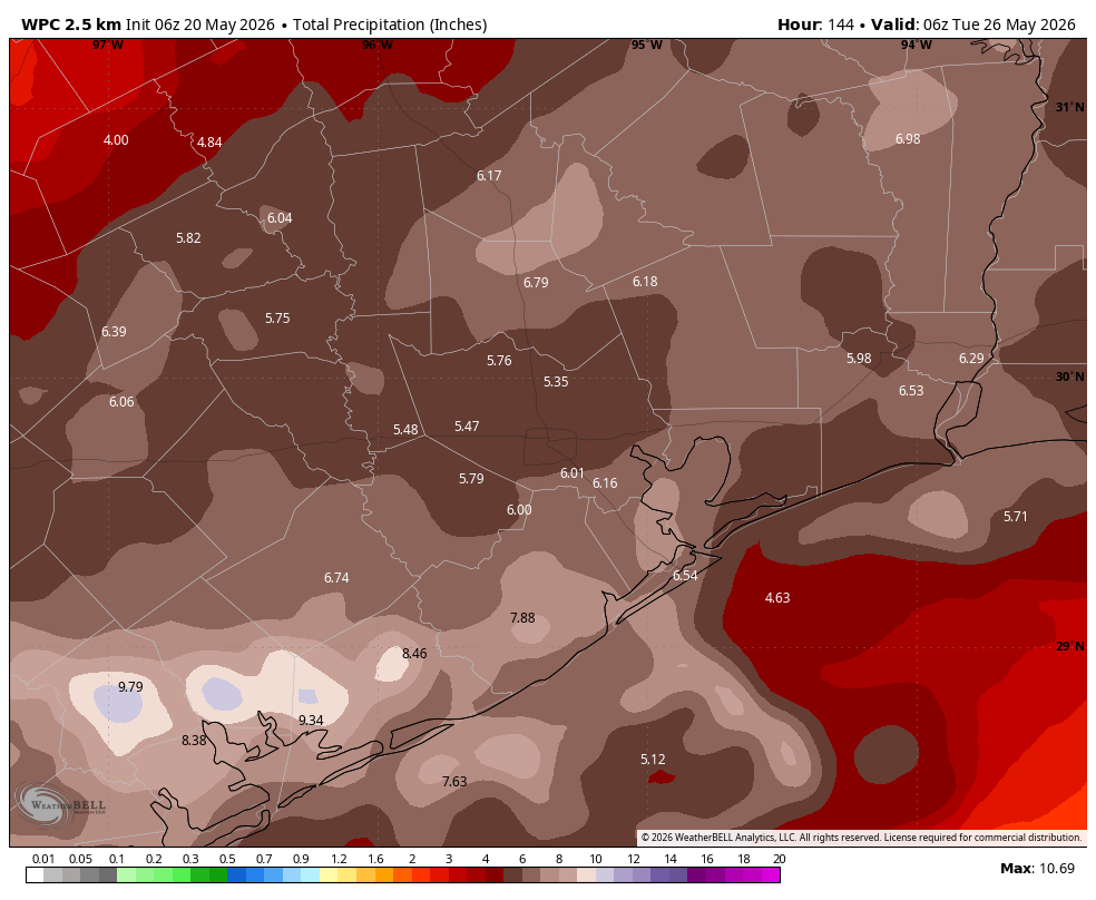
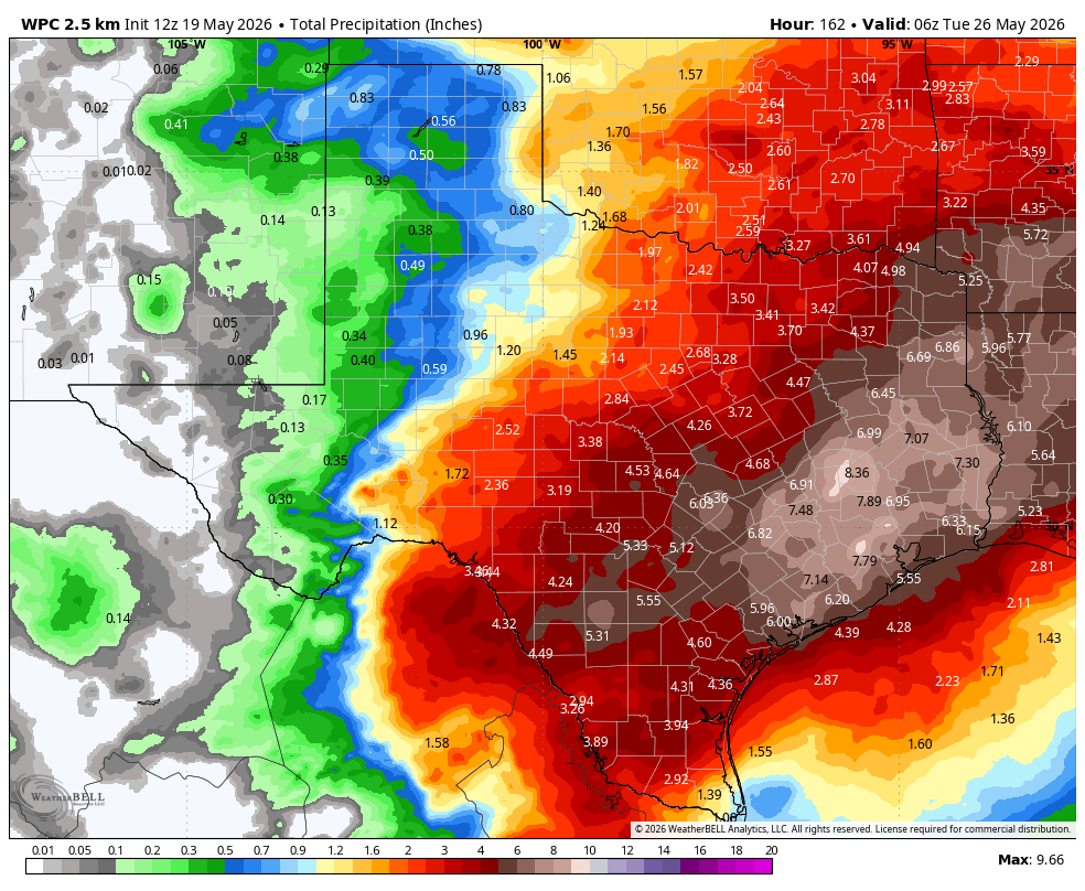
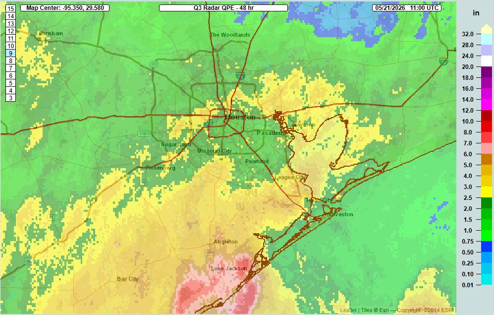
Since the beginning of these late May storms on Tuesday, most of the Houston area has picked up 1 to 3 inches of rainfall, which has been manageable. However areas south of Houston, particularly in southern Brazoria County near Angleton and Lake Jackson, have had a far wetter time of it. Some of these locations have already received 6 to 8 inches of rainfall. Unfortunately for these locations, it appears that rainfall on Thursday will be mostly concentrated over areas south of Interstate 10.
Thursday
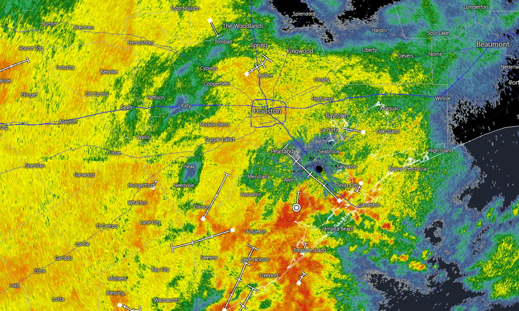
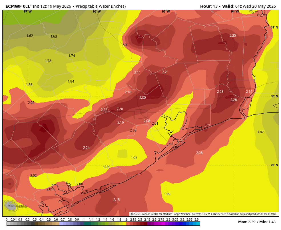
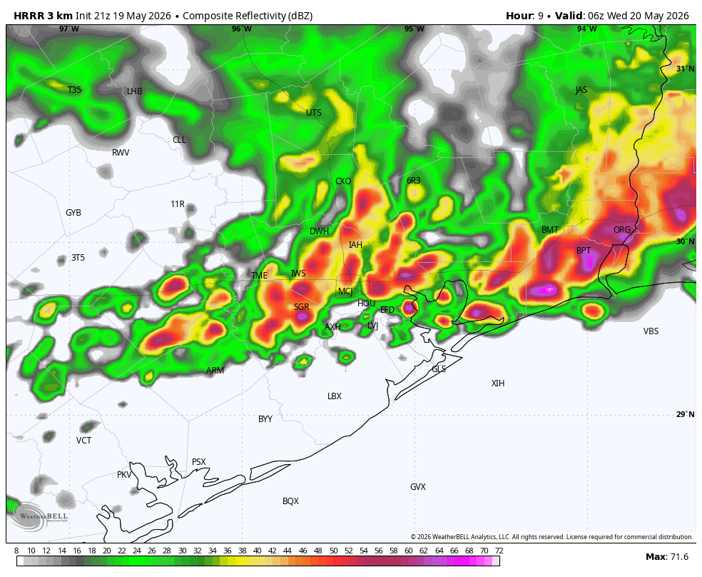
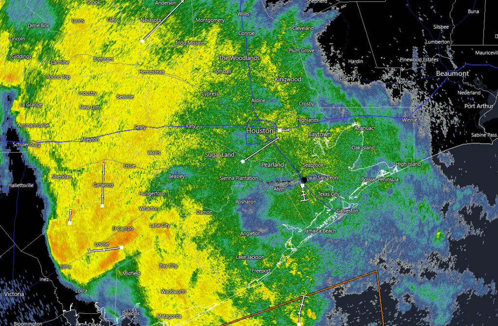
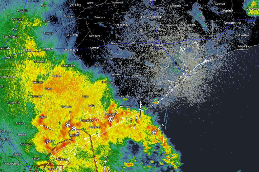
A check of the radar this morning shows a large mass of showers off to the southwest of Houston near Victoria Port Lavaca. These showers and thunderstorms should slowly move to the northeast, toward the metro area this morning. Our latest high-resolution guidance suggests these storms will largely remain confined to areas south of Interstate 10 as they move through during the morning hours, and likely exit to the east by early afternoon. Rain accumulations of 1 to 3 inches will be possible for coastal areas, but I’m hopeful that much of the heavier rain will fall just offshore.
For the rest of the Houston area rain showers and thunderstorms should be more scattered later this afternoon. Skies will be mostly cloudy with high temperatures in the upper 70s to lower 80s. (I have to say that afternoon temperatures on Wednesday afternoon were very comfortable for late May in Houston). Rain chances should be low overnight, with lows around 70 degrees.
Friday
This is looking like a day during which showers and thunderstorms are more scattered in nature rather than organized into a broader system; which is to say rain chances will be a bit lower than the weekend at about 50 percent. With mostly cloudy skies we can probably expect highs in the vicinity of 80 degrees.
Memorial Day Weekend
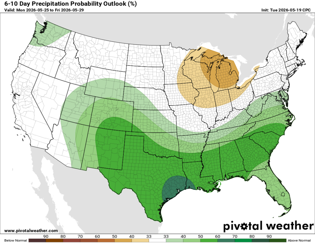
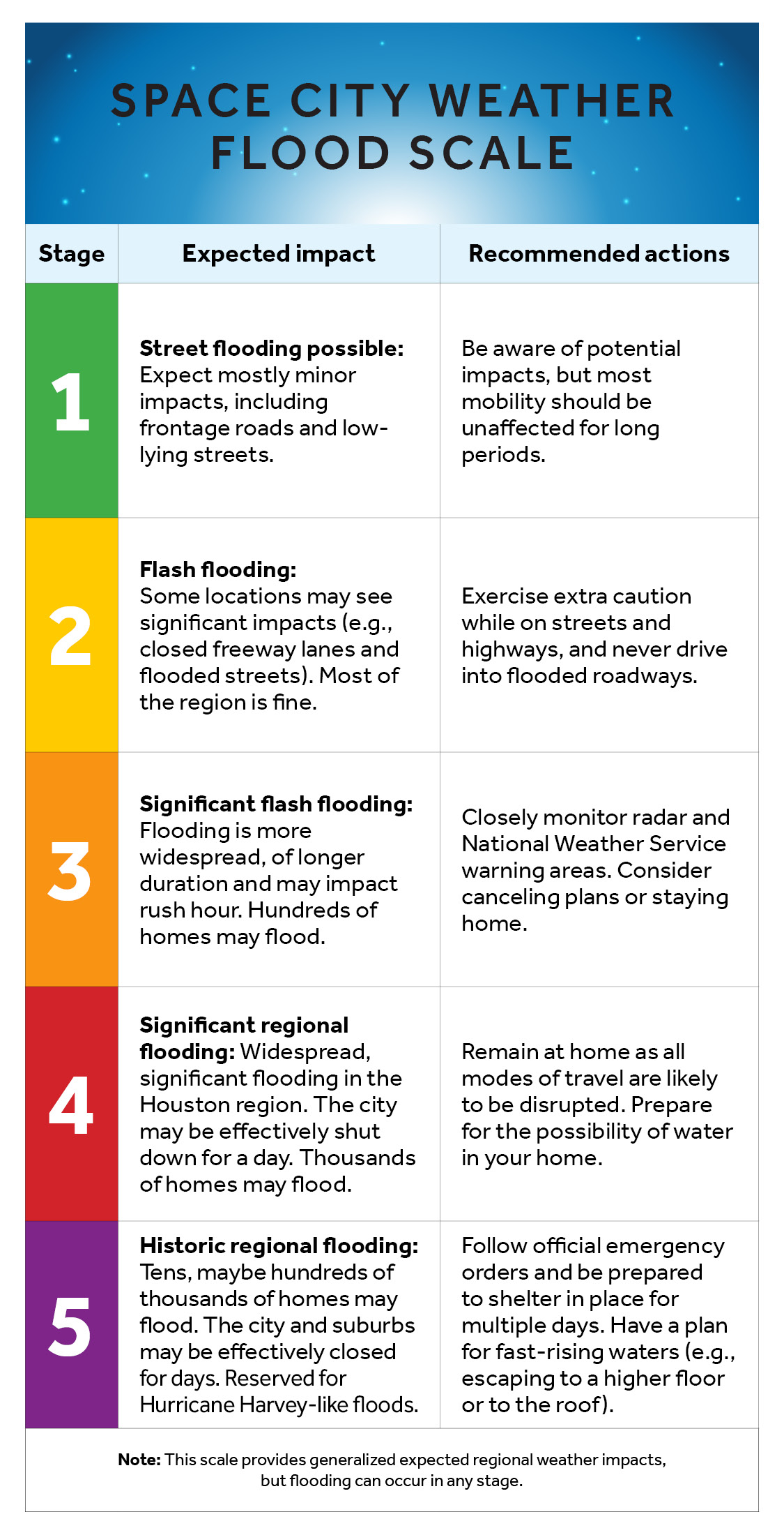
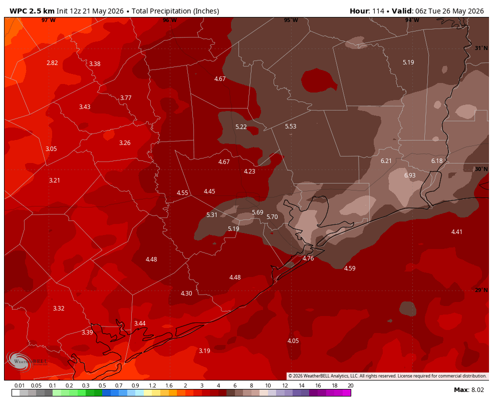
The upper-air pattern will become more amenable to supporting widespread showers and heavy rainfall this weekend as a low pressure system allows the passage of multiple disturbances over the region. Rain chances will be near 100 percent on Saturday and Sunday, and perhaps only a little bit lower on Monday. Most of the area is likely to pick up an additional 3 to 6 inches of rain this weekend, with higher isolated totals leading to at least street flooding, and possibly some flash flooding. For this reason we are maintaining our Stage 2 flood alert through the holiday weekend.
It’s still a little too early to have precise details about timing, but basically you should be prepared for some disruptions at any point this weekend. Certainly roads should be passable most of the time, but these are the conditions that support some impacts to mobility where rainfall is heaviest and/or prolonged. Basically we want you to be alert to the possibility of flooding, but not fear widespread mayhem.
High temperatures should remain in the low- to mid-80s this weekend with plenty of humidity, and nights not cooling down much. Saturday looks to be mostly cloudy, but we could see some breaks in the sky on Sunday and Monday when it’s not raining.
Next week
I don’t have great confidence in the forecast for next week. Daily rain chances continue to look healthy, perhaps in the vicinity of 50 percent or so, but at this point I think (and hope) amounts will be trending downward after Monday. Highs remain in the 80s, probably.