In brief: In today’s post we discuss our somewhat cooler-than-normal start to the month of May. Alas, it won’t last. After some lower humidity to start the week, dewpoints and overnight lows will rise considerably as we get into the weekend.
Stickier weather ahead
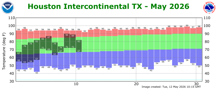
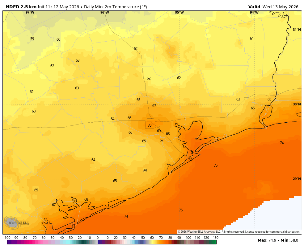
Through the first 11 days of this month the city of Houston’s average temperature has been 72.3 degrees, which is running 2.4 degrees below normal. We have had several nights in the 50s and lower 60s, along with a couple of fronts. All of this has given us a nice start to the month, and perhaps led some of us to forget that we are right on summer’s doorstep.
That will change later this week. Our moderately cooler nights and somewhat drier air will hang around through Wednesday or Thursday. But by this weekend a much muggier pattern returns to the area. We’re talking about daytime highs in the upper 80s to possibly 90 degrees. However the impact will be even greater at night, with very sticky conditions and lows only dropping into the upper 70s.
So if you enjoy more moderate conditions during the mornings and evenings—which I certainly do—today and Wednesday are your best bets.
Tuesday and Wednesday
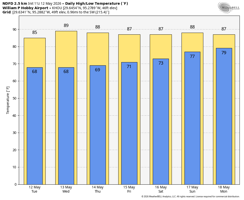
Houston will enjoy a light, northerly flow today and Wednesday, and this will bring us continued fine weather for May. High temperatures today will likely be in the mid-80s, followed by the upper-80s on Wednesday. Both days will be sunny. With dewpoints in the low 60s our humidity is not exactly low, but it will still be quite a bit more comfortable than it will be by this weekend. Mornings and evenings will remain quite pleasant, and we can expect overnight low temperatures to fall into the upper 60s in Houston, with cooler conditions for outlying areas.
Thursday and Friday
These will also be days with sunny to mostly sunny skies, but the air probably will be a bit more humid as our flow turns southerly. Expect highs in the upper 80s to 90 degrees, with nighttime temperatures in the low 70s.
Saturday and Sunday
As we head into the weekend Houston’s weather will turn more humid. With more atmospheric moisture I also expect partly to mostly cloudy days, although there will still probably be some afternoon sunshine about. This will likely determine how high temperatures get, but generally they probably will top out in the upper 80s to 90 degrees. Nights will only drop down into the upper 70s, so yeah, we aren’t going to cool down much. Rain chances are not zero, but they probably are about 10 percent so you should be good to go for outdoor activities.
Next week
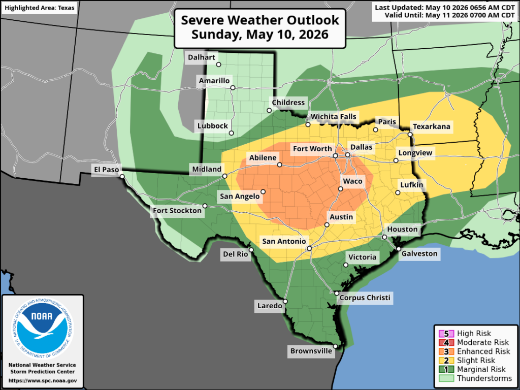
In the most likely scenario we will remain warm and muggy. However beginning Monday our atmosphere may turn somewhat more disturbed, and this would open our region up to some better rain chances.