Good morning. For the foreseeable future, Houston’s forecast remains one of very hot weather. The only real watch item of note is rain chances this weekend, particularly on Sunday and into Monday. Unfortunately, the models have trended a bit drier so my expectations of a good, solid soaking are not high. Especially if you live west of Interstate 45.
Wednesday
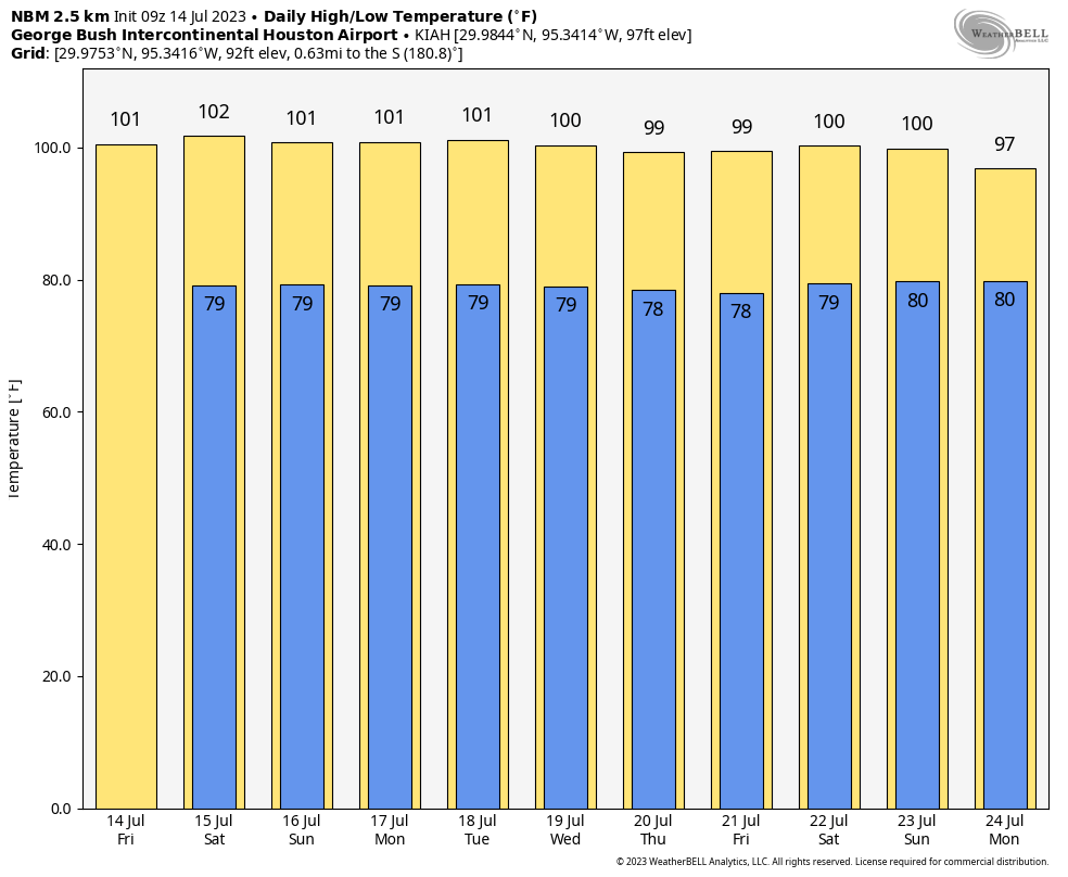
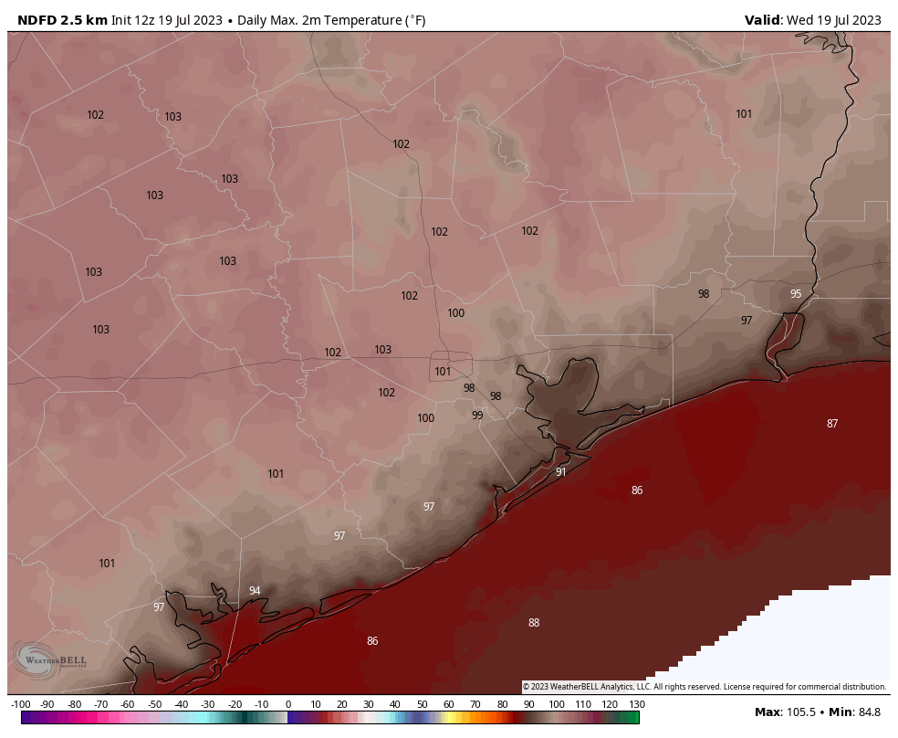
With high pressure solidly in place, we can expect another day of widespread temperatures of about 100 degrees in the Houston region, with sunny skies and high humidity. This will push the heat index high enough that the National Weather Service has called for a “heat advisory” to cover the area. Winds will not provide much relief, being only light, out of the south at 5 to 10 mph. Nights will continue to be warm and muggy, dropping to only about 80 degrees.
Thursday and Friday
More of the same.
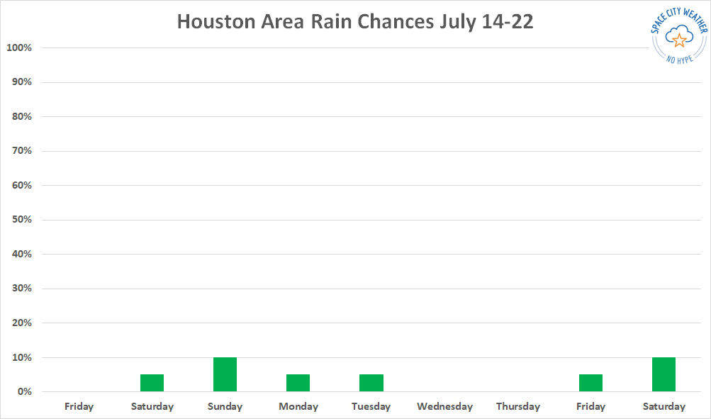
Saturday and Sunday
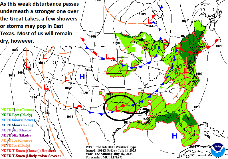
As high pressure eases to the west, it will open the window to a bit more troughiness, which is to say a disturbance pushing down into the southern United States this weekend may have some influence on our weather. However, the strength of any disturbances or boundaries pushing into the Houston metro area is suspect, and the influence of these is likely to be felt most keenly on the eastern half of our our region.
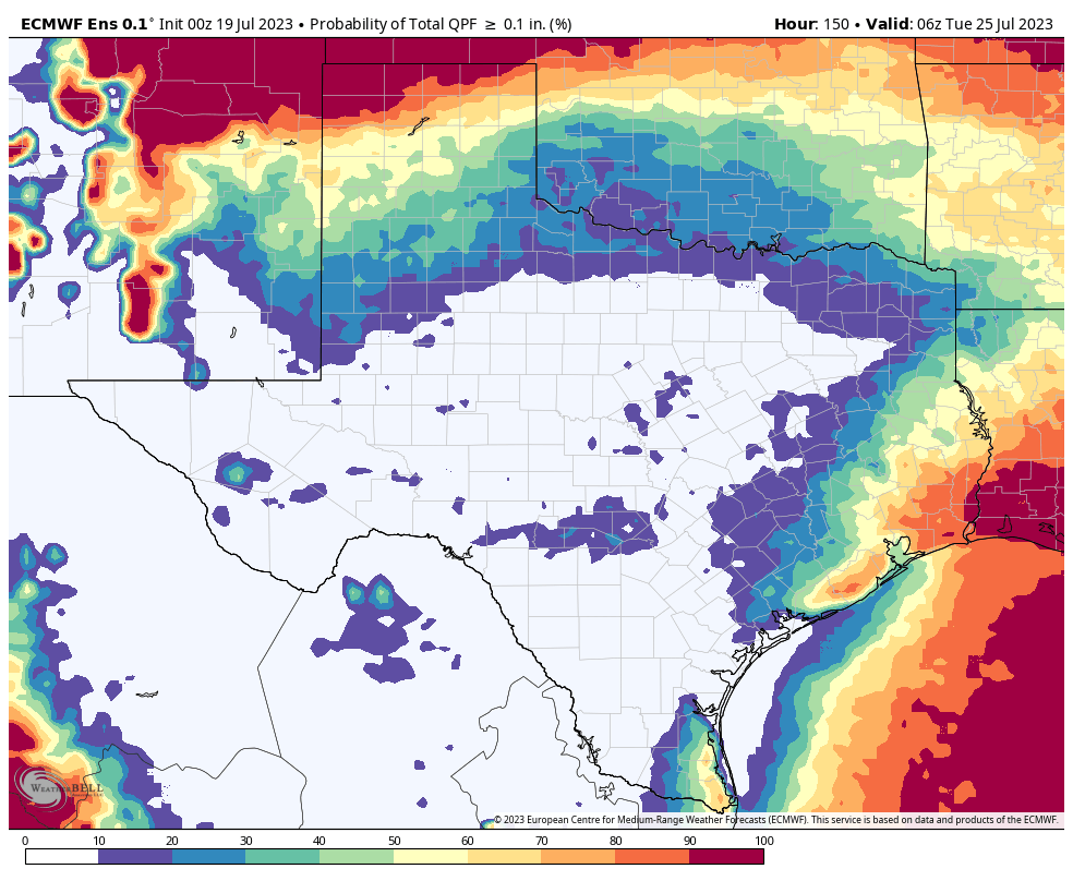
All of that is to say that we can expect partly to mostly sunny skies this weekend, with highs generally in the upper 90s. There will be a chance of showers and thunderstorms each day, perhaps peaking at 30 to 40 percent on Sunday. Unfortunately, accumulations look slight. Most of the modeling I’ve looked at suggests there is about a 50 percent chance that most of the area sees on the order of one or two tenths of an inch. So really, only a light and fairly inconsequential dusting of rain. There’s always the chance that things will change as we get closer to the weekend, but right now we’re trending away from meaningful relief from the heat and emerging drought.
Next week
Monday and perhaps Tuesday should be another day of temperatures in the upper 90s with modest rain chances. After that, I’m afraid, high pressure will probably begin to assert its control once again.