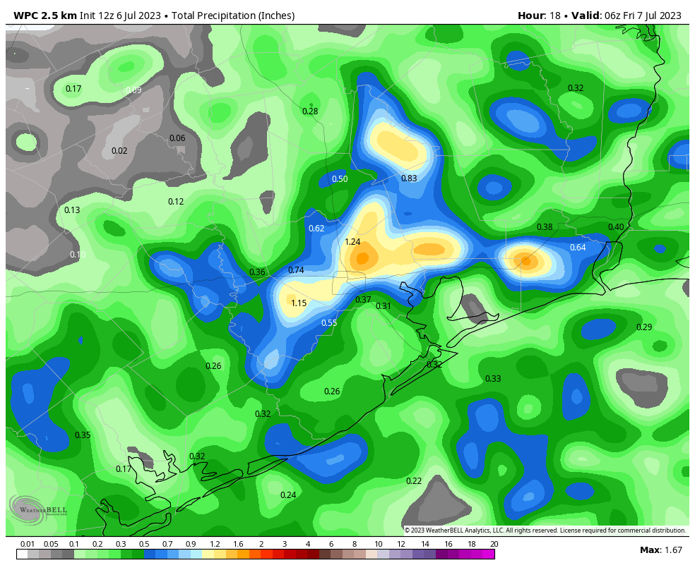
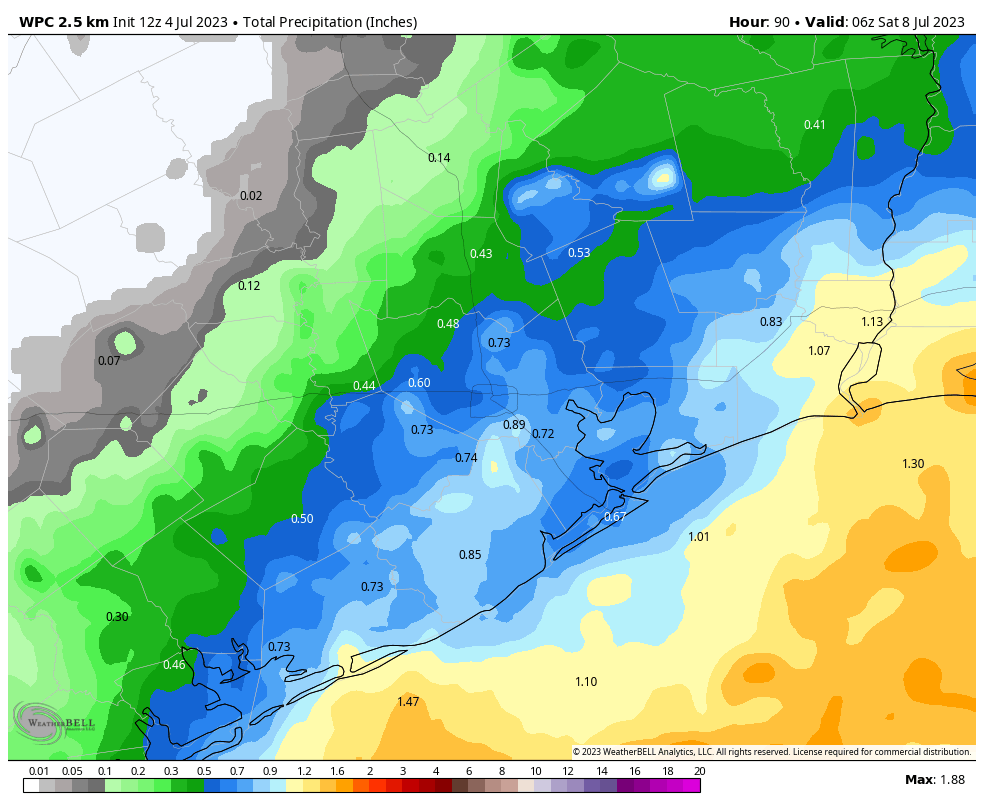
Yesterday saw some locally hefty rains across the area. We picked up anywhere from 1 to 4 inches of rainfall between Pearland and Westchase, with another bullseye out west of Cypress along 290 into Waller County.
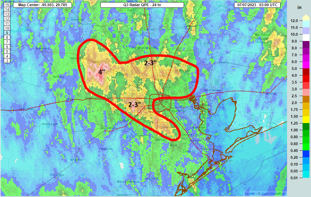
Areas just south of The Woodlands saw 2 to 3 inches of rain as well. Even Matagorda Bay (not shown above) saw about an inch or more in most the area. We are not yet done with the rain, though we do not believe today will play out quite as yesterday did.
Today
We’re starting the day off with an area of rain sitting near Matagorda Bay and just a few showers in and around Galveston Bay and the island.
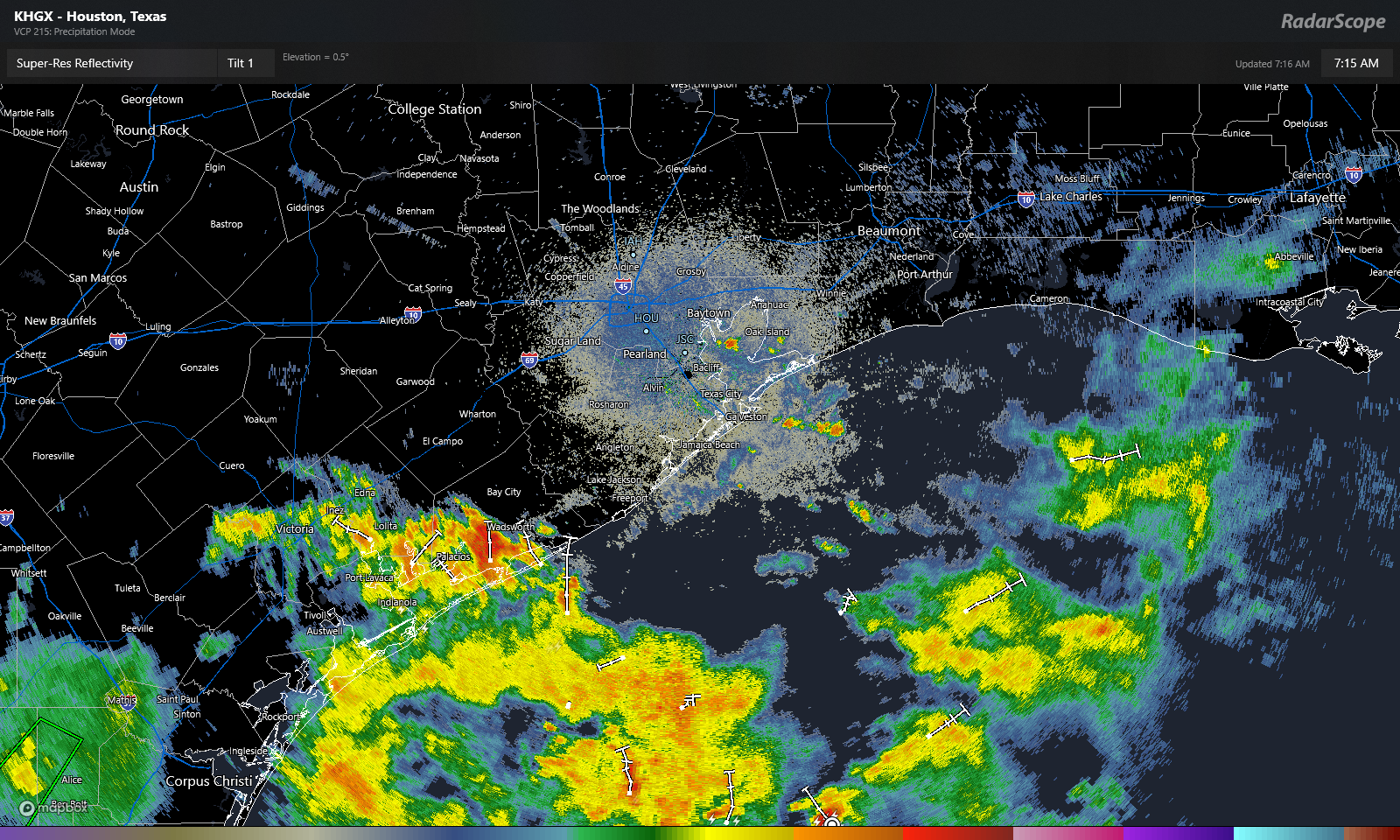
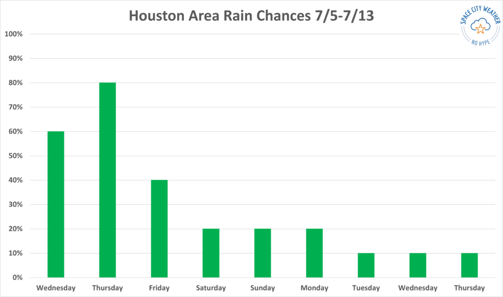
As the day goes on, look for more scattered thunderstorms to develop across the area. The highest chances will be south and east of about Cypress. So much of the area will see showers or at least hear thunder again. Those that see showers today could see as much as an inch or two of rain, while others will see next to nothing. Look for generally low 90s and light winds (except localized gusts in storms).
Saturday & Sunday
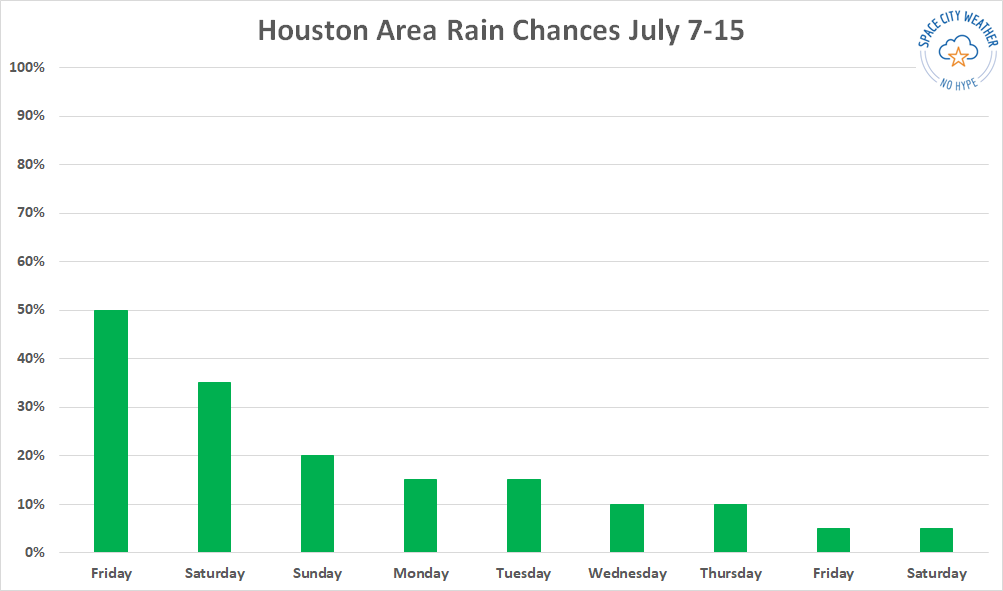
If you have weekend plans, you will probably be fine. But there will certainly be thunderstorms in the area. Look for about a 30 to 40 percent chance of showers and storms on Saturday, followed up by about a 20 percent chance on Sunday. Outside of showers, look for sun, clouds, and slowly increasing temperatures. We’ll be in the low to mid-90s tomorrow and firm mid-90s on Sunday. Morning lows should be in the 70s on Saturday before back closer to 80 degrees on Sunday morning.
Early next week
Rain chances don’t quite go to zero to start next week, but they will drop off to the 10 to 20 percent range on Monday and Tuesday. As that occurs, look for temperatures to warm into mid to upper-90s, with morning lows near 80 degrees. It will begin to feel rather uncomfortable with peak heat index values over 105 degrees.
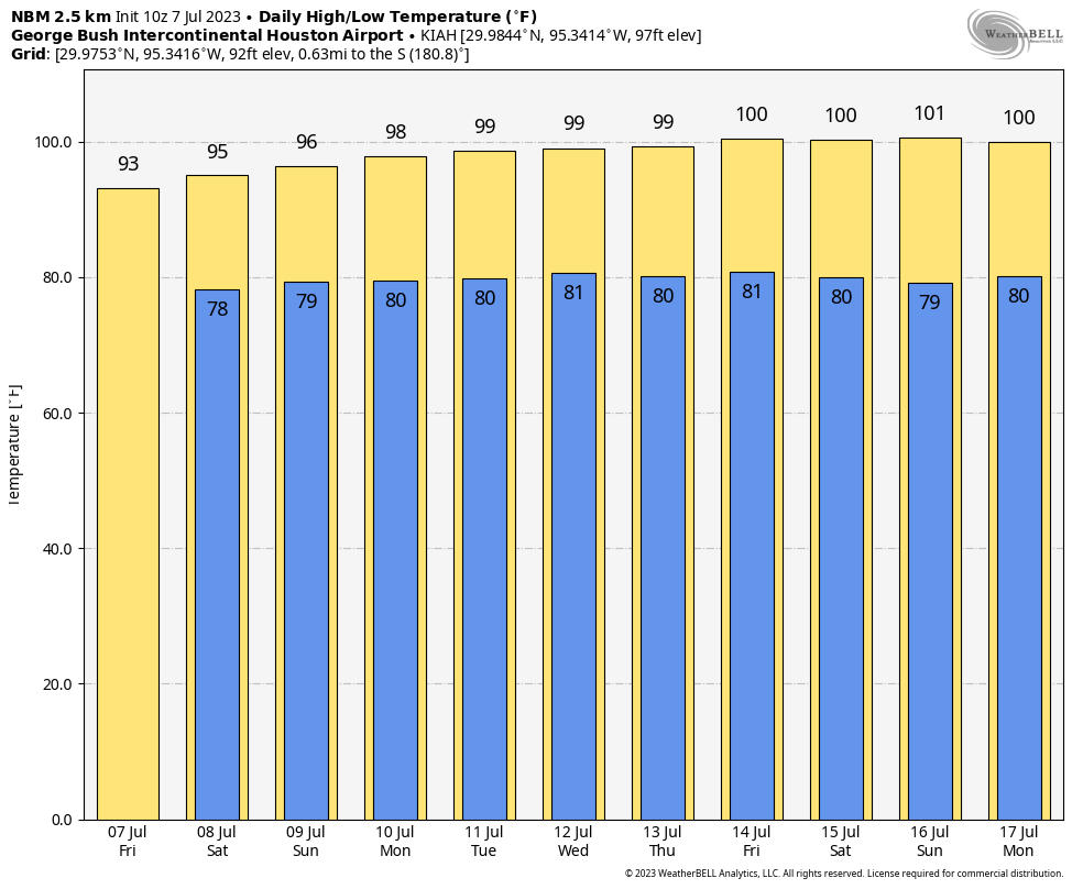
Heat returns
By the time we get to Wednesday, look for high temperatures near 100 degrees, give or take a couple, with morning lows around 80 degrees. The difference between this heat wave and June’s heat wave will be noteworthy. In June, the high pressure setup directly over northern Mexico or Texas, and we just baked with extreme (for June) heat. This time around, it looks more like a traditional summer heat wave, with high pressure centered over the Desert Southwest. It will strengthen and expand to a point where we see just a lot of generically “hot for July” weather in southeast Texas but probably not extreme heat. If the June pattern had recycled this time around, we’d probably be talking 102 to 105 degrees every day. Instead, we’re probably talking 98 to 102 degrees, which while quite uncomfortable is not terribly uncommon in July.
That said, I fully expect heat advisories to re-enter the chat by early next week. As this will again be a potent, long-duration period of high heat and humidity, heat precautions should be taken as they were in June.