In brief: We recap Sunday’s showers and highlight the potential for some isolated storms today. After that we’re warming up this week toward highs in the upper 80s. The weekend forecast is uncertain due to the likely arrival of a front to cool us down for a few days.
Big winners and losers with Sunday’s showers
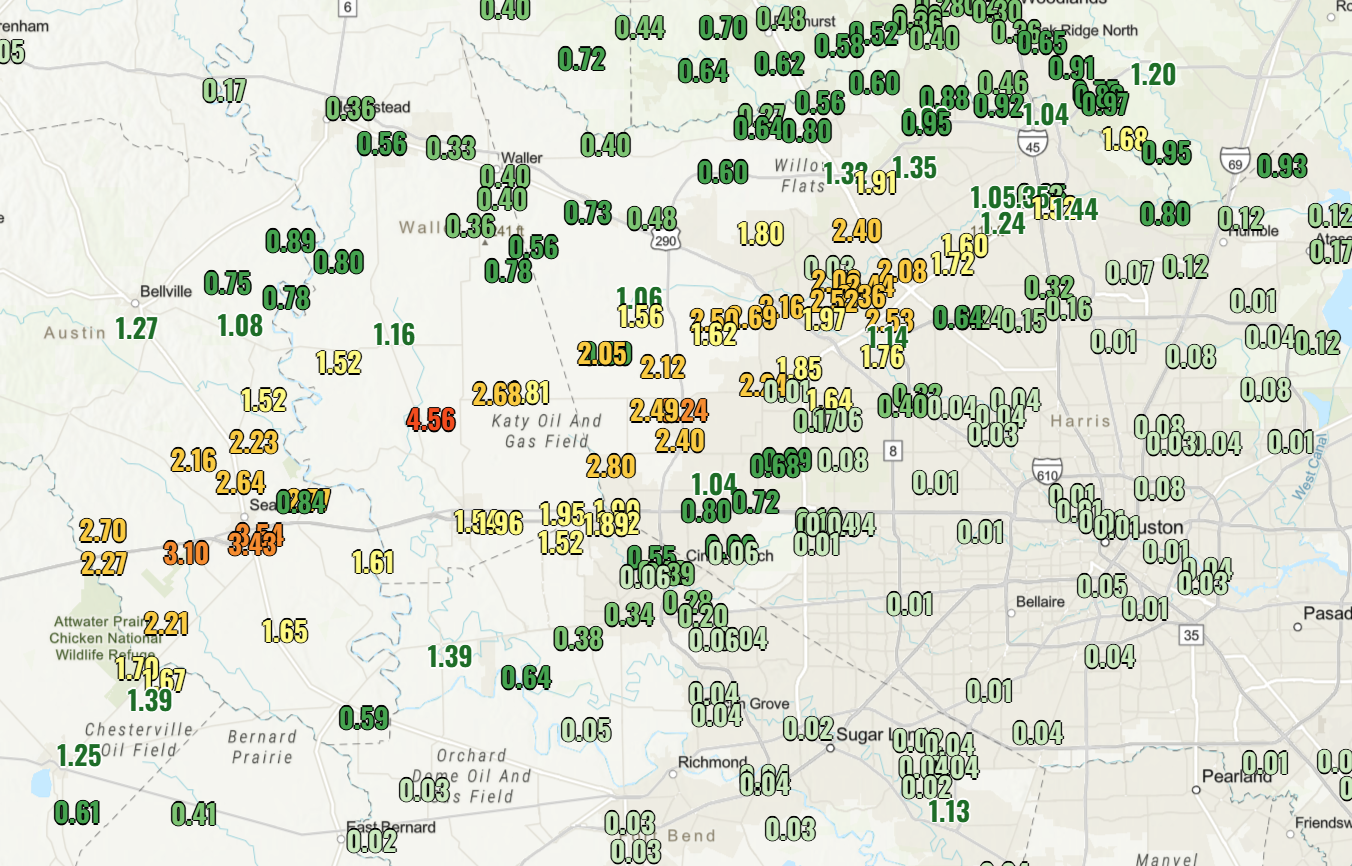
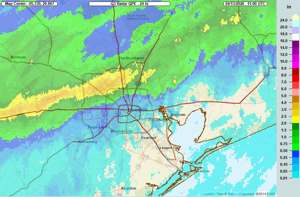
It’s safe to say that, for areas northwest of central Houston, showers and thunderstorms on Sunday over-performed expectations. Matt correctly predicted on Friday that “the atmosphere will be pretty juiced up this weekend,” but we expected the heavier rainfall to occur a little further north of Houston on Sunday. Instead, a large swath of areas northwest of Houston, such as Sealy, Cypress, and Tomball, generally picked up 2 to 5 inches of rainfall, with some very intense bursts of rainfall. Most of the rest of the area picked up below 0.25 inch. We’ll have one more shot at some showers today before most of this week is rain-free. Our next (decent) chance will come next weekend, likely with a front.
Monday
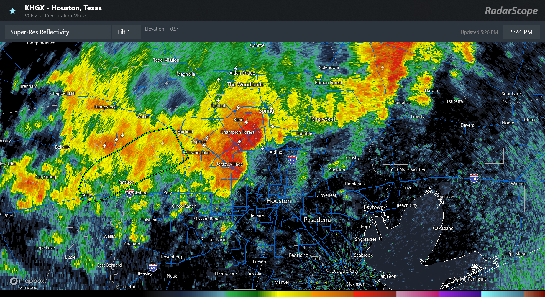
The atmosphere remains fairly moist, and I think we could squeeze out some fairly isolated to scattered showers and thunderstorms. Probably only 20 or 30 percent of the area will see rainfall today, but for those that do there could be some briefly strong showers. Otherwise I expect a partly to mostly sunny day with high temperatures in the lower 80s for most locations. Our atmosphere remains plenty humid. This afternoon, and for pretty much all of this week, we can expect gusty southerly winds during the afternoon, perhaps up to 25 mph. Overnight lows remain very warm, around 70 degrees.
Tuesday through Friday
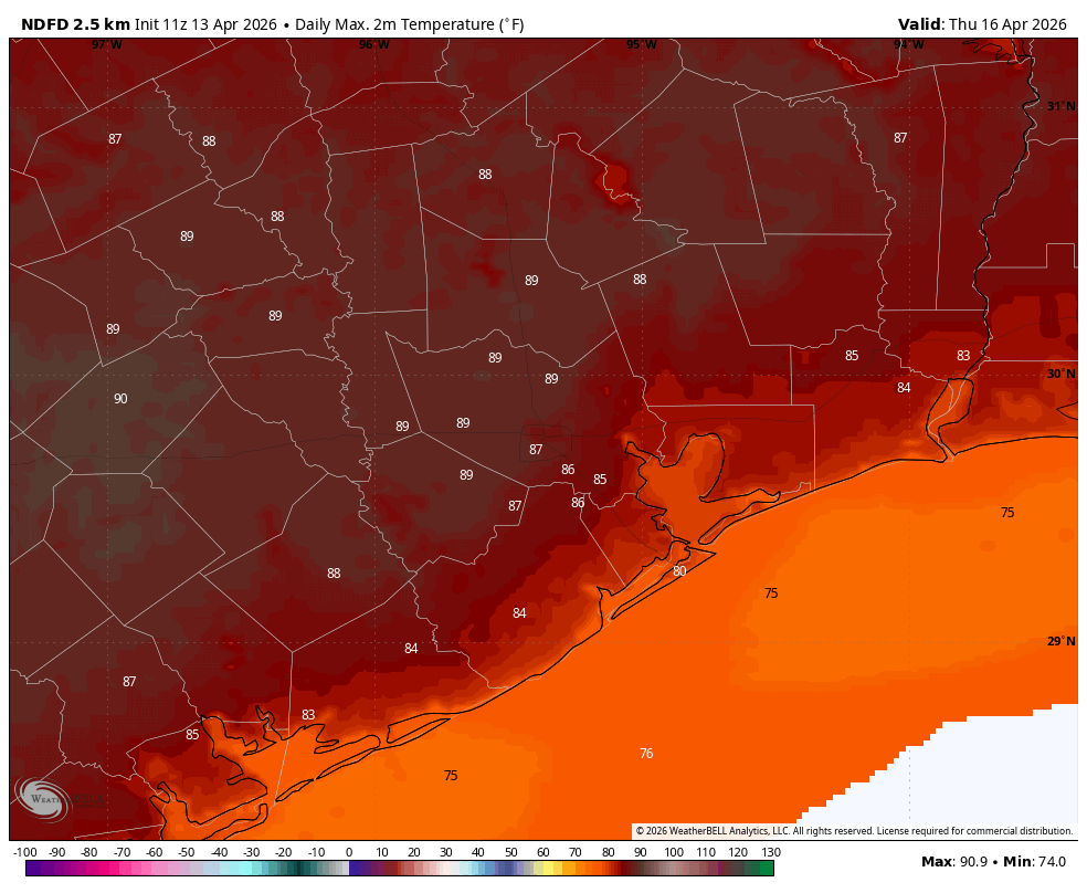
We’ll see a warming trend in daytime temperatures this week, with highs eventually pushing into the upper 80s (perhaps 90 degrees for a few inland locations). Each day will see a fair bit of sunshine, with Thursday perhaps the sunniest. Our air remains humid, and our nights warm. Rain chances each day are probably about 10 percent, or perhaps a bit higher for areas along and north of Highway 105, well north of the city of Houston.
Saturday and Sunday
I don’t have great confidence yet in the coming weekend, but generally it looks probable that some sort of cold front will move through on Saturday, Saturday night, or early Sunday. Accordingly I expect another fairly warm day on Saturday, with highs likely in the upper 80s. There will be a chance of rain (still too early to say how high) with the front’s passage, and then Sunday should see drier air (assuming the front pushes all the way off the coast) with highs in the 70s. Give us another day or two to fine-tune the weekend forecast, please.
Next week
We should see a couple of cooler nights in the wake of the front, and I’m hopeful that Sunday and Monday nights will both drop into the 50s, but we’ll have to see. Our highs will probably return to 80 degrees, or higher, by Tuesday or Wednesday of next week.