In brief: The forecast for Houston remains on track overnight, as freezing temperatures enter the western fringe of Greater Houston. We expect periods of rain, freezing rain, and sleet overnight with falling temperatures and isolated thunder. Roads will likely be sloppy in spots, especially north and west of Houston. We encourage folks to heed the advice of local officials and stay off the roads tomorrow, at least until they can be evaluated and assessed.
Good evening everyone. I just want to shout out Eric for doing virtually everything himself this week, as I have been quite active with preparations for this storm. Winter storms are always challenging to forecast, and this one has been no different. But we’re almost into primetime now, so let’s look at where we stand heading into the overnight.
Temperatures
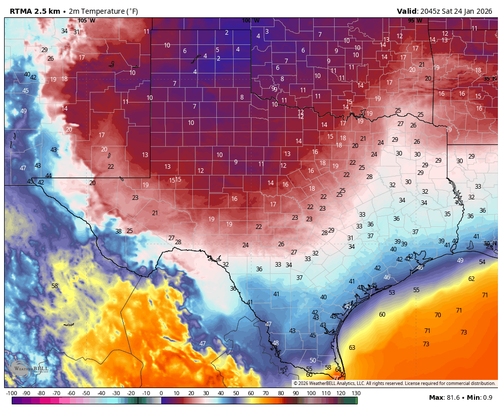
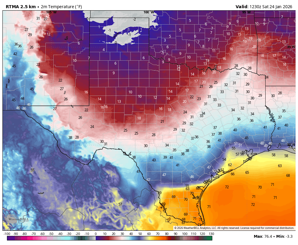
Generally, the entire Houston Metro area remains above freezing as of 10:45 this evening. Outlying areas west of the city are dropping below freezing now, particularly near Sealy, Bellville, Navasota as examples.
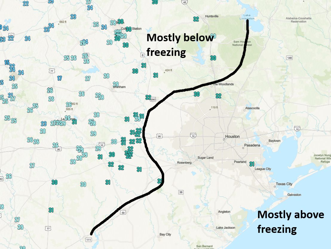
Temperatures will continue to drop, with the freezing line probably entering the western Metro area around 1 AM or so, the I-45 corridor north of I-10 around 3-4 AM, and the Inner Loop by 7 AM. Note that the freezing line will push farther south than it will east faster, so places like Bay City and Wharton will drop below freezing before places like Humble as an example.
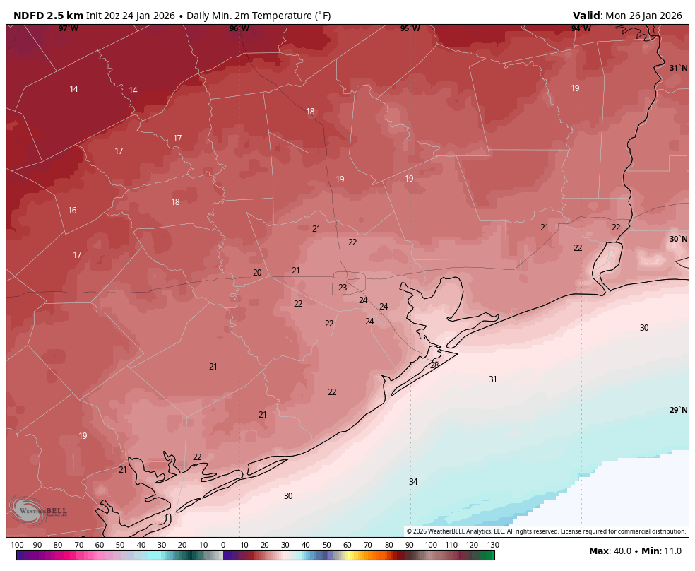
Then on Sunday, expect temperatures to hold near freezing all day from Houston north and west and probably around 32 to 34 degrees south and east.
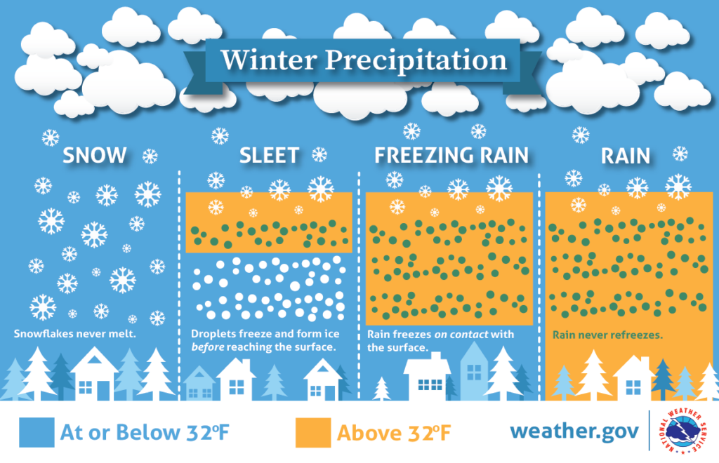
Freezing rain & sleet
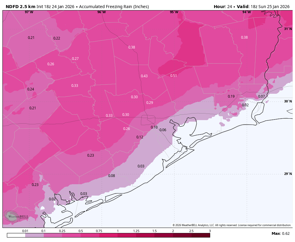
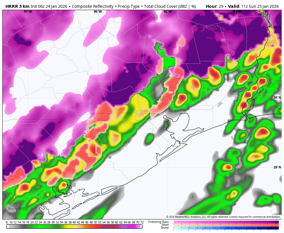
The area has been in a lull this evening with sprinkles, drizzle, fog, mist, a couple showers, but nothing else really. That will change over the next few hours. Expect showers to become more numerous in the area with a period of moderate to heavy precipitation arriving in the Houston area between 1 and 6 AM. It won’t be precipitating heavily during that entire time, but there will be areas that see moderate rain and freezing rain or even moderate sleet as well.
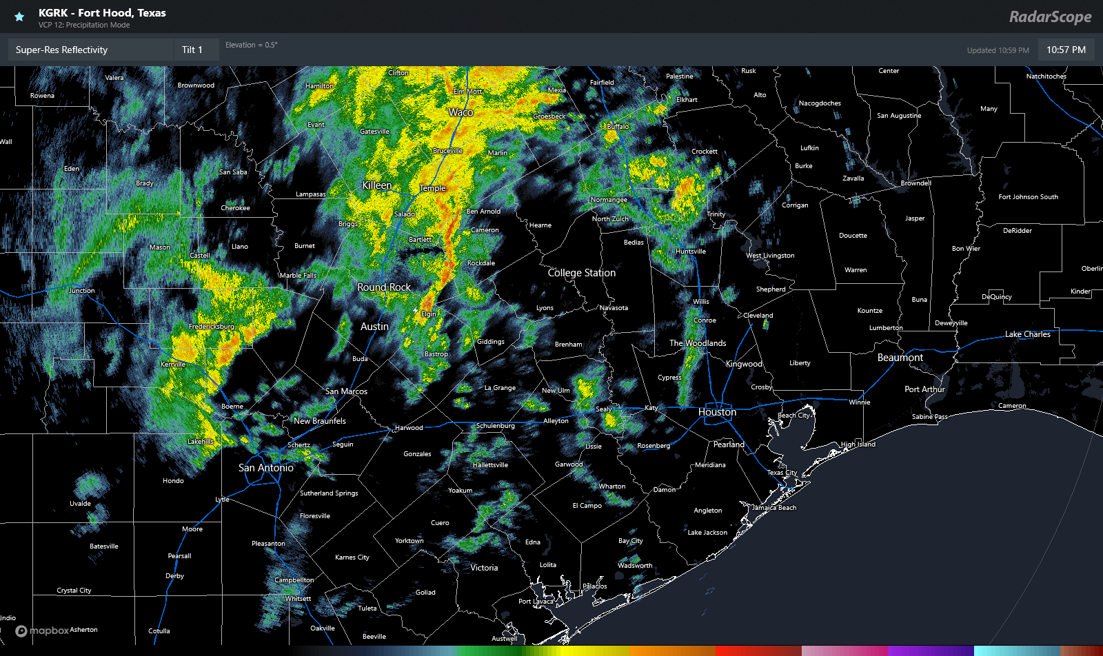
The heaviest of the precipitation will thankfully pass to our north. However, it will be this area of rain or freezing rain or sleet that begins to cause problems on area roadways. This will be especially true north and west of Houston. I think most places are going to see around 0.10 of ice or perhaps a bit less, especially if sleet overtakes freezing rain as the dominant form of precipitation. There will likely be patches in northern Wharton, Austin, Waller, Fort Bend, western Harris, Montgomery, Walker, Grimes, and Washington Counties that see perhaps 0.1 to 0.2 inches of ice. At those levels, we’ll almost certainly see very slick bridges and overpasses, as well as freeway flyovers. Surface streets will take a little longer to freeze, but I would expect patchy black ice on area roads late tonight and Sunday morning.
In addition to the precipitation, there will likely be at least a few lightning strikes overnight. With a wicked temperature inversion (temperatures warming with altitude), some of that thunder may be extra loud. I don’t think the excitable dog index gets much higher than a 2 or 3 out of 10 due to mostly isolated strikes.
The message we’ve been echoing from our local elected officials and emergency management agencies is that we strongly advise you stay off the roads overnight and on Sunday morning. Let officials check the situation out in the morning. If it’s not as bad as feared, wonderful. But if it’s a slopfest, we need to keep those roads wide open for first responders who also will need to slow down and drive carefully. Stay safe.
Other notes
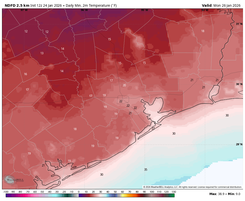
Winds will be blustery on Sunday. Expect gusts of 20 to 25 mph creating wind chills in the teens, especially in the afternoon. I am not optimistic that we’re going to see much sunshine tomorrow. In fact, the cloud cover may linger into tomorrow night helping keep temperatures milder than forecast, likely in the mid-20s in most of the metro area. We should see the sun return by Monday afternoon. With clearer skies, it’s plausible that Tuesday morning will actually be colder than Monday in Houston, not by a ton but at least a little bit. You’ll want to maximize your cold weather protections through Tuesday.
Eric will be up early on Sunday to give you an update on the latest. Stay safe, and stay warm!