In brief: In today’s post we discuss an exciting, upcoming space launch that we all should be rooting for. As for our weather, our warm conditions will turn slightly cooler this weekend before warming up again. And rain chances, maybe they return about a week from now.
Putting the “space” in Space City Weather
I want to thank Matt for covering the last couple of days while I was in Washington D.C. for NASA’s Ignition event. There, the space agency rolled out an exciting new plan for space exploration over the next decade, with the central achievement being the establishment of a lunar base. Houston’s Johnson Space Center, not to mention local companies such as Intuitive Machines, Axiom Space and others, are a big part of all of this. I’ve written about space for a long time, and this is the first time I think NASA has set both a meaningful goal in deep space and laid solid plans to go about achieving it.

Everyone should also be excited about the launch of Artemis II next week, likely on Wednesday evening from Florida’s Kennedy Space Center. Thousands of Houston people have worked hard toward preparing for this lunar flight during which four incredible astronauts—Reid Wiseman, Victor Glover, Christina Koch, and Jeremy Hansen (most of whom are Space City Weather readers)—will fly around the Moon for the first time in more than five decades. Theirs is a bold mission, testing new hardware, and it will be super fun to follow their adventures. The early weather for next week in Florida looks fine for a launch, but we’ll see. I’ll be traveling for that as well, so there may be some minor disruptions in posting here.
The bottom line is that we, as a city, should be proud of what’s happening in space, and Houston’s important ongoing role. Your meteorologists certainly are.
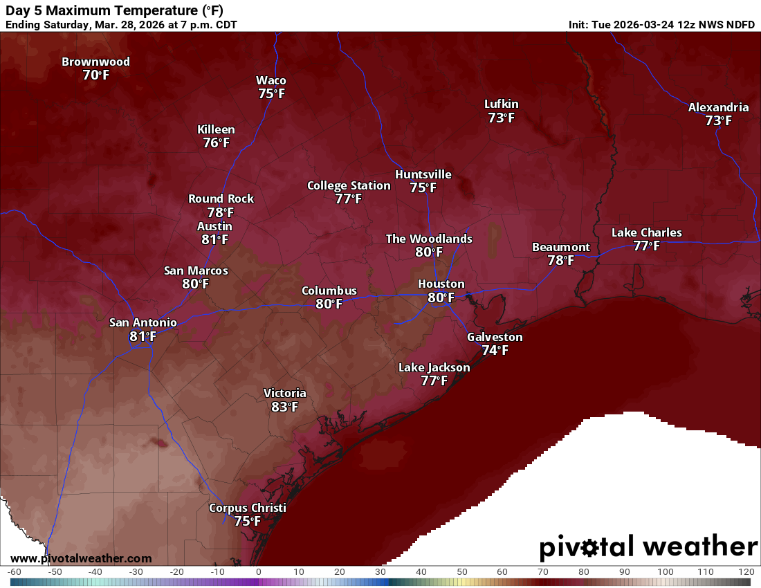
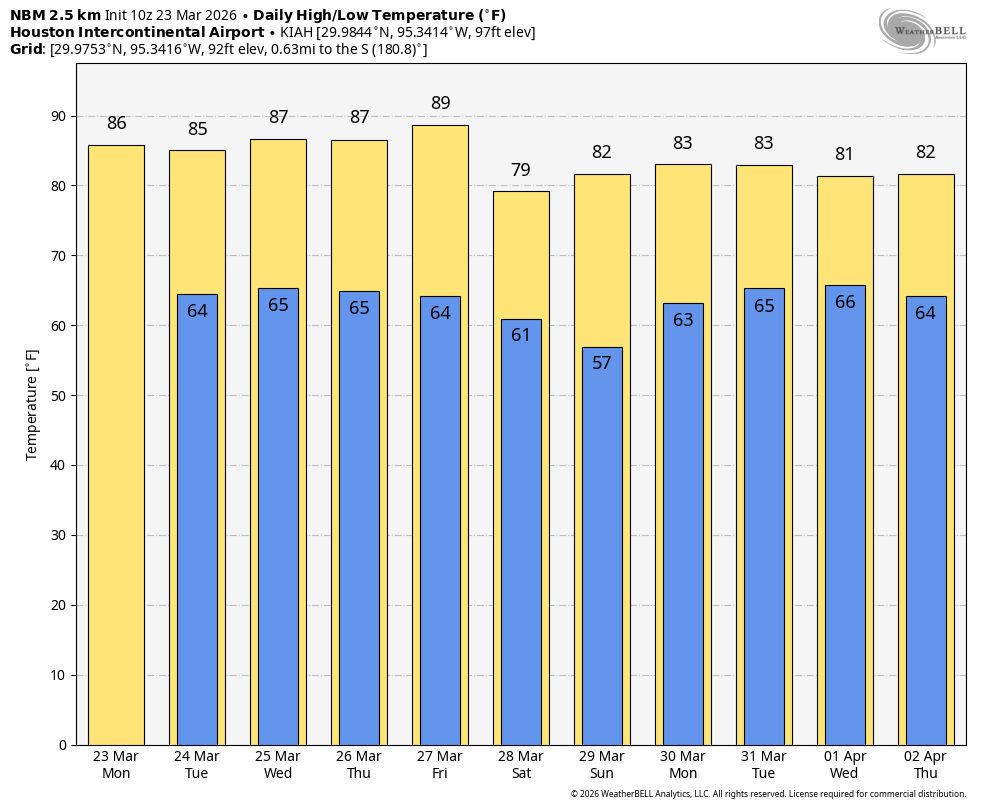
Thursday
Our weather forecast remains much as Matt has described it over the last couple of days. We’re going to see continued warm weather for a couple of days before a slight cooldown this weekend. Highs today will generally be in the mid-80s in Houston, with slightly warmer conditions for inland areas. Skies will transition from partly cloudy this morning to mostly sunny this afternoon. Winds will be from the south at about 10 mph, with stronger gusts this evening. Lows tonight will fall into the mid-60s.
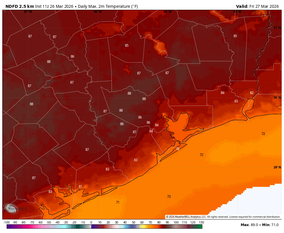
Friday
Expect more of the same, with daytime temperatures possibly even a degree or two warmer. Lows on Friday night will again be in the 60s, although they will drop a little further by Saturday morning. Why? Because overnight we will see some moderately drier air moving in from the northeast. This will significantly lower our humidity for Saturday, and somewhat for Sunday.
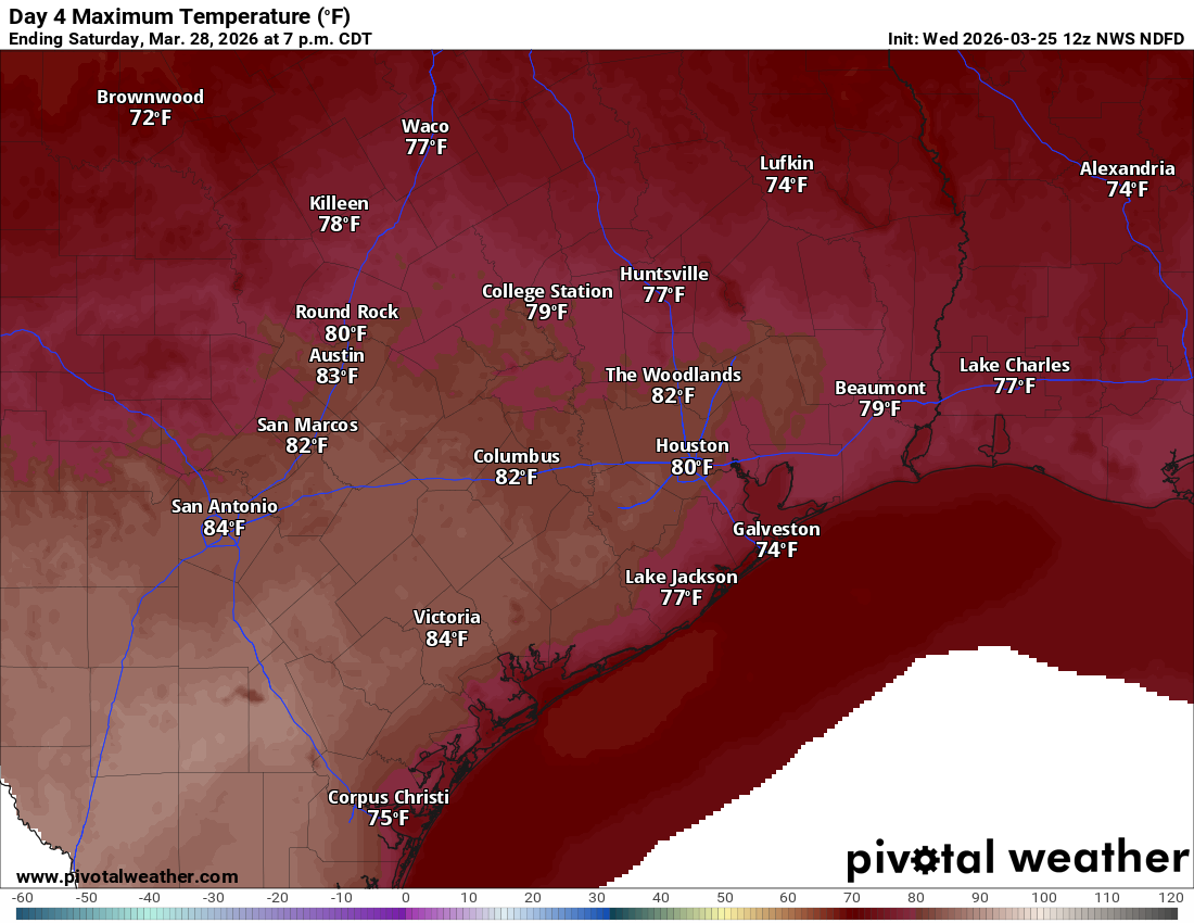
Saturday
High temperatures will range from the upper 70s to lower 80s, with lower humidity. Winds will be from the northeast at 10 to 15 mph with higher gusts. Some locations may briefly drop into the 50s overnight on Saturday night, but it’s not like temperatures are really going to bottom out.
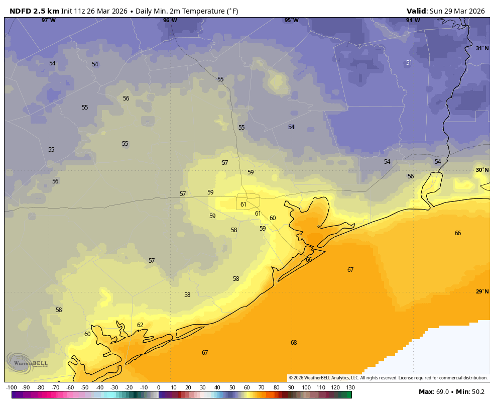
Sunday
By Sunday we should already begin to feel the effects of returning air from offshore, so look for high temperatures in the mid-80s, sunny skies, and moderate but rising humidity levels. Lows on Sunday night will be in the mid-60s.
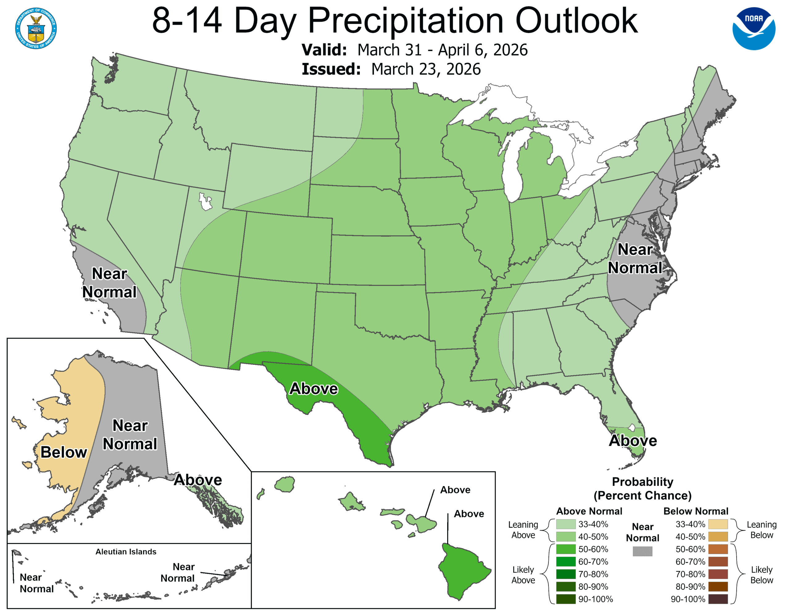
Next week
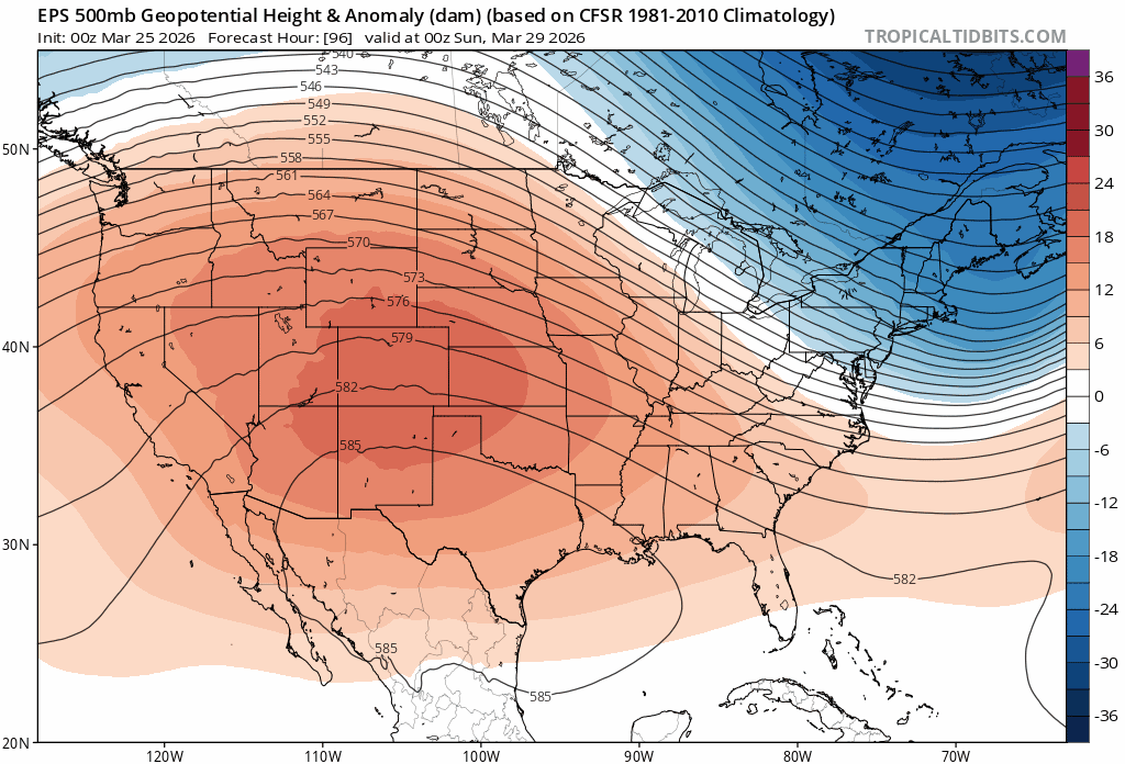
This warmer pattern will continue through midweek before that persistent ridge of high pressure that has been anchored to our west finally begins to break down. This will allow for the return of some modest rain chances, which may improve even further as we head toward next weekend. I don’t want to make any promises we can’t meet, but I’ll just say we could really use some rain and the odds may start to turn in our favor a little. At the same time I’m also cognizant of the Easter holiday about 10 days from now. When we have more clarity on this forecast we will, of course, share it with you.