In brief: In today’s post we have some good news, and some bad news. Let’s start with the good. There are many, many outdoor activities this weekend in the Houston region, from sporting events to public gatherings. All of these should have fine weather. The bad news is that a drought that has been building all winter is starting to become acute.
A deepening drought
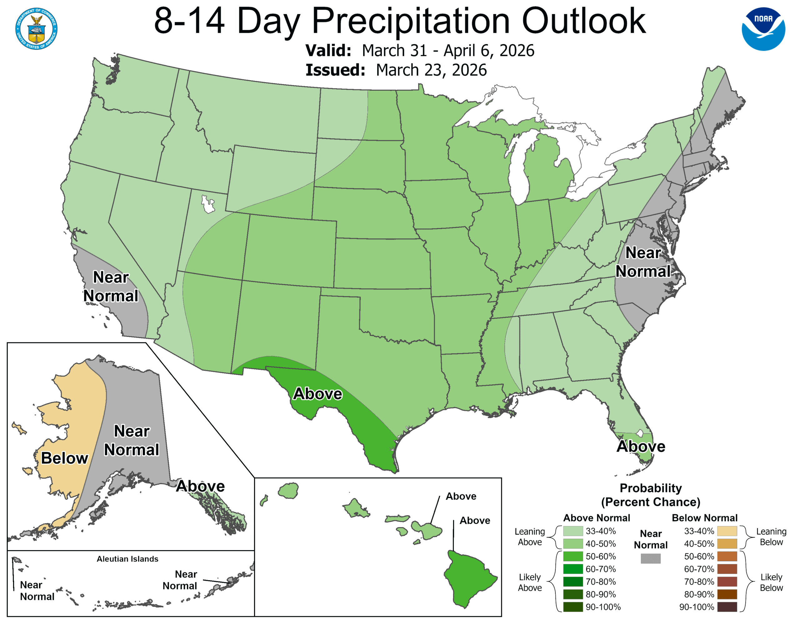
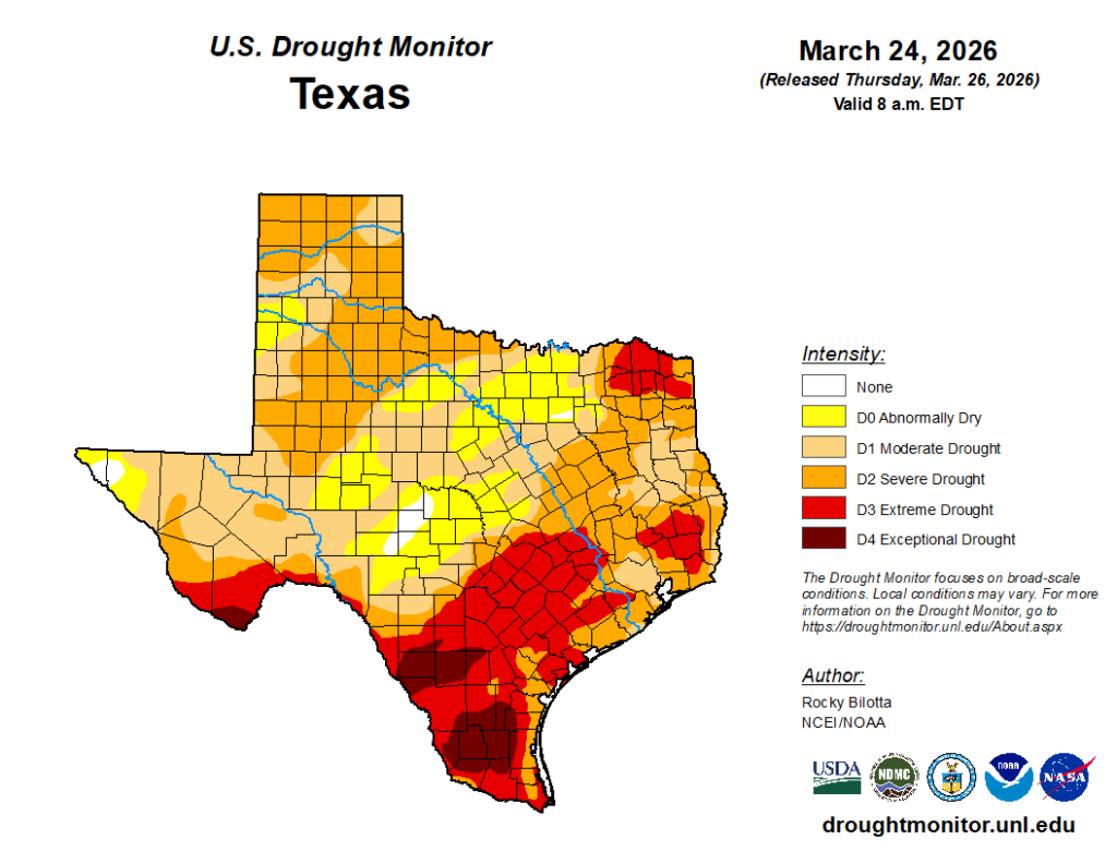
We’ve been talking about drying soils a lot here because the state of Texas, particularly the eastern half of the state, has had such a dry winter and start to spring. At the beginning of October, last year, just 23.6 percent of Texas was in a ‘moderate’ drought, and only 13 percent in a ‘severe’ drought. Those numbers today, respectively, are 84.5 and 55.5 percent.
For the greater Houston area the problem has been building this winter, but until recently was not acute. As days lengthen and warm up, that is now changing, and areas of ‘severe’ and an even worse category, ‘extreme’ drought now encroaching upon Harris County. Much of Chambers, Waller, and Fort Bend counties now find themselves in an ‘extreme’ drought.
I am concerned about this because the next six months or so represents the warmest period of the year, with the Sun reaching a much higher angle in the sky, meaning that droughts develop much more quickly. Typically we see springtime rains in Houston (and don’t look now, but we’re only a couple of months from the opening of the Atlantic hurricane season), but for now the overall forecast shows no drought busters. No one wants flooding, of course. But we could use some rain events in the coming weeks.
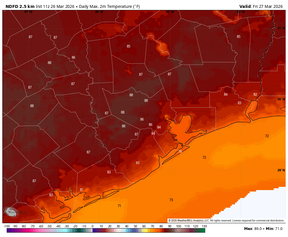
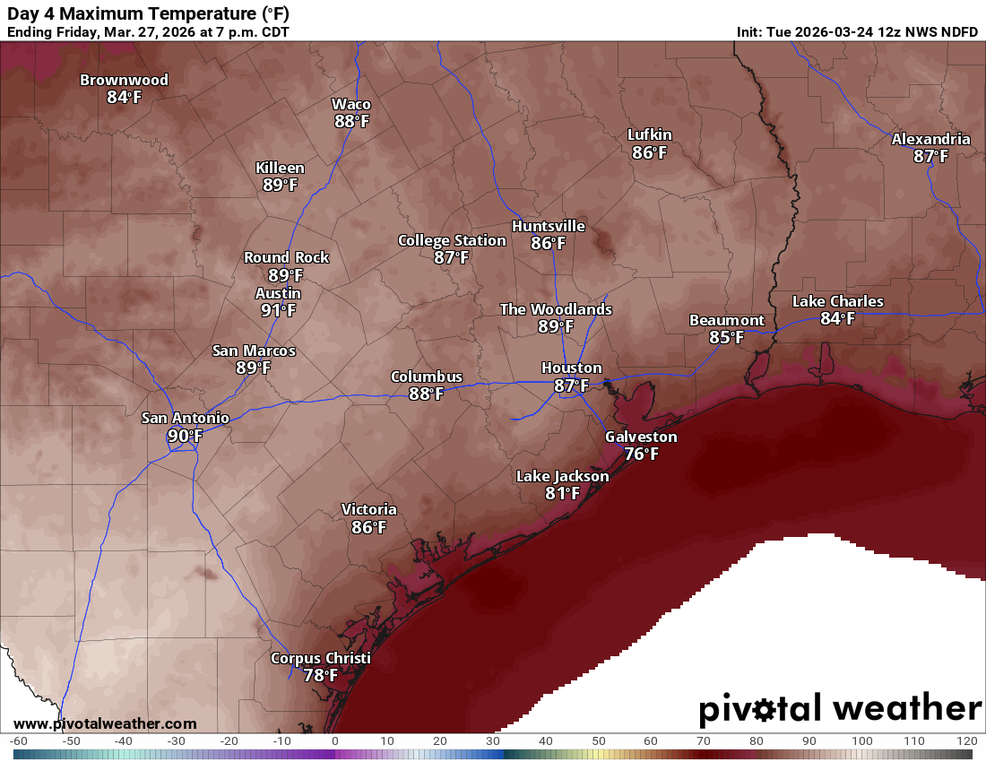
Friday
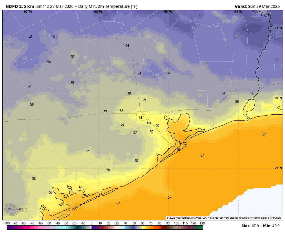
Highs today should reach the mid- to upper-80s across the Houston area with mostly sunny skies. You know the drill as our weather has not changed much over the last week. It will be another mild evening. However conditions should begin to change tonight, likely around or after midnight, as winds shift to come from the north-northeast and bring in much drier air. As a result I expect temperatures to drop into the upper 50s by Saturday morning, with noticeably lower humidity.
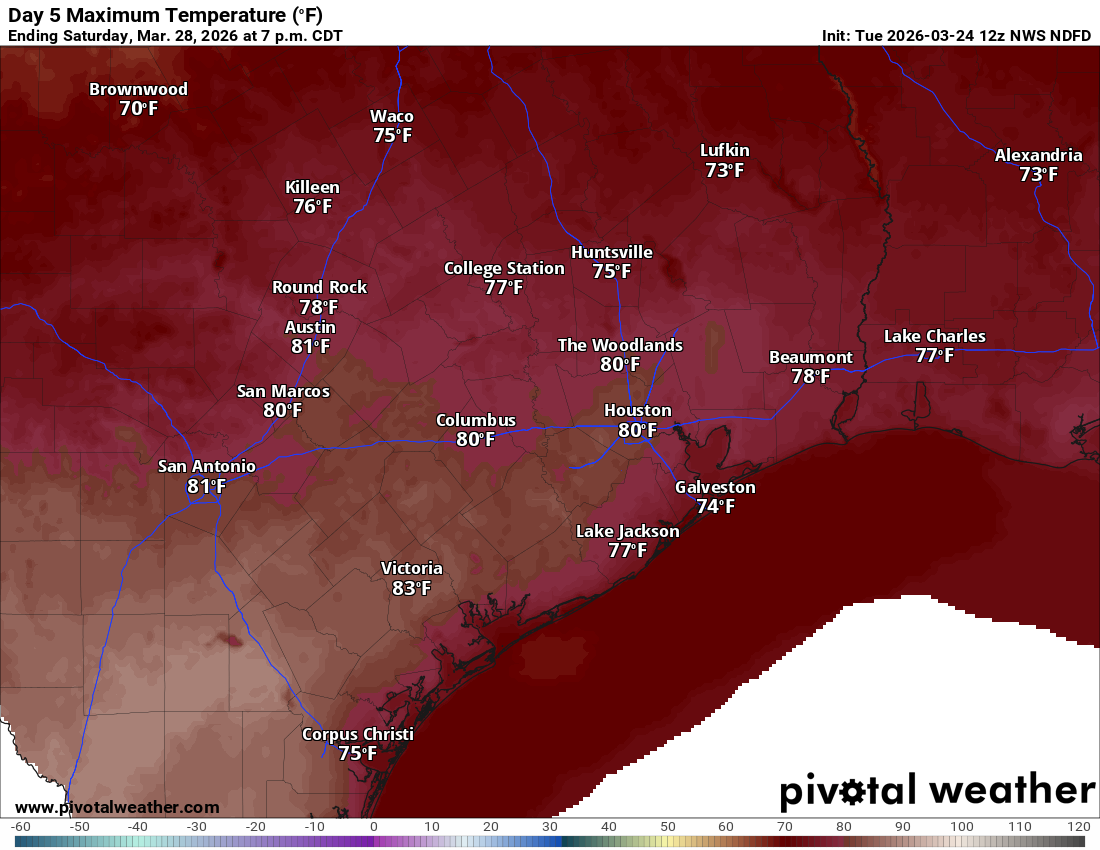
Saturday
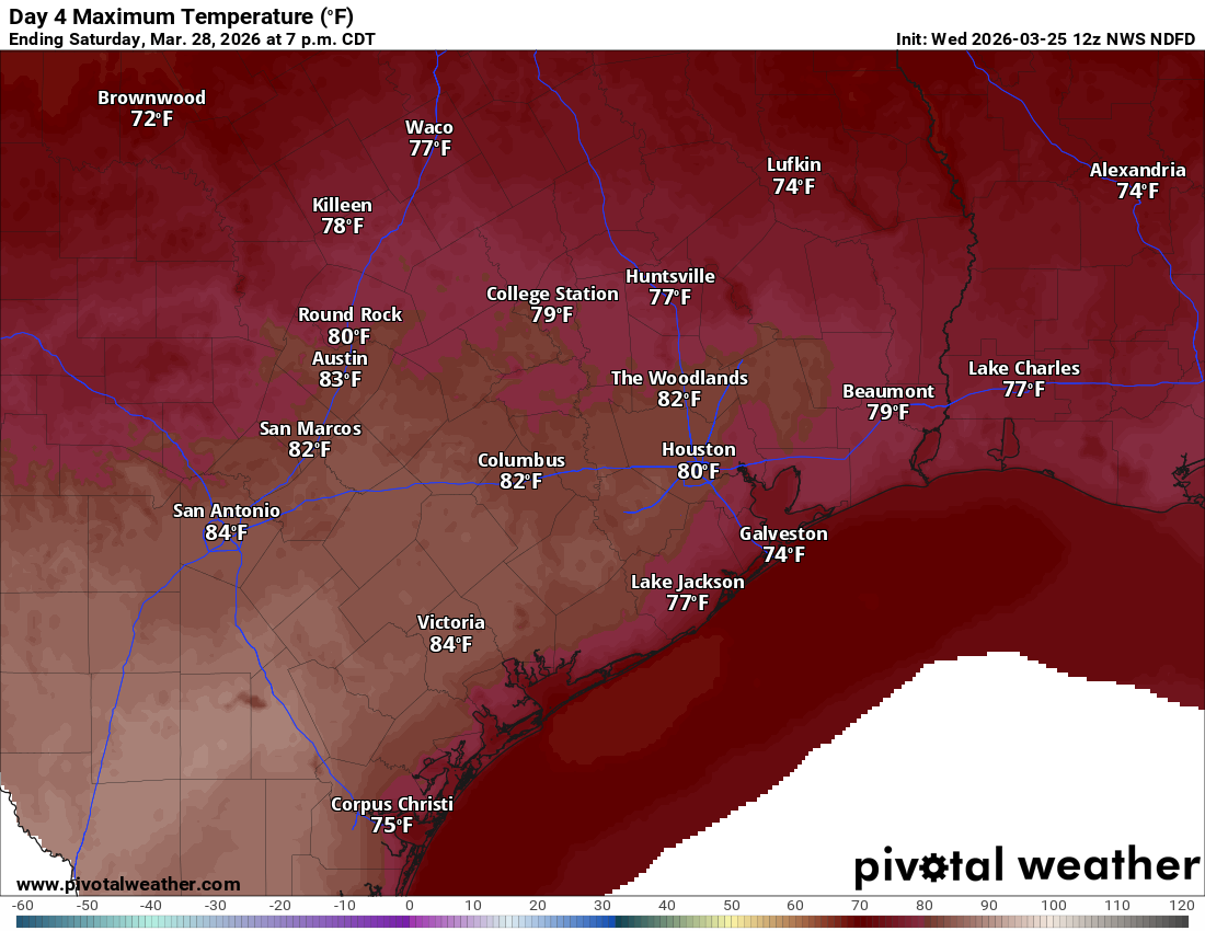
Saturday morning may see gusty winds up to about 25 mph, but these should start to fade by the afternoon hours. As for high temperatures, this will depend on the extent of any lingering cloud cover as skies will eventually turn fairly sunny. I expect highs will get into the mid- to upper-70s with low humidity. Saturday evening looks exceptional, and then most areas outside of the urban core should drop into the mid- to upper-50s on Saturday night. We know there are a ton, just a ton of outdoor activities from major sporting events to marches and parades this weekend, and the weather just looks exceptionally fine. (And if you took my long-standing advice for outdoor weddings in Houston, which is to hold them during the last two weeks of March, well done).
Sunday
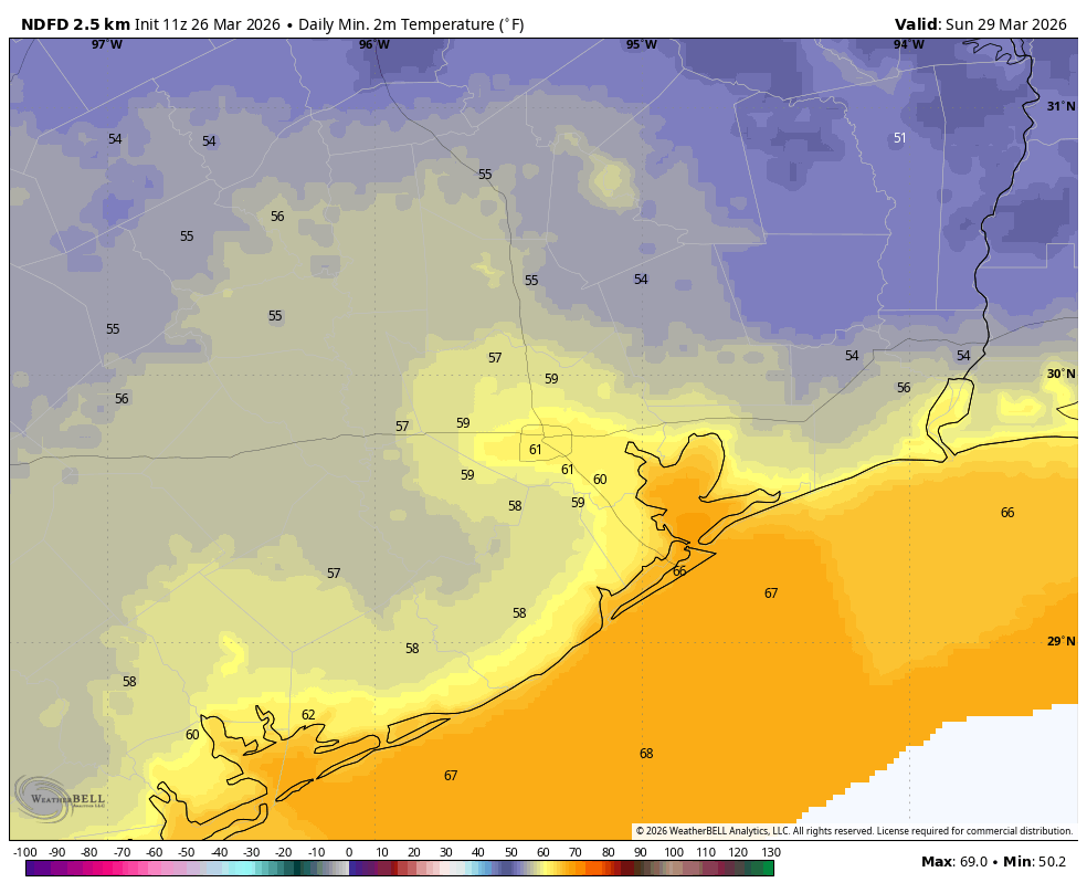
Just as quickly as the front came in on Saturday, it’s likely to ease out on Sunday as the onshore flow resumes. Highs should reach around 80 degrees with mostly sunny skies and rising humidity levels. Lows on Sunday night will only fall into the low- to mid-60s.
Next week
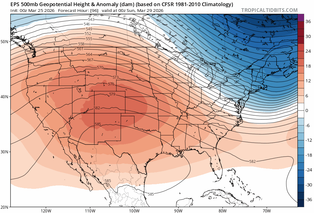
We’re back into the mid-80s for much of next week, but there will be some overall changes to the forecast as high pressure recedes somewhat. At some point we’ll start to see partly to mostly cloudy days, and our nights will turn a little warmer and muggier (i.e. overnight lows drop to 70 degrees in Houston, rather than 65). By Wednesday or Thursday we’ll also finally start to see some slight rain chances enter the forecast.
As we get into next weekend, and remember Easter Sunday is then, rain chances may go up further. It’s still too fuzzy for confidence, but my sense is that we’ll see a stronger front trying to move through our region in 8 to 10 days, and that this will bring with it a healthier chance of more widespread rain. But whether this happens on Easter Sunday, or the day after (or heck, even not at all) remains impossible to say at this point.
For now, please enjoy what looks to be a fine weekend weather-wise in Houston.