In brief: Houston is going to be doing some heavy flirting with 90 degrees beginning today and continuing into next week. That’s it. That’s the summary.
If you are Very Online™ or even if you’re not, surely you’ve seen someone post their memories of the 90s in the latest viral trend. Well, we may once again find out what we were like in the 90s for the first sustained period since October.
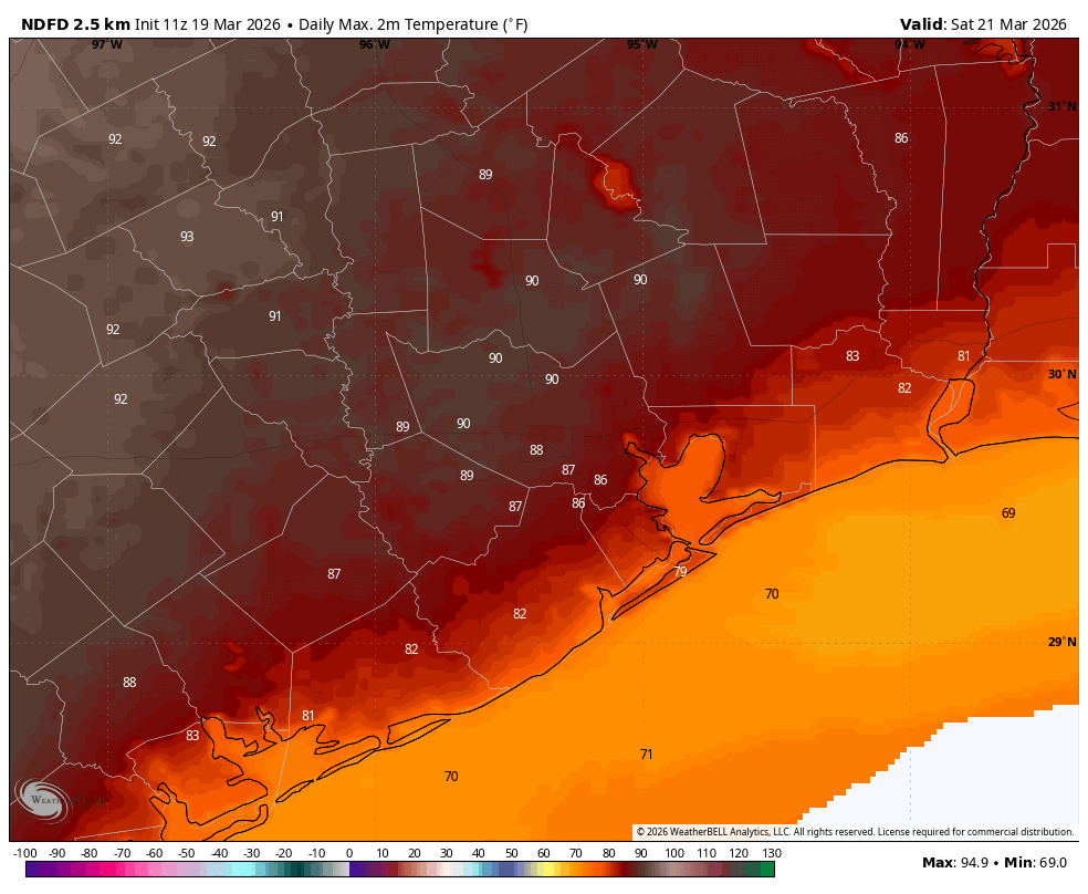
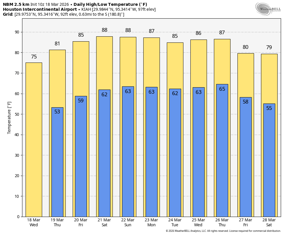
Today through Monday
Not a lot to say here. There could be some late night or early morning fog each day, but otherwise it looks clear, with nothing worse than some passing high clouds at times. Temperatures will warm into the mid or upper-80s today, upper 80s to near 90 tomorrow and Sunday, and perhaps near 90 again Monday with a slight chance of slightly drier air.

Houston Rodeo Forecast
Hard to believe that we’re coming to the end of the Houston Livestock Show and Rodeo this weekend. Temperatures should fall rather quickly from the 80s into the 70s this evening and Sunday evening. It will be hot tomorrow, with upper-80s to near 90 degrees so if you are attending, just keep that in mind and make sure to stay hydrated, preferably with water if you’ll be doing any of the outside attractions.
Tuesday through Thursday
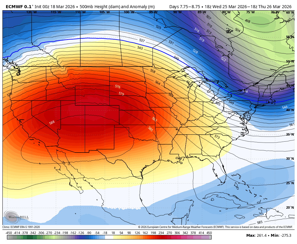
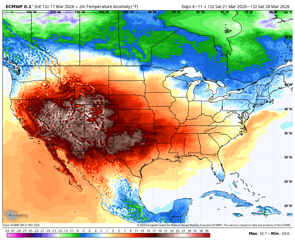
Even if we manage to cool down some on Sunday night or Monday, we will quickly bounce back well into the 80s next week. And yes, we will flirt with a chance of 90 degrees every day it appears. Blind Melon’s “No Rain” (1992) is a nice companion soundtrack next week.
Later next week
Can we get a cold front next weekend? That’s the question. There are strong signs within model data that we may see a brief cooldown next Saturday and Sunday (think highs in the 70s or low 80s). Right now, it does not appear that any kind of cold front will come with meaningful rainfall but we may at least get to enjoy some slightly less May-like weather for a few days. Stay tuned.