It is pretty clear that the worst of winter is now behind us in Texas, and while winter is by no means “over,” we should see generally pleasant conditions going forward. Occasional cold fronts will probably ensure that outcome at least through next weekend.
Today
Fog is around much of the area outside the city this morning, so take some care while driving.
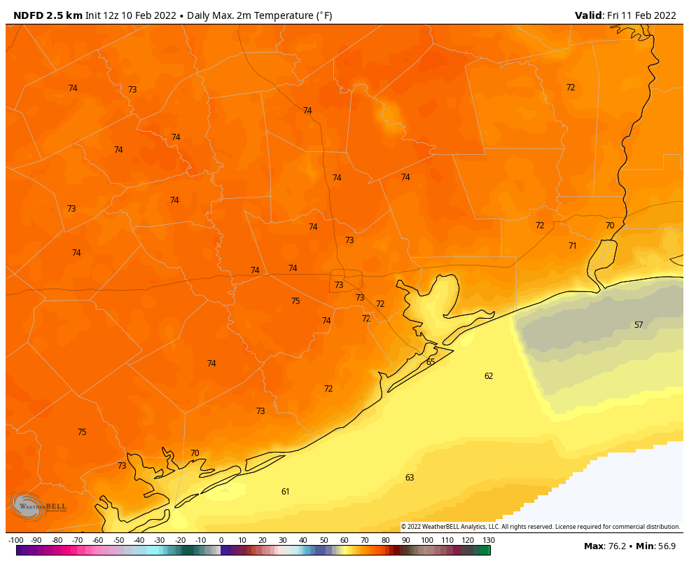
We’ll see plenty of sunshine again today, but there should be at least a few clouds around. We’ll warm back into the 70s again this afternoon.
Saturday
I think tomorrow will come with mixed reviews. We have a cold front that will push through the region in the morning. This will probably bring at least a broken line of showers or some rain through the area in the morning hours. So if you have outdoor plans, I might suggest the afternoon over the morning if possible. However, that may also come with a price tag in the form of cooler temperatures. No 70s on Saturday; we’ll see temperatures likely peak in the 50s in the morning and then probably stay there Saturday afternoon.
With a noticeable breeze included, 15 to 25 mph at times, it will feel like February.
Sunday
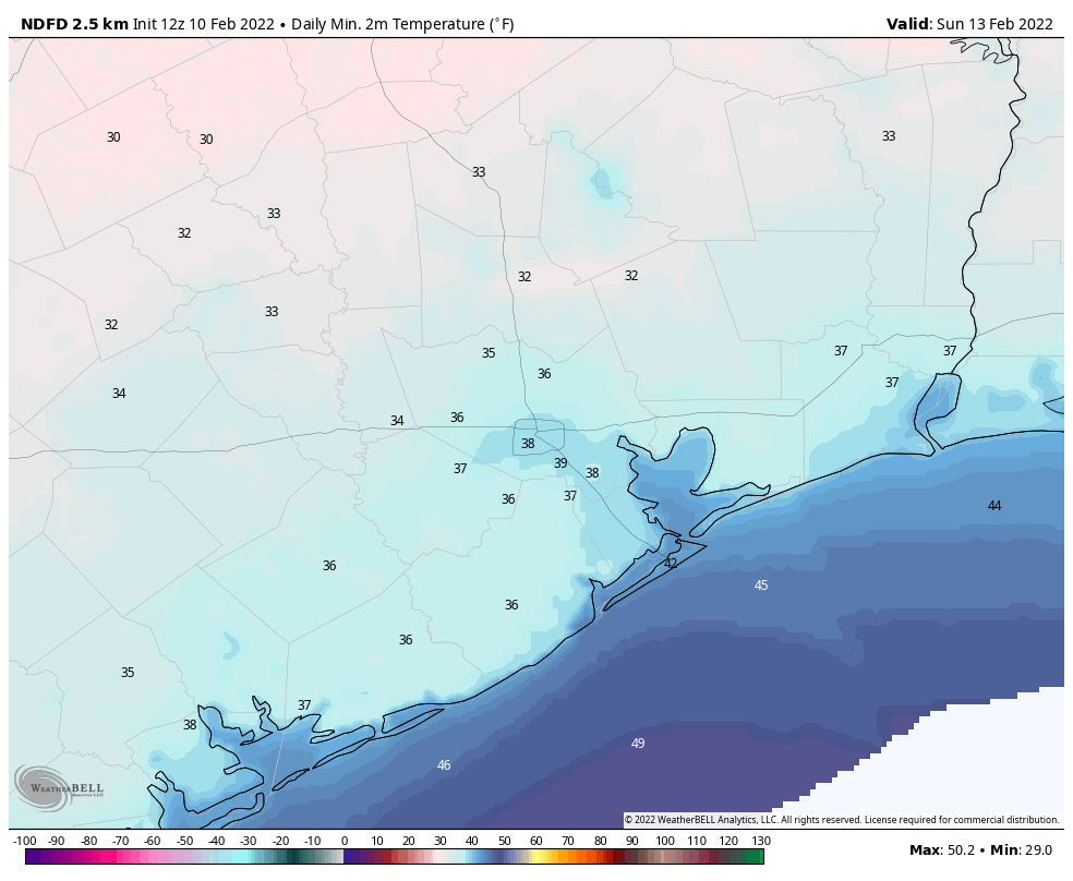
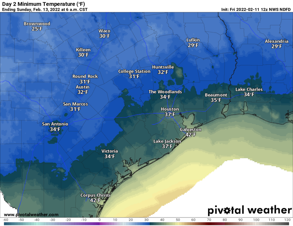
Temperatures will drop through the 40s and into the 30s Saturday night, bottoming out in the 30s in most areas away from the coast. Look for AM lows perhaps at or below freezing up near Conroe or in some isolated spots outside the city and suburbs.
Sunday itself will be delightful with sunshine, diminishing winds, and highs near 60 degrees.
Monday & Tuesday
Look for continued pleasant weather on Valentine’s Day with temperatures starting in the 30s and warming into the 60s. Dining al fresco will be cool but probably tolerable with evening temperatures around 60 degrees, give or take. Winds will be light. Tuesday should be similarly nice, with sunshine and upper 60s after morning 40s.
Beyond Tuesday
We’ll see a pretty aggressive warm up begin Tuesday night and Wednesday with a 10+ day stretch of sub-50 degree low temperatures likely ending on Wednesday. Temperatures will warm into the 70s on Wednesday and not drop below 60 degrees on Wednesday night. Our next cold front is aiming for Thursday, and Thursday’s temperatures will depend on the exact timing of the front. If it’s late in the day, we’ll go deep into the 70s, but if it’s earlier, we may not get much past the mid-60s. More on that for you Monday.
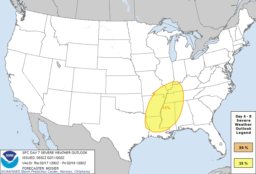
As far as actual weather goes, we’ll likely contend with some fog at times on Wednesday and Thursday, in addition to clouds and sun. Thursday’s front may come with a bit of punch, so I suspect we’ll be tracking thunderstorms, particularly north of I-10 as it passes through. The Storm Prediction Center is already highlighting days 6 and 7 for severe risks in North Texas (Wednesday) and northern Louisiana (Thursday). This looks like a more classic Houston situation where “capping” in the atmosphere will be present for us, limiting risk of severe weather. But we’ll give you more details on that next week. Fair, cooler weather should build in for Presidents’ Day weekend.
As a reminder, you can download the Space City Weather app on your Apple or Android device. And if you o or someone you know would prefer your weather information in Spanish, please check out our Spanish language companion site, Tiempo Ciudad Espacial, helmed by Maria Sotolongo!