In brief: In today’s post we discuss the warm pattern we’re in, which is likely to persist for most of the rest of the month. What does that mean for freezes? We also look ahead to the holiday weekend, which should have a lovely second half.
Warm February impact on freezes
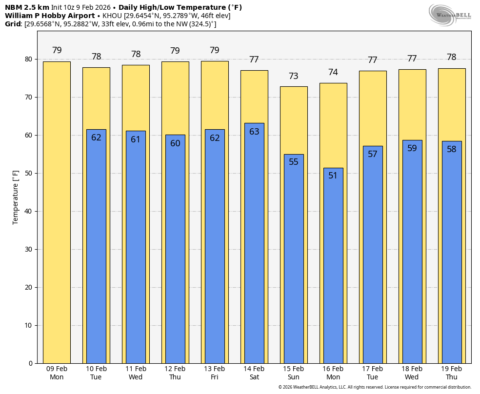
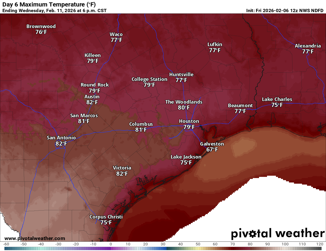
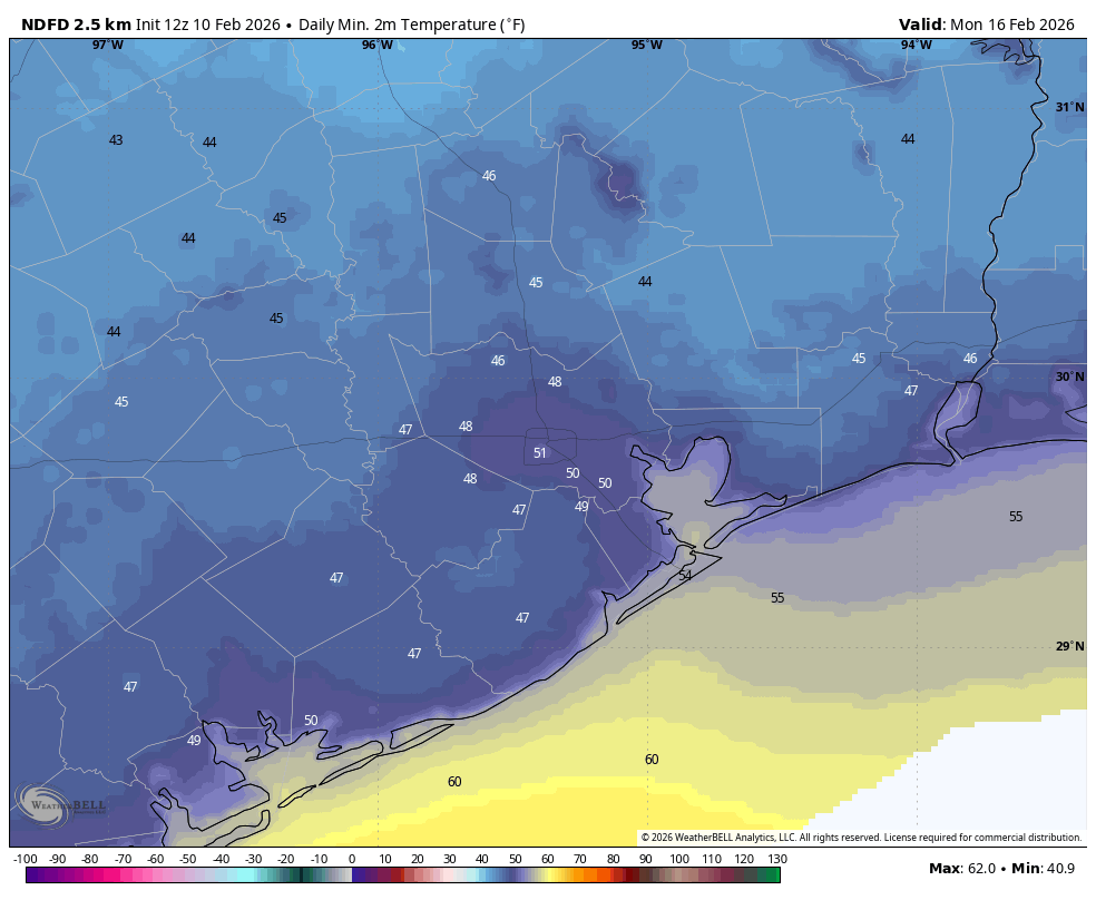
The weather Houston is experiencing this week is more characteristic of mid-April than February, with temperatures running 10 to 15 degrees above normal. Looking ahead to the next 10 or so days, we have a few modest fronts in store, but nothing that will bring temperatures close to freezing again. So is that it for freezes here?
After the hard freeze in January I’m guessing that your garden may look like something of a nightmare. It’s tempting to think about going in and doing some work. And I’m not here to tell you it won’t freeze again in Houston. My gut tells me that, for the urban core of Houston and areas closer to the coast, the city will not freeze again. But today is only February 10. We can get hard freezes throughout the month of February, historically, and a light freeze any time in March.
So yes, it may not freeze again this winter. I would go so far as to say it probably won’t. But am I tearing up my garden? Not yet.
Tuesday
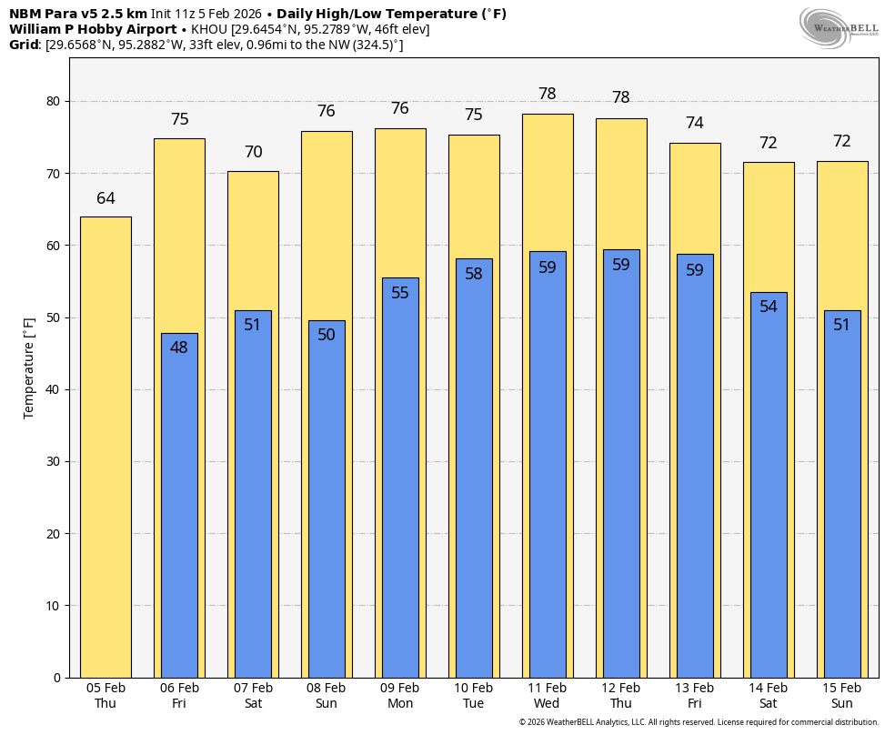
Today will be similar to Monday, with a warm southerly flow and high temperatures generally in the upper 70s. However with a little more moisture available, I expect skies to be partly to mostly cloudy this afternoon. Winds will get a little frisky this afternoon, perhaps gusting up to about 20 mph from the south. Lows tonight will drop to around 60 degrees in Houston.
Wednesday
Our weather on Wednesday is looking a little more interesting as a disturbance moves into the area. There is now about a 30 percent chance of showers (mostly light), likely during the afternoon hours. Skies will be partly sunny otherwise, with highs again in the upper 70s. On Wednesday afternoon a nose of drier air at the surface will attempt to move into the region from the northwest. I don’t think this drier and slightly cooler air will make it down to the coast, but I could see it pushing down to the Interstate 69/Highway 59 corridor by Wednesday evening or early Thursday. This leaves some uncertainty with lows on Wednesday night. I think the coast remains in the 60s, but some inland areas could drop into the 50s for a few hours on Thursday morning.
Thursday and Friday
The front’s effect, if you feel it, will be short-lived. Both Thursday and Friday will see highs in the upper 70s to lower 80s, with partly to mostly sunny skies. Lows will be back in the lower 60s for pretty much the entire area.
Saturday
The first half of the weekend will start out warm, with another day likely in the upper 70s. However we are likely to see widespread showers (and maybe a few thunderstorms, but nothing severe) on Saturday ahead of a front that should move through sometime during the afternoon or evening hours. The most likely time for showers is during the afternoon, but I’m not ruling out any time on Saturday night now. I’m going to continue to spitball rain accumulations of 0.25 to 0.75 for the area, but let’s put those in pencil for now, rather than writing them confidently in ink. Lows on Saturday night will drop into the 50s.
Sunday
This looks like an exceptional day, with sunny skies and a high near 70 degrees. My only concern at this point is winds, which could be gusty from the north at about 20 mph. But my hope would be that that die down somewhat during the afternoon hours. Sunday night into Monday morning looks to be the coolest night of the period, with lows falling to perhaps 50 degrees in Houston, with cooler conditions for outlying areas.
Next week
Monday—a holiday for many in honor of our presidents—should also be a rather pleasant day. Expect highs in the low- to mid-70s, with low humidity and light winds. Lows on Monday night should also drop into the 50s. After that we look to be warmer again for the remainder of the week, probably with highs in the upper 70s to 80 degrees, and overnight lows around 60 degrees. Another modest front is possible toward the end of next week. We’ll just have to wait and see.