In brief: In this morning’s post we dig into the data to find that yes, this October definitely still ‘feels’ like summer. Will this ever end? Also, we look ahead to increased rain chances this weekend.
Fall is more than half over, and yet…
You may not realize it, but meteorological fall is already half over. We crossed that threshold last week. But this morning aside—which is lovely!—much of September and October have felt like a continuation of summer. I crunched the numbers this morning, and the average high temperature so far this month, through Sunday, has been 91.3 degrees. If that sounds strikingly warm for October, well, it is.

The normal high during the first three weeks of this month is about 85 degrees. This month’s temperature, through 19 days, is the hottest ever, beating the record of 90.7 degrees (set last year). Compare this to the ‘normal’ high temperature for September, which is 90.4 degrees. So yes, if you’re thinking that large swathes of October have felt like a continuation of summer-like weather, you’re not wrong. If you’re wondering if fall is ever going to arrive, the answer is yes, hopefully a little more than one week from day. More on that below.
Monday
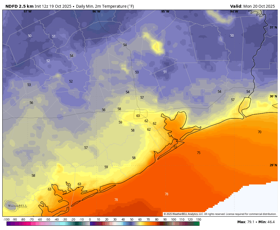
Temperatures this morning range from about 50 degrees in the usual cold spots, such as Conroe, to the lower 70s right along the coast. For most of us, these are the coolest temperatures of the season. However the front that brought this weather to us is already washing out, and we’ll see winds swing to come from the east-southeast today, perhaps gusting up to 20 mph. We’ll also see sunny skies, with highs near 90 degrees, and rapidly rising dewpoints. As a result humidity levels will be higher by this evening, and overnight lows will only drop into the 70s for pretty much everyone.
Tuesday
Another front will push into the region later on Tuesday, and this will bring a slight chance of rain, perhaps 30 percent for Houston, and a little bit higher for coastal areas. This will be humid and warm day ahead of the front with temperatures in the lower 90s for most. Temperatures should fall into the 60s for most on Tuesday night behind the front as drier air moves in.
Wednesday and Thursday
These should be a pair of partly sunny days with highs in the 80s. Wednesday will have lower humidity, but Thursday also does not look excessively humid. Wednesday night should see lows drop into the mid-60s (colder still north and east of Houston), whereas Thursday night only falls to around 70 degrees. Rain chances on both days is near zero.
Friday, Saturday, and Sunday
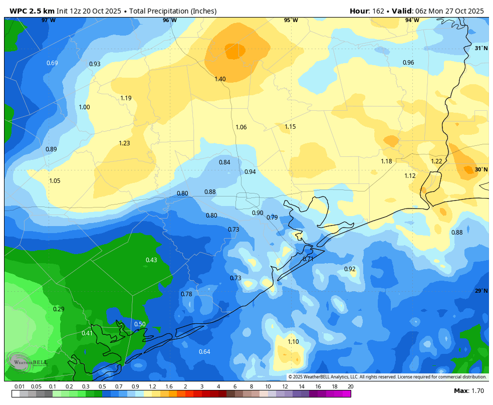
The combination of an upper-level low and the onshore flow will bring a better chance of rain into the forecast for the weekend period. It’s not clear when the best chances will come, but it likely will be between Friday and Saturday night. It’s too early to have much confidence in accumulations, but most of the area could pick up on the order of 1 inch of needed rain through Sunday. In any case, these days should see partly sunny skies with highs in the 80s. Lows will likely be in the vicinity of the upper 60s to 70 degrees.
Next week
The warmer weather will hang on to start next week, but following that there is a a fairly strong signal in the global models for a pattern change, and this is supported by an atmospheric setup that should allow colder air over Canada to move down into the United States. We think this probably will allow a stronger, fall-like front to arrive in our area a couple of days before Halloween. Because this is still 7 to 10 days away we cannot have total confidence, but it does seem likely to occur. This would probably bring us a few nights in the 50s.