In brief: So the great ice-apocalypse forecast by some did not happen in Houston. We explain why not, and why most Houston roads are good to go. Also, we take a peek at lows tonight and Monday night.
So what happened?
If you’ve been carefully reading Space City Weather for the past week—and you have, haven’t you?—we’ve talked ad nauseum about the uncertainty surrounding air temperatures on Sunday morning, and what that would mean for freezing rain and ice accumulations. Back on Thursday, for example, I outlined a couple of scenarios that were possible; a faster freeze and a slower freeze. In the end we got lucky, and the “slower freeze” happened.
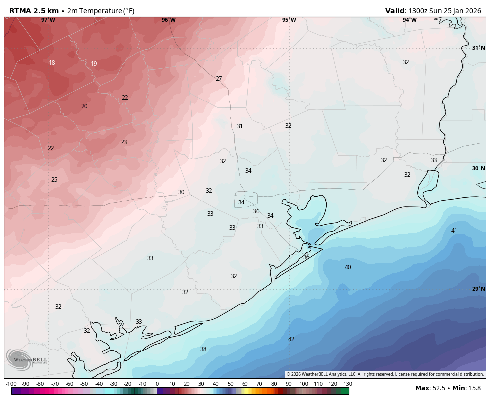
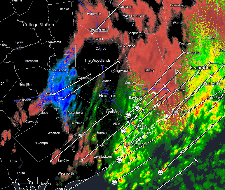
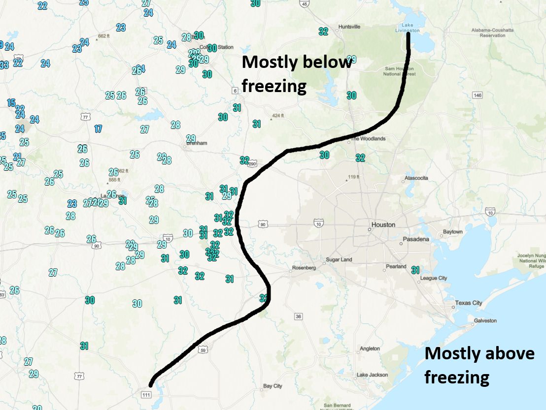
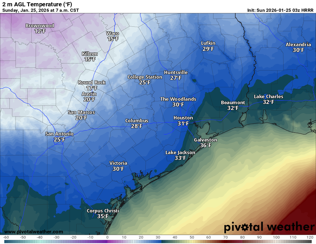
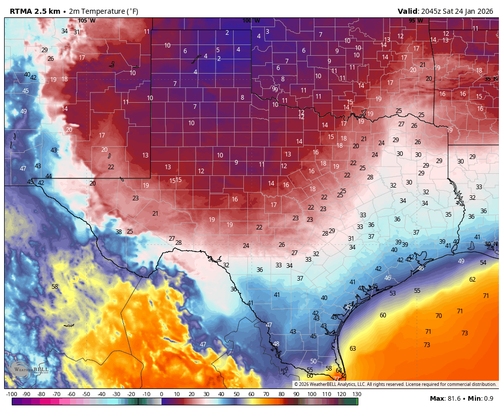
Basically, temperatures during the key moments of precipitation this morning across most of the Houston area remained in the 32 to 35 degree range. (The map above shows air temperatures at 7 am CT). We actually saw surface temperatures warm very slightly when the stronger showers moved through this morning as this heavier precipitation dragged some of the warmer air higher in the atmosphere down to the surface. These couple of degrees helped ensure that a lot of precipitation feel in Houston as cold rain or sleet. Moreover, because surfaces were still well above freezing (it’s been warm for the last week) there was not enough time for these surfaces to cool down to support sticking ice.
We received about 0.25 to 1 inch of precipitation this morning. Had that been snow, we would have had inches of the white stuff laying around. Had it been freezing rain, our roads would be an icy nightmare. Because it was what it was, our roads have had some time to dry out before temperatures plunge tonight.
Are there issues with driving?
Things are fine for the most part out there in metro Houston. As of noon on Sunday there are just about a dozen icy locations on area freeways, and these are largely where you would expect them: to the west, northwest, and north of Houston, mostly on overpasses. But by and large the rain has evaporated from streets before it could freeze, and a lot of area roads are clear. Locations that are dry now will be fine from now on.
There are still some locations with patchy ice, and areas with standing water will freeze tonight. So I’m not saying you should drive without caution. But getting around Houston should be fine if you drive with care tonight and on Monday.
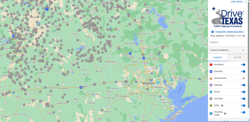
But boy oh boy, when you get outside of Houston conditions deteriorate pretty quickly. If you browse over to Drive Texas there are hundreds of reported incidences of ice and snow on Texas highways. So if you need to get from Houston north to Dallas, or west to Austin and San Antonio, travel is not recommended. (I-10 east into Louisiana is fine). Neither Austin nor Dallas will be comfortably above freezing until Tuesday, but road conditions may improve before then due to treatment.
So how about power issues?
Houston has dodged the first of two potential bullets when it comes to electricity. Because we never recorded much in the way of freezing rain this morning, ice never accumulated on tree limbs and power lines. Therefore, CenterPoint and other utilities never had distribution issues.
The second bullet is power generation, especially tonight into Monday morning when the state faces some of its coldest weather. If you peruse supply and demand projections from ERCOT, a possible crunch remains from 6 am to 10 am on Monday morning. So far ERCOT has not issued a call to conserve energy usage, so my sense is that things will be more or less OK on Monday morning from a power generation standpoint. But we’ll keep a close eye on things, and update Space City Weather if this projection changes.
Sunday and Monday nights
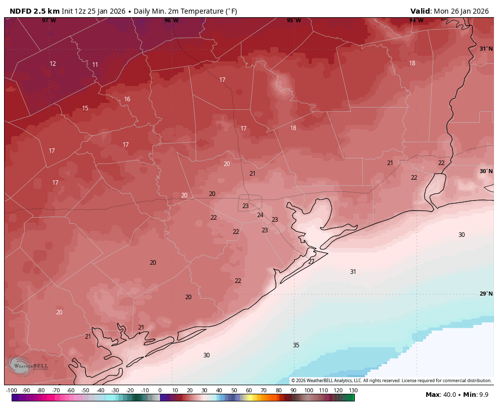
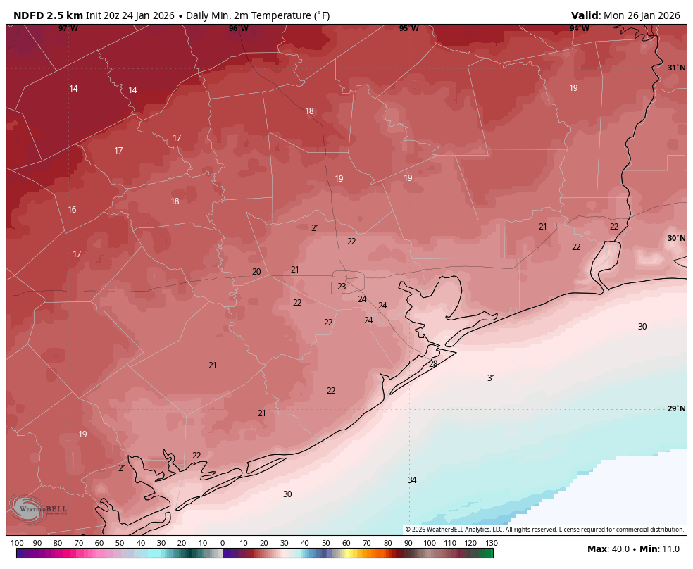
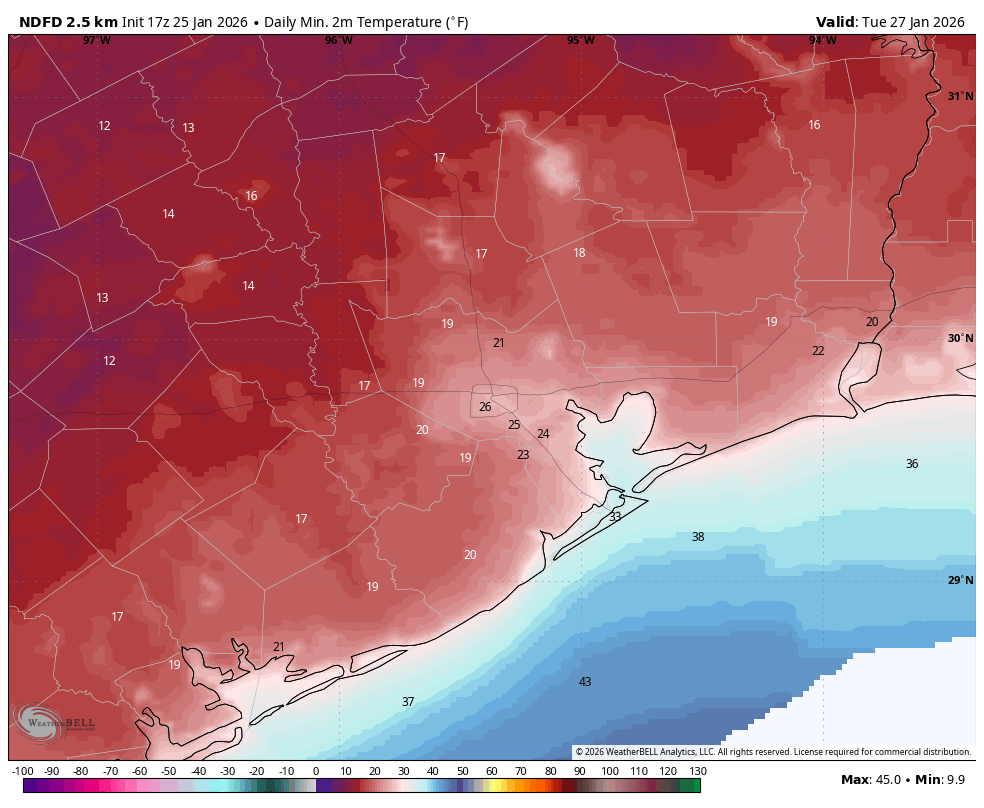
Our main remaining concern with this winter system is temperatures tonight and on Monday night, when the coldest air mass will be in place. Temperatures have trended slightly warmer of late, and I believe this is due in part to a lack of ice on the ground in and near Houston. This would have lead to more efficient cooling of air near the surface. I expect lows of generally 20 to 28 degrees in Houston on both nights, with slightly cooler temperatures possible north and west of the city. Below is a forecast for lows on Tuesday morning, which now should be the coldest of the period due to clear skies and light winds.
Our next update will be posted around 7 am CT on Monday morning.