In brief: Today, we tackle some colder weather for Houston this weekend, but most importantly, we look at the prospects of snow during the Texans/Patriots game in Foxborough on Sunday. We also have the latest on next week’s rain chances and some signs of colder weather again next weekend-ish.
Texans Outlook
We’re going to start in New England rather than in Texas today. Obviously, many of you are amped up for the Texans/Patriots game, with the Texans having a chance to do something exciting and positive for both the city and America in general. We are too. We’re also pretty intrigued by the forecast. The 50,000 foot view here is that a storm system is likely to pass through on Saturday, with rain showers ending as snow showers across southern New England. Then, on Sunday another storm system is going to develop off the Southeast coast, perhaps bringing some snow as far south as southern Georgia or even the Florida Panhandle. As that moves offshore and to the northeast, it will likely graze southeastern New England. It will be a close call for the Texans game.
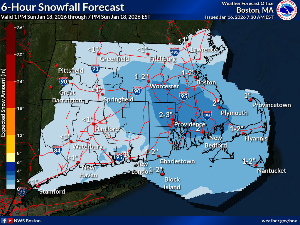
A couple reasons for this. First, the storm track is not set in stone yet. A more suppressed storm would keep most precip closer to Cape Cod or coastal Massachusetts than Foxborough (remember, Gillette Stadium is closer to Providence than Boston). But if the current models are correct, Foxborough will be in the sweet spot for developing snow late on Sunday afternoon. Most importantly, timing is everything. Models have varied a bit on the snow’s onset for Sunday. Kickoff is 2 PM CT/3 PM ET, and it appears that snow develops in that window. It could be a situation where the game starts out with nothing worse than flurries, but the second half gets a little gnarly. Is that good for the Texans? The offense and fans should enjoy temperatures that may actually be about 4 to 8 degrees warmer than in Pittsburgh (mid to upper 30s) despite the snow, with lighter winds (5 to 10 mph). The defense? I’m pretty sure you could put them in a hockey rink on roller-skates and they’d still be scary good. Whatever happens: Let’s go Texans!
Today
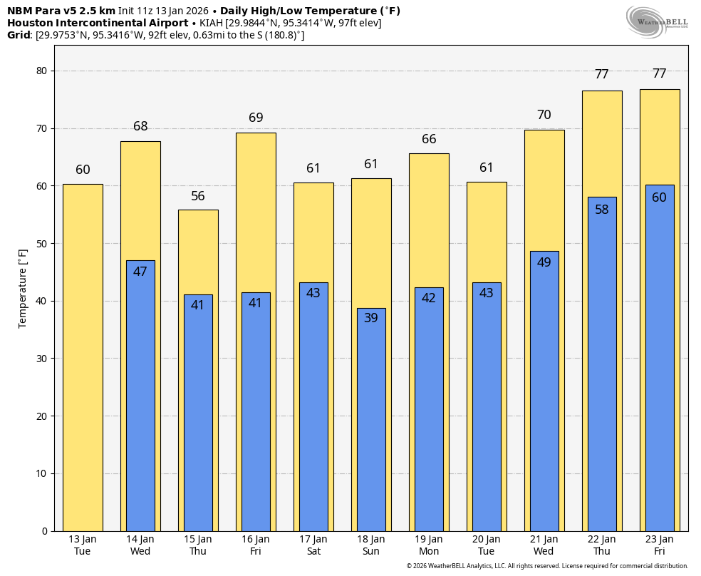
Back to our local weather, it’s a cool start again today, but we’re heading up, up, up this afternoon. With sunshine, we should push into the low-70s.
Weekend
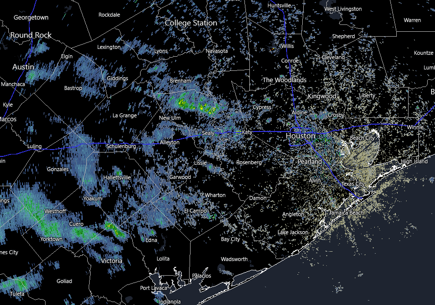
Another uneventful cold front pushes into the area tonight with maybe just a passing shower south and east of Houston. That will push offshore overnight, and much cooler weather will drop back in for Saturday. Morning lows will be in the 40s and 50s, followed up by breezy conditions and highs in the mid-50s at best. Saturday will be sunny once again.
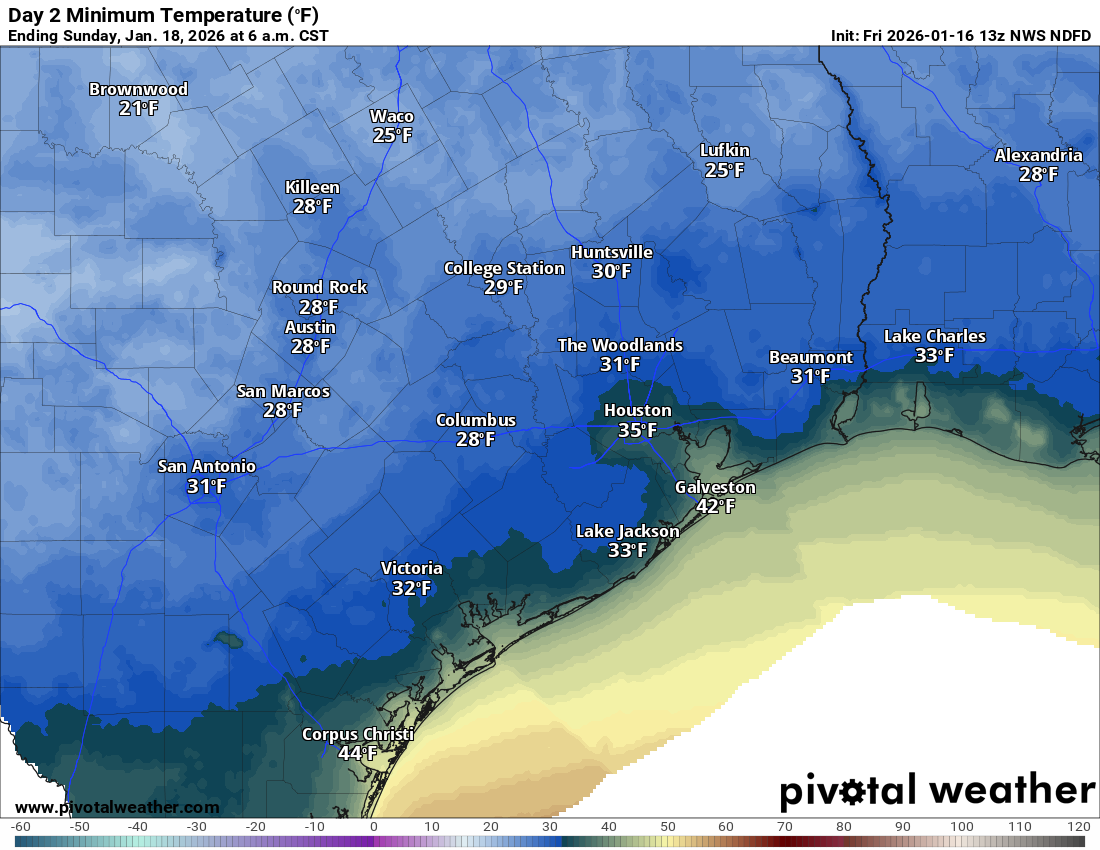
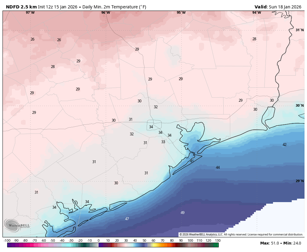
Our coldest night of the current stretch so far will come tomorrow night into Sunday morning with lows in the 30s across the area. We will likely see temperatures near the freezing mark across northern parts of the area, as well as the usually sheltered colder spots out toward Bellville and Sealy and into Fort Bend and Wharton Counties, as well as in Liberty County. Sunday itself looks like a lovely winter day with sun and highs in the 50s.
Next week
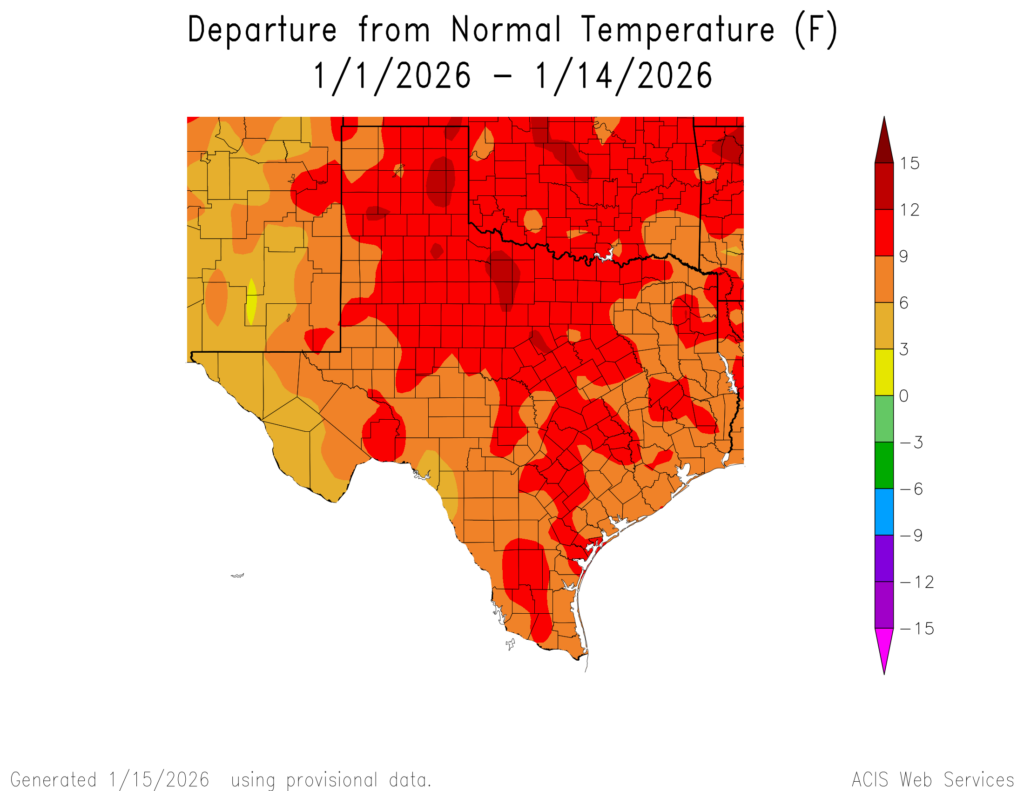
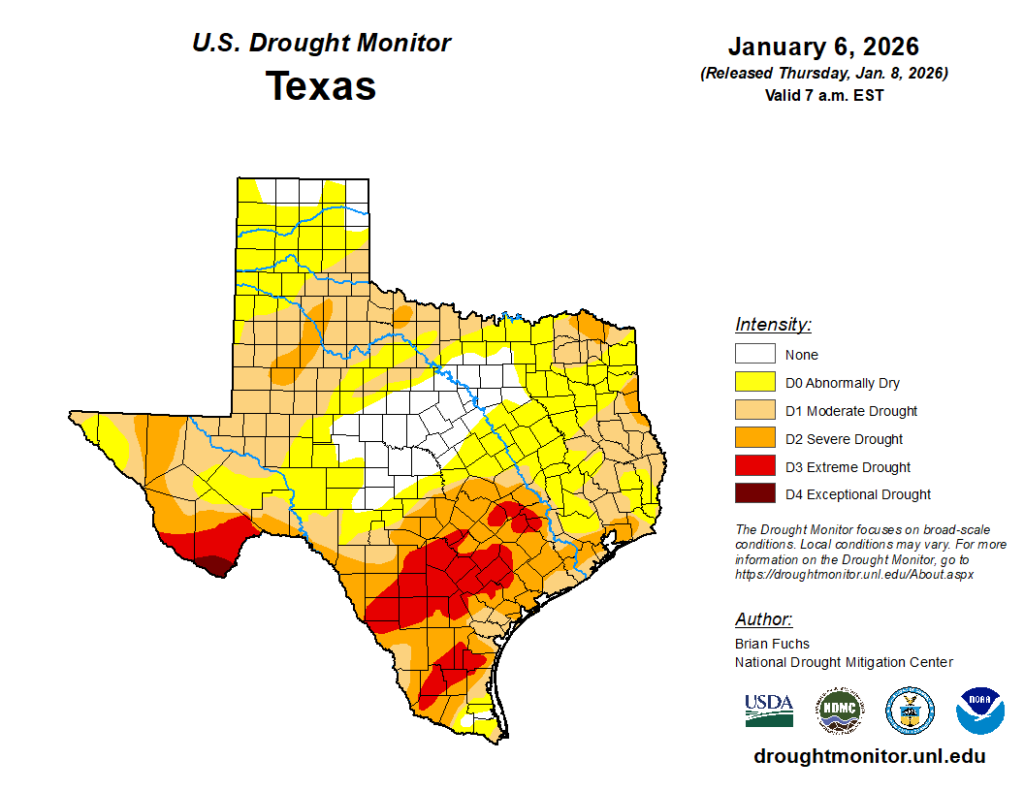
There are no big forecast changes for next week. Monday starts quiet and sunny for those able to honor and enjoy the MLK holiday. Highs will be in the 60s after morning lows in the 30s and 40s. Clouds move in Tuesday, along with cooler temperatures. And the prospect of a widespread rain remains somewhat in the cards for Wednesday and Thursday. Stay tuned. Extreme and severe drought has expanded over the last week in the Houston area. We need rain.
Thereafter, we’ll watch for colder risks next weekend, possibly some of the coldest air of winter (though a Texas freeze event does *not* look likely at this time). Speaking of cold…
A message from Reliant
As Eric explained in yesterday’s post, January has been warm so far but cooler temps coming our way this weekend! At Reliant, we’re sharing a few energy-efficiency tips and simple home improvement tasks that can keep your heating system from working harder than it needs to and keep you from spending more on winter electricity bills.
Try space heaters in high-traffic rooms. Lower your thermostat and use an energy-efficient space heater in rooms where you spend the most time.
Check your thermostat. If you have an electric heater, set the thermostat to 68 degrees while you’re awake. Lower it and add an extra blanket while you sleep to save energy.
Use your drapes. Thermal drapes can help block drafts and retain heat, especially on older windows. Open south-facing curtains during the day to let in sunlight and close them at night to trap warmth.
Invest in smart plugs and smart power strips. These allow you to control the power supply to devices remotely via a smartphone app. This way, you can easily shut off power to devices not in use, even when you’re not at home.
Layer up. Reach for a sweater or blanket before reaching for the thermostat. Weather-appropriate clothes help reduce the demand for heat. Plug in your electric blanket and stay warm for around 25 cents a day.
Install insulation. While more of a long-term project, you can regulate your home’s temperature and reduce heating costs by adding insulation.
Weatherstrip exterior doors and windows. With a couple of hours’ work, you can seal out the cold and save up to 10 percent on total energy costs.