In brief: Houston’s weather will behave more typical of January this week, with temperatures both a little cooler and a little warmer than normal at times. Thankfully, it looks to remain on the quieter side of things overall.
First off, you don’t always get Matt on a Monday, but that’s because I’m letting Eric sleep in after setting a personal record in yesterday’s Houston Marathon! What a day for a run, what a day for some new course records. But congratulations to Eric on the achievement, and congratulations to those of you who did any of the events yesterday!

Today
We have a fair bit of middle and upper level cloud cover passing through the region today, so it’ll be one of those “sunny in name only” days. Look for intervals of sun and clouds. Temperatures should manage about 58 to 61 degrees this afternoon on average. Winds will be on the lighter side.
For those of y’all watching or going to the Texans game in Pittsburgh tonight, it looks chilly and breezy. If you watched the games in Philly or New England yesterday, you saw the winds and their impacts. In Pittsburgh, winds will be lightening up this evening, with temperatures falling from the mid to upper-30s to the low or mid-30s during the game. Go Texans!
Tuesday
This is our first kinda-sorta interesting weather day this week. The overall picture is straightforward: We’ll continue with these higher clouds. Temperatures should be a couple degrees cooler tomorrow, as cloud cover may be more prevalent. We will probably either squeeze out a couple showers or some virga (rain that evaporates before reaching the ground). However, with the cooler temperatures and relatively drier air, even with temperatures in the 50s, I would not be at all shocked if someone tags us on social media saying they see sleet/ice pellets at their house, particularly closer to Sealy or the Brazos Valley. There would be zero impacts, but I’m just noting that!
Wednesday
Ahead of our next front, we warm up on Wednesday with temperatures deep into the 60s and perhaps a bit more sunshine.
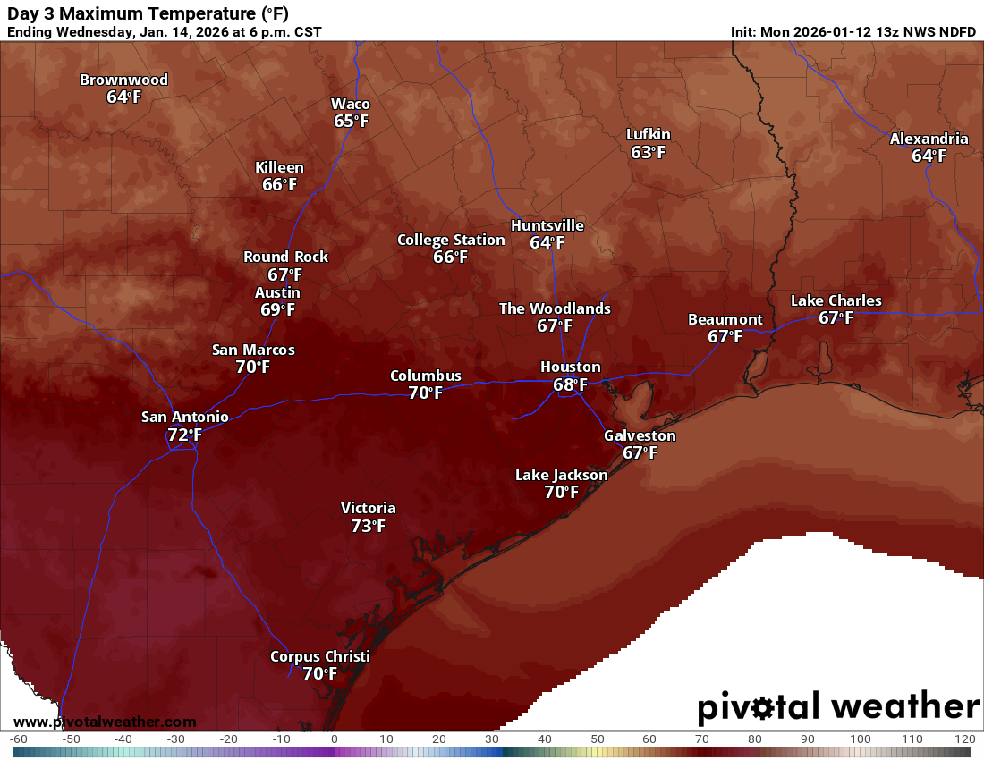
A cool front hits the area on Wednesday evening, so winds may pick up a little bit overnight (20-30 mph or so). Otherwise, the front should come through with minimal impacts.
Thursday into the weekend
We’ll cool off a bit on Thursday behind the front with highs probably in the 50s across the area and sunshine! Friday looks delightful, with more sun and highs in the 60s. Another front hits the area on Saturday. There’s a little uncertainty on whether or not we can squeeze out a few rain drops or (again) ice pellets with this as it passes through. But even if we do, any precip would be very, very light. Temperatures should again cool down with highs near 60 or in the 50s Saturday, and then low-60s on Sunday.
Overall, this looks like fine, mostly typical January weather for Houston after what has been quite a warm stretch.