In brief: In today’s post we take a look back at Hurricane Katrina, and what has changed in the 20 years since then. Additionally we discuss a front that will slog into the area and make for a soggy weekend. However, we do expect drier and cooler weather for much of next week, which is a fine way to start September.
Katrina at 20 years
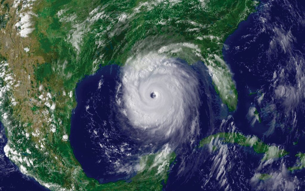
As many as a quarter of a million people evacuated from New Orleans to Houston before and after Hurricane Katrina struck the city 20 years ago, today. My hope is that, if you’re from Louisiana and reading this site, that you have found a good home in the greater Houston area. One thing I love about this city is that we are generally a welcoming people, with a warm culture that rewards hard work. Hurricanes are awful disasters, tearing apart not just physical structures but communities and human bonds. In that sense Katrina is the most wrenching storm of our lifetimes, utterly transforming New Orleans and upending so many lives.
Katrina marked a defining moment in my career. By 2005 I had been writing about science for the Houston Chronicle for half a decade, and had very recently begun a science blog for the newspaper called “SciGuy.” (The Chronicle has taken it offline, but you can find it on the wayback machine). As I had written about the “big one” hitting southern Louisiana before, I decided to go all-in on covering the storm online. It was my first real experience writing about weather, forecast models, and meteorology in real time. Three weeks later I went even deeper when Hurricane Rita threatened Houston and prompted a horrendous evacuation. That experience helped me realize that it was possible to compete with television stations online in weather forecasting. It was the beginning of a journey that led to me getting an education in meteorology, becoming a meteorologist, and starting Space City Weather 10 years later. And here we are.
Finally, I worry a lot about what would happen if a storm like Katrina threatened the Gulf coast again. It surely will. Certainly our ability to predict where a storm will go, and how strong it will get, has improved dramatically in 20 years. But beyond that, as a society, I fear we are in a worse position. The public’s trust in the federal government has been shaken. For example, in the wake of Hurricane Helene last year FEMA workers were harassed. In terms of a media environment, no one trusts anyone, and misinformation about weather is rampant online. Heck, we cannot even agree on what to call the Gulf any more. Hurricanes rip at the fabric of our societies and governments, and that fabric is weaker than it was two decades ago; our communities and institutions more riven by politics and mistrust. I have spent some time over the last week reading government reports from 20 years ago in the wake of Katrina that assessed failures (i.e. this bipartisan report from Congress), and it is painfully obvious we have not heeded many of the lessons that Katrina taught us. We are bound to learn them again with future storms.
Friday
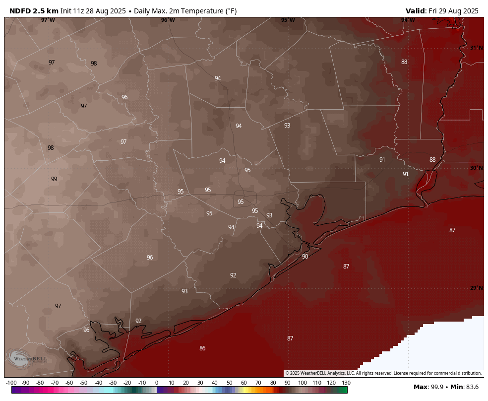
We are still watching for the possibility showers and thunderstorms later today, which could impact Friday Night Lights and the beginning of high school football. Overall chances are pretty low, perhaps in the range of 20 percent. But the atmosphere is perturbed enough that anything that gets going could develop into something with a fair bit of lightning this afternoon or evening. Otherwise we can expect a hot and mostly sunny day, with high temperatures in the mid-90s for most locations away from the coast. Clouds will increase tonight, with lows dropping into the upper 70s.
Saturday
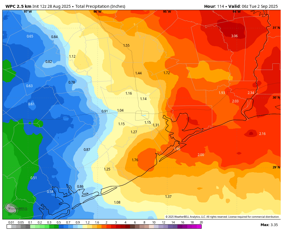
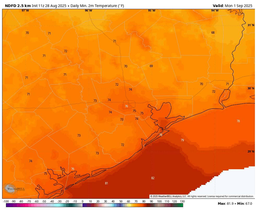
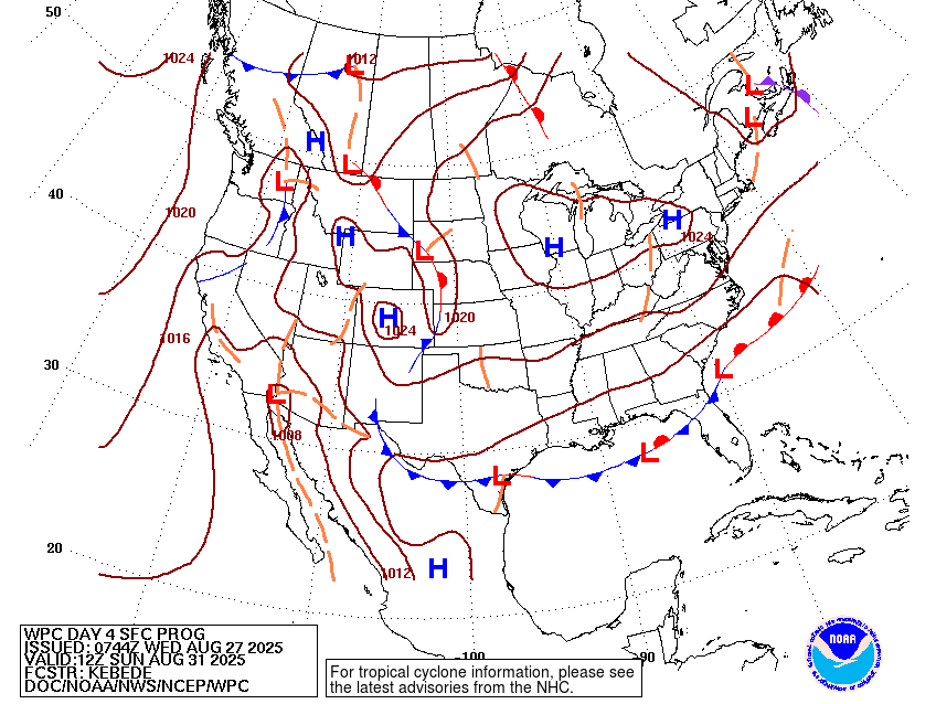
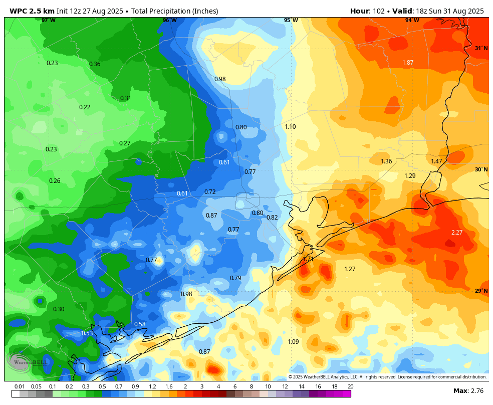
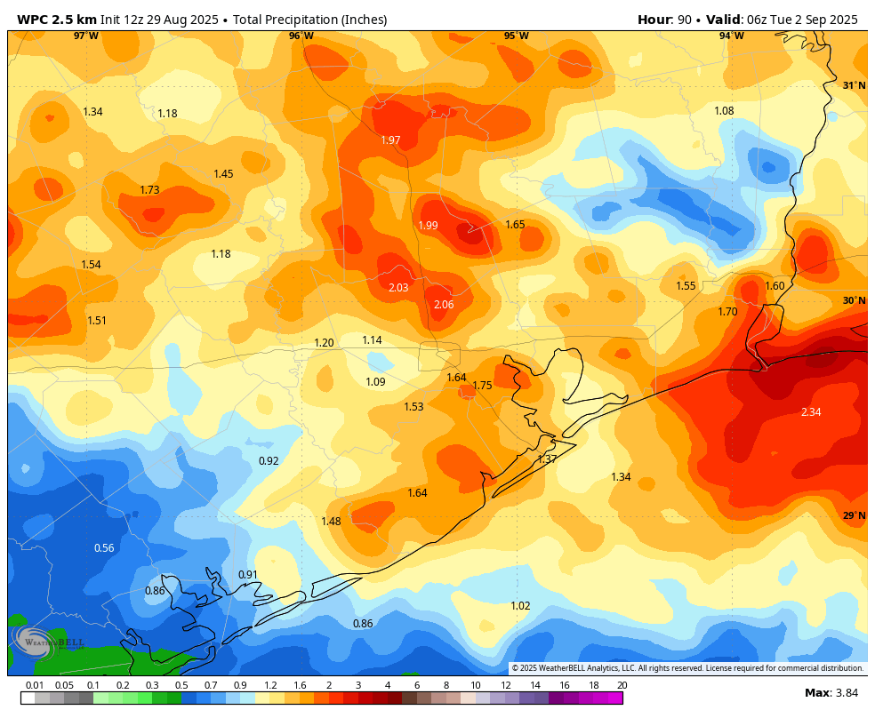
A cool front will approach and move into the city on Saturday. Once again I want to be clear about expectations. We are not at the point of the the year when fronts come barreling into the region and one can step outside and say, “ahh, that’s refreshing.” Maybe October for that. So this front will move in and then dry air should slowly accumulate over the next few days. Alright, so Saturday is still going to be pretty warm (low 90s) and humid. We are also going to see a healthy chance of rain, about 50 percent, that will continue for much of the Labor Day weekend. It won’t be wall to wall rain for sure, but there should be rounds of showers that add up to 1 to 2 inches over the weekend, with isolated areas getting more. Lows on Saturday night will probably remain stubbornly in the upper 70s.
Sunday and Monday
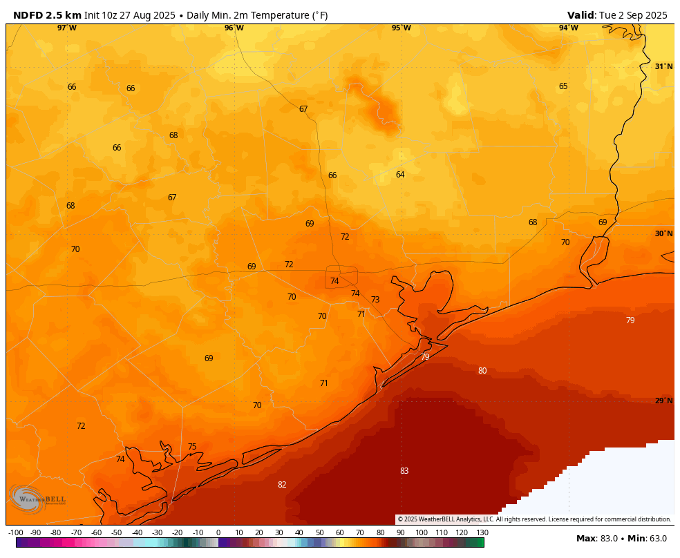
I think rain chances will probably peak on Sunday before falling back a bit to about 50 percent on Labor Day. This will help moderate high temperatures, keeping them at about 90 degrees, with nights in the mid-70s. The bottom line is that yes, you probably will be able to find some sunny spots of weather this weekend, but you’re also going to need to be dodging showers that could bring some spurts of moderate to heavy rainfall. Matt and I will be watching things this weekend, and if an update is warranted regarding the potential for flooding, we’ll have something for you. But for the most part we expect these to be nuisance showers rather than something that is seriously impactful to mobility.
Next week
Rain chances should drop significantly by Tuesday. We generally should remain in a pattern where there’s a northerly flow next week, and possibly into next weekend. This means, I think, that we will see mostly sunny days with highs in the low 90s, and nights in the low 70s. Eventually (by Monday or so) we probably will start to feel some drier air that does knock down humidity a bit.
Finally, I don’t want to give anyone false hope, but the European model has been hinting at the possibility of a slightly stronger front by Friday-ish of next week for a couple of days now. I’m not certain that will happen, but it does seem possible. We shall see.