After a dreary Monday, we’re starting off with a dreary Tuesday now. But! I do think there is more sunshine “risk” in the forecast today and tomorrow. Let’s discuss.
Today
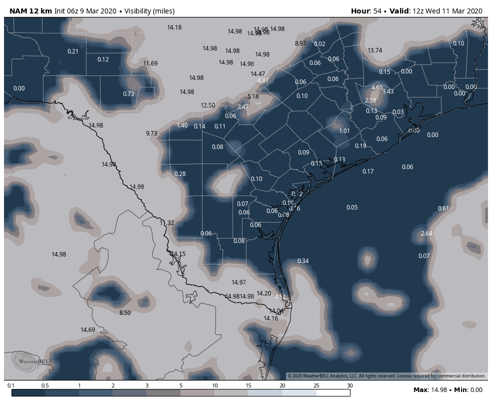
There are Dense Fog Advisories posted west and north of Houston this morning and along the immediate coast, as visibilities have dropped overnight.
Most of Harris County is not dealing with fog, except near the bay. Galveston is at a half-mile, as are parts of Liberty County, the Brazos Valley, and areas west of about Katy. As fog dissipates later this morning and afternoon, look for mostly cloudy skies. Hopefully some sunshine, but I think tomorrow has the better chance. A shower, downpour, or stray thunderstorm cannot be ruled out today. Temperatures this afternoon should get close to 80 under cloud cover, or perhaps into the low-80s with sunshine.
If you’re going to check out NCT 127 tonight at the rodeo, temperatures should drop from the  mid-70s early this evening to near 70 by 9 or 10 PM. It will be humid, and it could be a foggy drive home for you, so make sure you’re able to take a little extra time heading home from the rodeo festivities.
Tonight & Wednesday
Look for dense to again develop this evening in spots, probably before midnight. Fog may be a bit more widespread tonight and tomorrow, and it will linger through at least mid-morning on Wednesday. All areas should clear out a good bit Wednesday afternoon, except for the immediate coast, where fog could drift in and out through the day. With some sunshine, I see no issues with us pushing back toward 80 or into the low-80s on Wednesday afternoon.