In brief: We’ve got a lot to get to today. First up is our region’s coldest night of the season, by far, in which some far inland areas may experience a light freeze. Then, looking ahead, we have our first real rainfall in weeks on the horizon. And finally, we are excited to share details about our annual fundraiser, which begins today.
2025 fundraiser
It’s here!
Our annual fundraiser, in which you can buy merchandise or simply donate, begins this morning. This is your one opportunity a year to directly support our efforts to provide accurate information, without hype, to the greater Houston region. If you don’t have extra money, please do not feel pressure to give. But if you can help, we’d greatly appreciate it. You’re ensuring our work is freely available to all.
For more information, see our information page. To jump right to the merch, click here.
Monday and Monday night
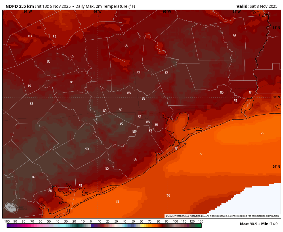
We are starting out with temperatures ranging from the mid-30s in the far north of the region (hello Conroe) to low 40s in Houston, to upper 40s right along the coast. And despite sunny skies, we are unlikely to see high temperatures rise above 60 degrees today. Winds will be decidedly lighter than on Sunday, but we still could see some northerly gusts through the early afternoon hours.
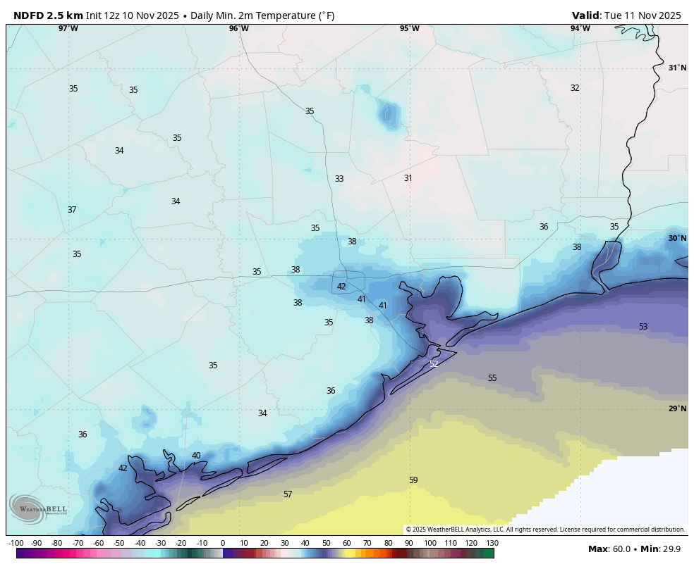
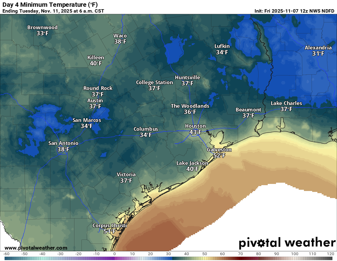
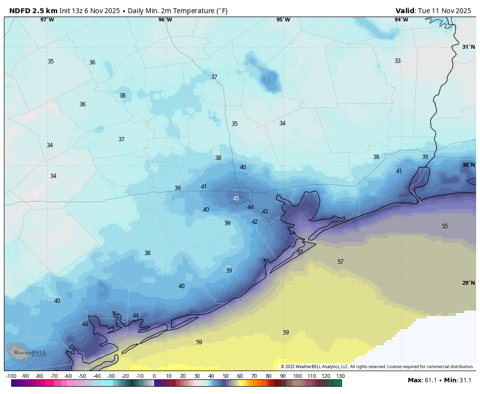
After that, our focus turns toward tonight when clear skies and light winds will provide ideal conditions for radiational cooling. In the center of Houston’s urban core I expect low temperatures to hold at around 40 degrees, but for many areas outside of the central city and away from the coast, we are likely to see lows drop into the 30s. Some areas north and north east of the city may flirt with a light freeze, including parts of Montgomery and Liberty counties.
Tuesday
Veterans Day will start out cold, but temperatures should rebound into the upper 50s by mid-morning, going all the way up to the lower 70s in the afternoon with ample sunshine. Winds will shift to come from the south, gusting up to 20 mph or so later in the day. Low temperatures will be quite a bit warmer, falling only into the upper 50s in Houston, with slightly cooler conditions further inland.
Wednesday, Thursday, and Friday
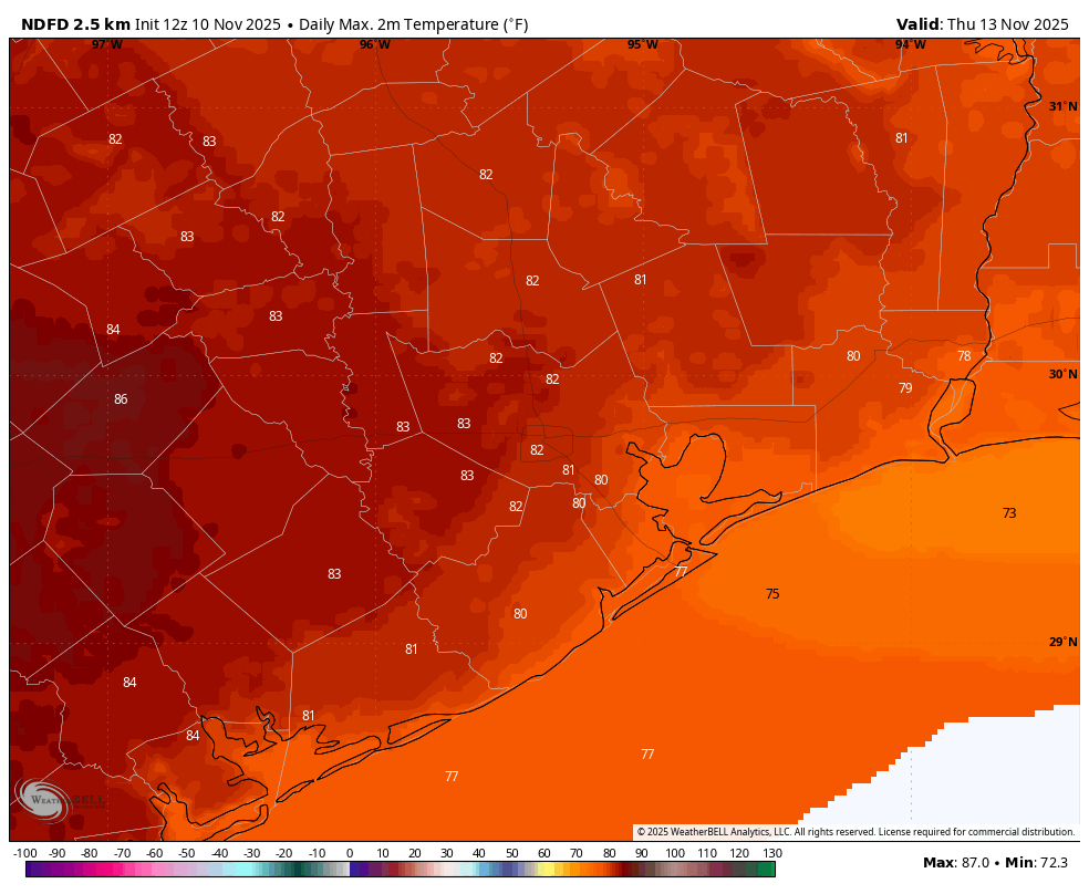
These will be three mild, partly to mostly sunny days. Highs will generally range from the upper 70s right along the coast to lower 80s for areas west and north of Houston. Will it feel humid? A bit. Dewpoints will be right around 60 degrees. So that’s moderately humid, but nothing like mid-summer or even early fall. Nighttime lows will generally fall into the mid-60s. Rain chances are low to non-existent until Friday night, at least.
Saturday and Sunday
If you have outdoor plans for the weekend you’ll want to keep an eye on the forecast in the coming days. Saturday should start out warm and somewhat humid, but at some point a front is going to advance toward the area. Because we’ll have several days of onshore flow this week there will be plenty of moisture in the atmosphere. I suspect the approach of this front will therefore lead to a good chance of rain. Timing is suspect, but I think there will be about a 50 percent chance of showers on Saturday and Saturday night, with perhaps a bit lower odds on Sunday. Accumulations don’t look too great, with totals ranging from a few tenths of an inch of rain to one-half inch. Highs on Saturday will likely be in the vicinity of 80 degrees, and perhaps 70 degrees on Sunday (depending on the timing of the front). There remains some question as to the strength of this front, but my guess is we’ll get a couple of nights with lows around 50 degrees out of it.
Next week
We are getting toward the part of the forecast that is usually pretty fuzzy. However there is decent agreement in the models about another (maybe stronger?) front later next week, and this should bring some more cooler weather and another healthy chance of rainfall. We’ll have more details for you in the coming days, but if we could pick up an inch of rainfall through next week, or so, that would do our soils some real good. A few people have asked about a Thanksgiving forecast, but I would be a turkey to try and predict something that is 17 days out.