In brief: Today’s post provides some more information on the region’s burgeoning drought, and why scattered showers to end this week are unlikely to bring any relief. We also discuss the return of September-like humidity for a couple of days before a front on Sunday.
We could use some rain
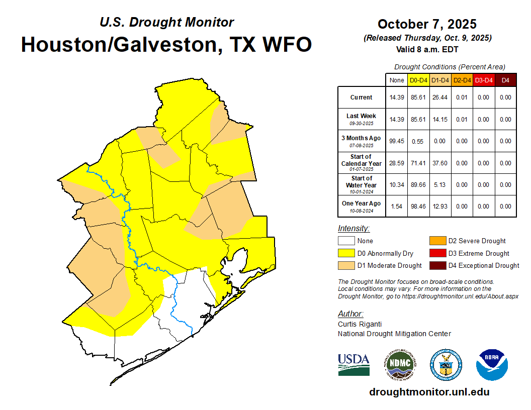
As Matt noted on Friday, drought conditions are starting to spread into the region after a dry late summer and early fall period. Houston’s official weather station at Bush Intercontinental Airport has not recorded more than a trace of rain since September 24, and in both August and September the region received substantially lower rainfall totals than normal.
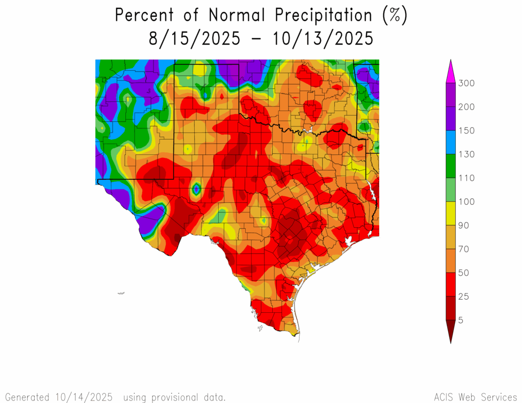
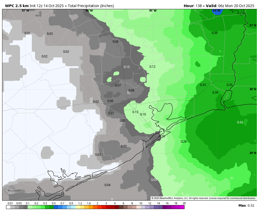
With shorter days and a lower Sun angle we don’t need as much rain to really help out our soils than we would in the middle of summer. A little goes a long way. However, although a decent shot of rain is in the forecast to end this week, the meager amount we are likely to get is not really going to help much. Most areas are likely to get one-tenth of an inch, or less. And that is just not going to cut it. Any significant rain accumulations likely remain eight to 10 days away.
Wednesday
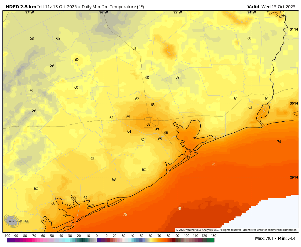
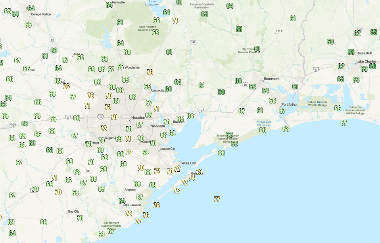
We’re going to enjoy some modestly lower humidity levels for another day or so before the return of the onshore flow. Accordingly, high temperatures today will range from the upper 80s to 90 degrees today, with sunny skies. Winds will be light, from the northeast. Lows tonight will again drop into the 60s in Houston on Wednesday night, with cooler conditions in suburban and outlying areas.
Thursday
This will be another sunny day, with highs generally in the upper 80s. However, with dewpoints a good 10 degrees higher than Wednesday, our air will feel more humid. Over the course of the day winds should shift to come more from the southeast. Lows on Thursday night will only drop into the lower 70s (with more moisture in the air it will be slower to cool down).
Friday and Saturday
These will be warmer and more humid days, feeling almost like summer outside I’m afraid. With highs in the vicinity of 90 degrees and plenty of humidity it will be a throwback to September. Each day should bring a decent (40 percent, maybe?) chance of showers. But as noted I expect these to be light, short-lived, and bringing hundredths to tenths of an inch of rain (at most). Skies, otherwise, should be mostly sunny. Nights will be warm, in the lower 70s.
Sunday
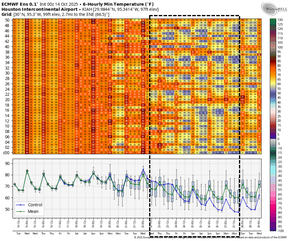
A decent shot of drier air will push into the region on Sunday as a front moves in. This will be more of a ‘humidity’ front than a true cool front, but it will still feel somewhat refreshing after Friday and Saturday. look for highs around 90 degrees on Sunday, with cooler conditions on Sunday night into Monday morning. Lows will depend on where you live, but I could see outlying areas drop into the 50s while much of Houston remains in the 60s.
Next week
Sunday’s front will be fairly short lived, with humidity and temperatures likely to rebound early next week. After that we are going to be looking for the possibility of a stronger, more fall-like front. There is still no clear or certain signal yet, but I’m hopeful we might see this at some point during the second half of next week. Notably, the GFS model out just this morning has finally leaned into such a solution, but since we are still a week or more out, I just cannot say anything with high confidence.