BREAKING: The clouds. Maybe. More on that below. If you’ve noticed that it’s been a lot drearier than normal this month, you have statistics available to back you up.
And yes, if you're wondering, it has been miserably dreary this month. It's been cloudy 83% of the time so far at 10 AM in Houston. Way above average right now. Via Iowa State IEM. pic.twitter.com/iWeUa3aEc5
— Matt Lanza (@mattlanza) February 7, 2018
This image is off of a cool site from Iowa State that has all sorts of climate and weather nuggets.I admittedly cherry picked an hour here, but other hours show some variation on this also. The link should show 3PM, which has had overcast skies reported every day this month so far. It’s been grey and dismal, and as much as I want to tell you we have a nice, lengthy stretch of good weather upcoming, we don’t.
Today & Friday
All that said, clouds have broken up some and we’ll have a half-decent day today. Satellite shows cloud cover mainly in the southeastern half of our area this morning.
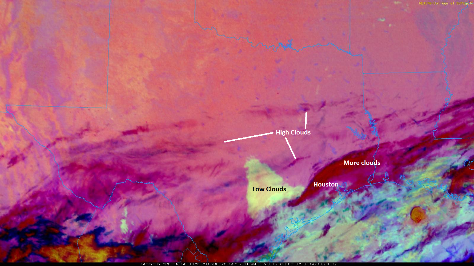
Based on the movement of the clouds, I suspect we’ll actually have more clearing today than I initially expected. We’ll call it partly cloudy to mostly sunny. Expect highs to top off in the upper 50s or so. Clouds will gradually thicken back up tonight and onshore flow will resume, allowing temperatures to not fall as much. We won’t get below the upper 40s this evening and may even rise a degree or two toward morning.
Onshore flow will continue to increase on Friday, pumping back in moisture and solidifying clouds overhead. It looks as though we’ll see showers also increase throughout the day, especially south of I-10. Expect temps to slowly, steadily warm on Friday into the mid-60s.