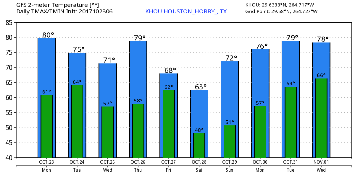
Two of my very favorite words in Houston weather are “reinforcing front.” Often, during fall, we will see a cold front move into the region, push into the Gulf of Mexico, and then return onshore a couple of days later as a warm front. But when additional shots of cooler and drier air reinforce the initial front, we can get a run of cool, mostly dry weather for a week or longer. And that’s just what we have ahead of us now.
Monday
It’s a chilly morning up north, with lows in the mid-40s for inland areas near Conroe and The Woodlands, and about 10 degrees warmer in the city of Houston and closer to the coast. With dry air and sunny skies, highs today should warm to about 80 degrees. But wait, there’s more! A reinforcing shot of cooler, drier air should move into Houston tonight.
Tuesday and Wednesday
With the additional, cooler air we should see some splendid fall weather both days, with highs probably around 70 degrees, give or take, beneath sunny skies. Overnight lows will range from the 40s inland to upper 50s closer to the coast. If you’ve been waiting for truly fall like weather, it has arrived.
