In brief: The next two days will feel pretty typical for Houston’s hottest and most humid month, but a front will usher in a pattern change for Labor Day Weekend. We will see higher rain chances on Saturday and Sunday, before some modestly drier air arrives. High temperatures for parts of the holiday weekend may top out in the 80s.
Thursday
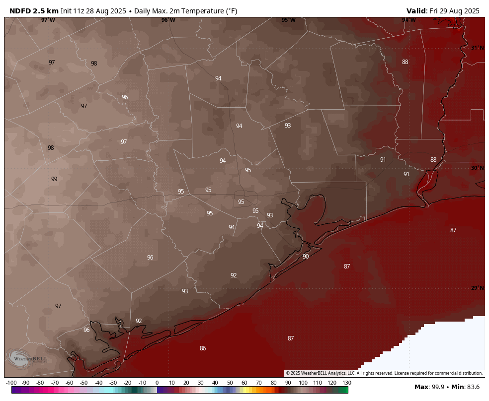
After fairly widespread shower activity on Wednesday the region should only see isolated rains today, with the best chances (perhaps 30 percent) right along the coast. Skies will be mostly sunny, with sticky humidity. Winds will blow from the south at 5 to 10 mph. In terms of temperatures, generally we can expect highs in the low- to mid-90s, which is pretty standard for this time of year. Lows tonight will be sticky, dropping only into the upper 70s.
Friday
Friday should be another mostly sunny day, with high temperatures pushing into the mid-90s for the most part. So, pretty warm. However, unlike on Thursday there should be a slightly better chance of showers and a few thunderstorms developing during the afternoon and evening hours. This is because the atmosphere should become a little more unsettled as a front slowly advances from the north, and this has the potential to impact some High School football games. There’s also a scenario in which the storms hold off until later on Friday night after the lights are turned off. We shall see.
Saturday
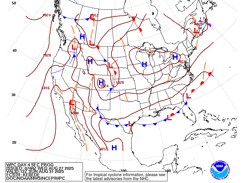
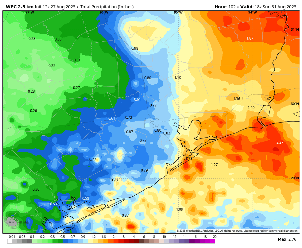
This is the day when a front slowly sags into the region. It will take some time for (modestly) drier air to work its way into Houston, so Saturday is still going to feel fairly warm and humid, with highs in the lower 90s. Showers and thunderstorms will become increasingly likely during the afternoon hours, with the best chances northeast of a line from Kingwood to Baytown. Rains remain likely on Saturday night and into Sunday, with lows dropping into the mid-70s.
Sunday
Skies look to remain partly to mostly cloudy, and along with ongoing rain chances (perhaps about 50 percent) for the area this should combine to limit high temperatures to the mid- to upper-80s. Our air will be slightly drier, but you should not expect to walk outside and say, “oh my, it’s fall!” Lows on Sunday night could drop into the lower 70s for areas inland of Interstate 10, but I’m still not sure just how much drier and cooler air will arrive this weekend.
Labor Day
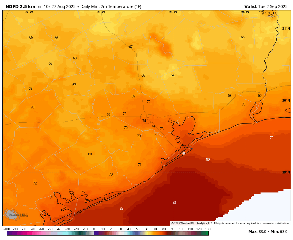
The holiday looks to be a partly sunny day. High temperatures should top out in the upper 80s to about 90 degrees, with a low-end chance of rain. Lows on Monday night should again drop into the lower 70s for areas away from the coast.
Next week
As rain chances back off, high temperatures may try to rally into the mid-90s for a couple of days with mostly sunny skies. There are some hints of another front by next weekend, but there is no real consistency in the models and I don’t want to set expectations. Pretty clearly, however, we are not headed toward a sizzling early September, like we sometimes see.