In brief: In today’s post we discuss the hints of forthcoming fall weather in our forecast, and also discuss the possibility of additional weather balloons in Texas. For our forecast, Monday looks to be quite hot, but with lower humidity After today there will be a smattering of rain chances all week, with the weekend looking cooler after a weak front (probably) arrives.
Signs of fall and weather balloons
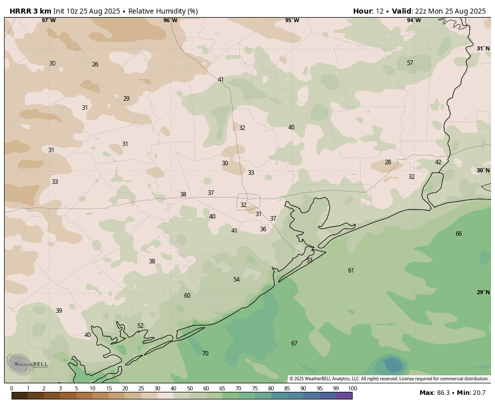
I wanted to hit on a couple of notes this morning. First up is the realization that this is the final week of August, and a period when we often see high temperatures in the 100s in Houston. For this week Monday, especially, looks to see hot weather. But one of the reasons for this is that we are seeing an influx of drier air, which is a harbinger of stronger fronts that will be possible in a few weeks’ time. This afternoon we may see dewpoints drop into the upper 50s in Houston, and while this is not super dry, it is significantly less humid than normal for late summer. This drier air will allow afternoon highs to spike into the upper 90s. Additionally, we have the prospect of another weak front sagging into Houston this coming weekend. Now these August fronts don’t carry much oomph, but they pave the way for the possibility of more substantial fronts in September. Also, we might get some lows in the lower 70s out of it, possibly even upper 60s for far inland areas. So yes, it’s still summer out. But if I squint, I can see change on the horizon.
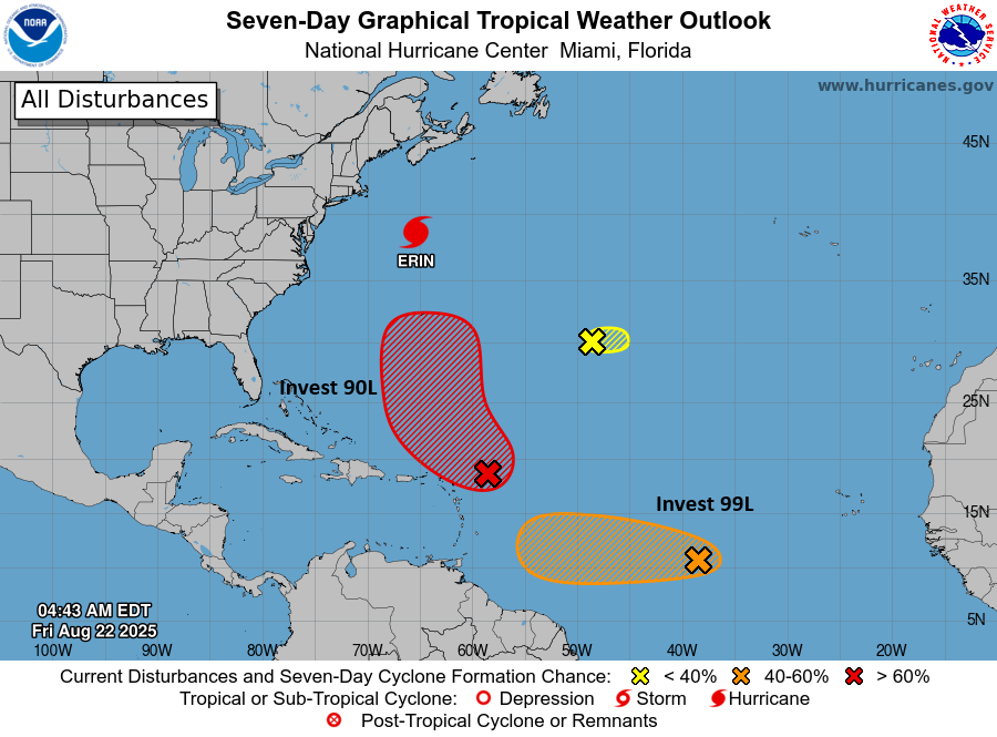
I also want to mention an editorial that appeared in the Houston Chronicle last week regarding the devastating Central Texas flooding in early July. The editorial correctly notes a paucity of weather balloon soundings over Texas (something we’ve often talked about here), and suggests that as part of their ongoing special session, Texas lawmakers consider creating a network of weather stations to better monitor conditions across the state, including setting up additional weather balloon launches on a daily basis. As a forecaster, I can say that this would definitely improve our ability to predict the most dynamic and impactful flooding events such as that which occurred near Kerrville.
Monday
As noted above, we are seeing an influx of drier air today. This should lead to a hot, mostly sunny day for the region. Expect highs in the mid- to upper-90s with a few far inland areas possibly toying with 100-degree weather. Overall humidity should be lower, however. So if you’re one of those “it’s not the heat, it’s the humidity people,” today is your day to shine. Rain chances are near zero. Lows tonight will drop into the upper 70s.
Tuesday, Wednesday, and Thursday
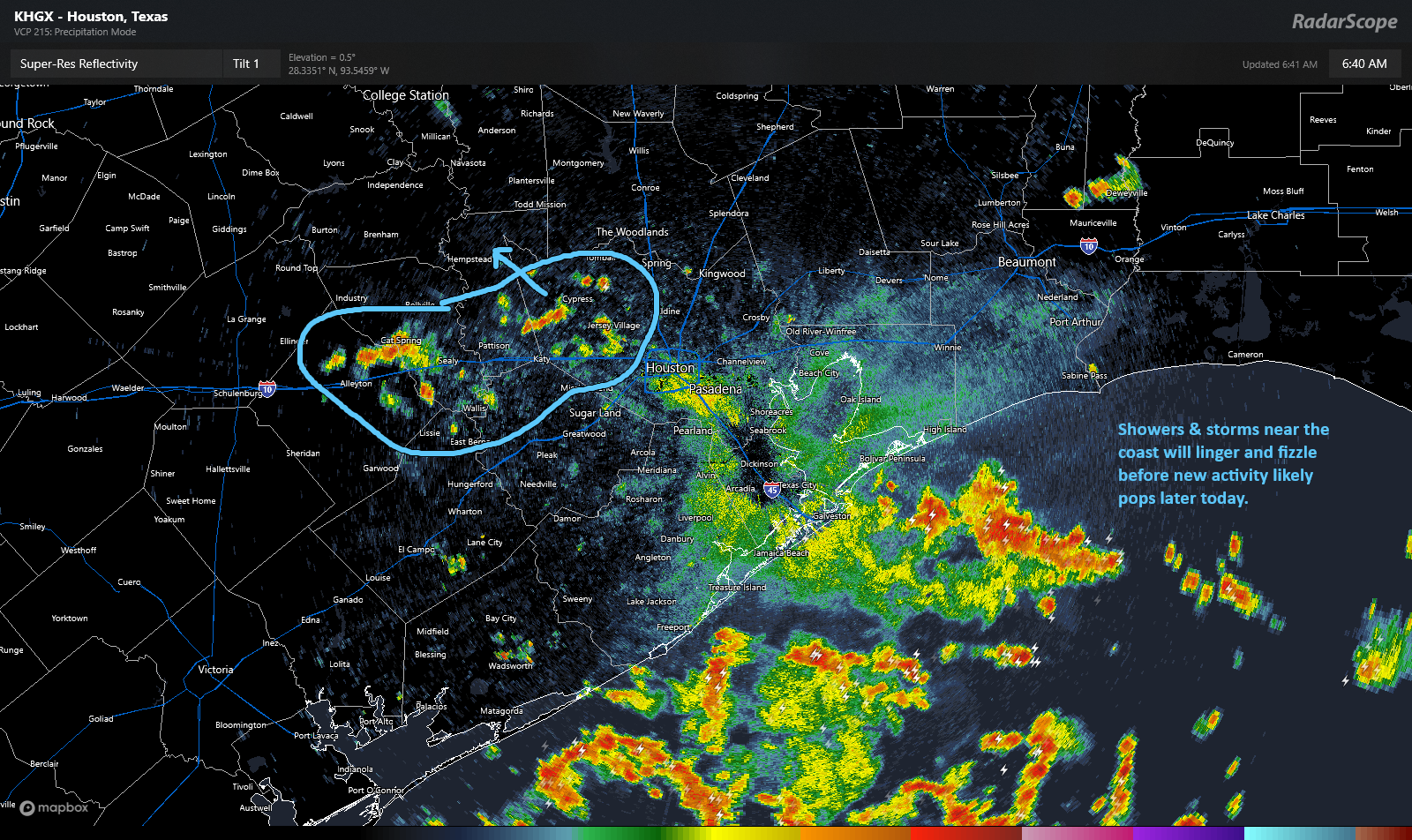
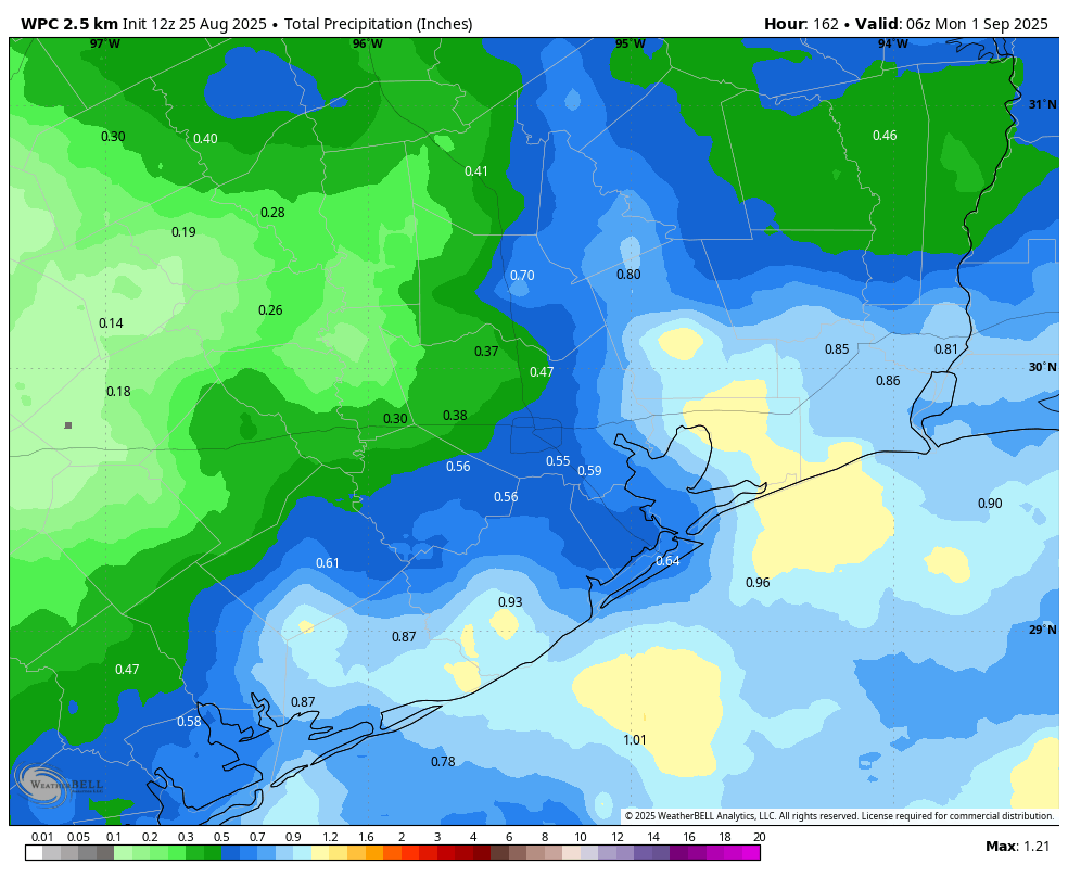
A pattern change will see slightly more unsettled weather move into the area for the mid-week time frame. Overall rain chances will be on the order of 30 to 40 percent daily, and for the most part accumulations should slight, on the order of a tenth of an inch of rain, or two. A slight increase in cloud cover should help moderate temperatures a bit. Highs should be in the mid-90s for most locations. The dry air will be long gone, so expect ample humidity. Lows will drop into the upper 70s for most.
Friday, Saturday, and Sunday
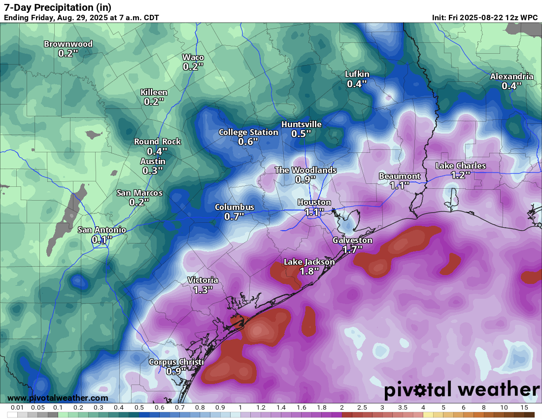
A weak front will approach the area on Friday, and likely push into the metro area on Saturday. The net impact of this should be to drive up rain rain chances to about 50 percent daily. Again, we are not looking at anything too special regarding accumulations, probably just tenths of an inch for the most part. But there could be a few stronger showers that bring a total of 1 inch or more to some areas near the coast by the end of the weekend. Highs on Friday should reach the mid-90s before falling to around 90 degrees this weekend with a few more clouds and slightly cooler air. Lows this weekend could drop into the low to mid-70s. Again, this is not chilly by any means, but a nice harbinger of what’s to come this fall.
Next week
The overall pattern next week should see continued highs mostly in the low- to mid-90s, with decent reain chances. Knock on wood, but I’m not seeing any sign of the early September spike in daily highs that the region sometime experiences.