In brief: We may see an additional round of storms this afternoon as a disturbance drops into the area, and then fairly widespread showers are likely on Thursday and Friday. The outlook for the weekend is sunnier, with lower rain chances.
A few more words about August
I wanted to share some feedback I received after yesterday’s comments about August weather in Houston. (If you don’t remember, I basically said there is nothing redeeming about August’s weather here). This person wrote in to say:
“I really like the in-depth forecasts, but the continued complaining about Houston’s hot & humid climate does not serve you well … If you moved here from a colder climate, and you don’t like the heat here, why torture yourself? Move back and enjoy your life. But if you’re going to call yourself a Texan, a Houstonian, or just live here, please consider dropping the complaints. It’s one reason I don’t frequent your site more.”
First of all, thank you for the feedback. We are always looking to improve the site and be more responsive to reader needs. However, I will be ignoring this suggestion. Yes, I realize that there are some people who like peak summer weather in Houston. Bless your hearts. However I do call myself a Houstonian (having lived here for 28 years), and one of the defining things about being a Houstonian is the God-given right to complain about the summer weather here. If that turns you off, I’ll just have to live with that.
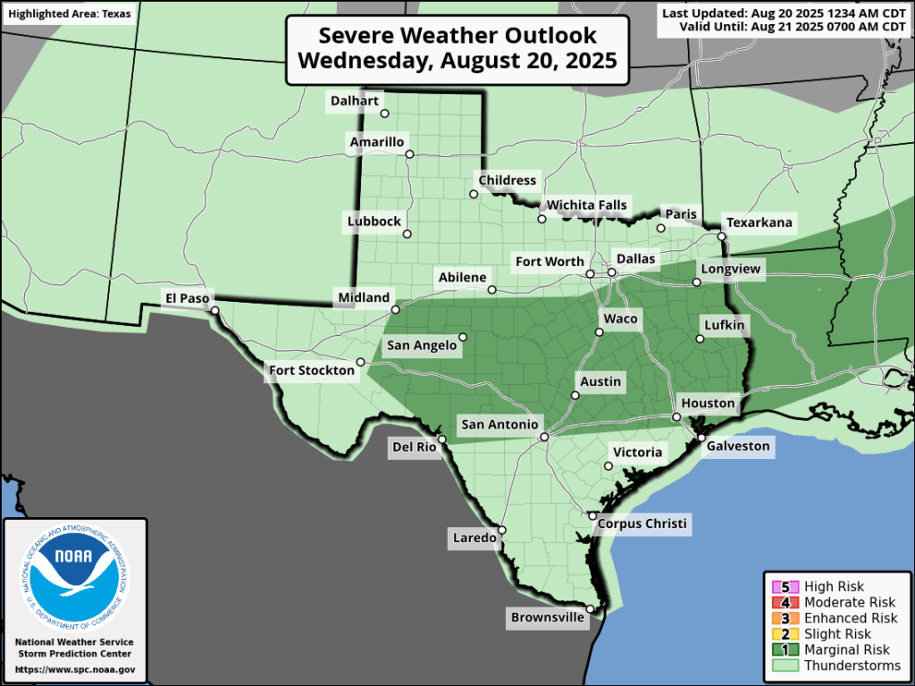
Wednesday
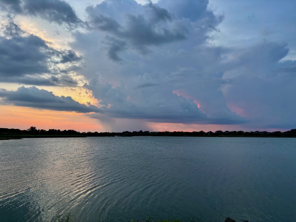
Today is an interesting one. We should see sunny skies and hot and humid weather, withs high pushing into the upper 90s this afternoon for all but inland areas. However, an upper level disturbance should drop down from north of the region later this afternoon and push into the city. I’ll be frank, the modeling has not been consistent with this. However, given what we have seen in recent days, and the abundant moisture in the atmosphere, I feel confident in predicting that some parts of the metro area will see rain this afternoon or early evening, and that some of these showers will turn into thunderstorms (possibly severe). So be on the lookout for storms later today, but they may very well not hit. Overall rain chances are probably only about 40 percent. Lows tonight will only drop to around 80 degrees.
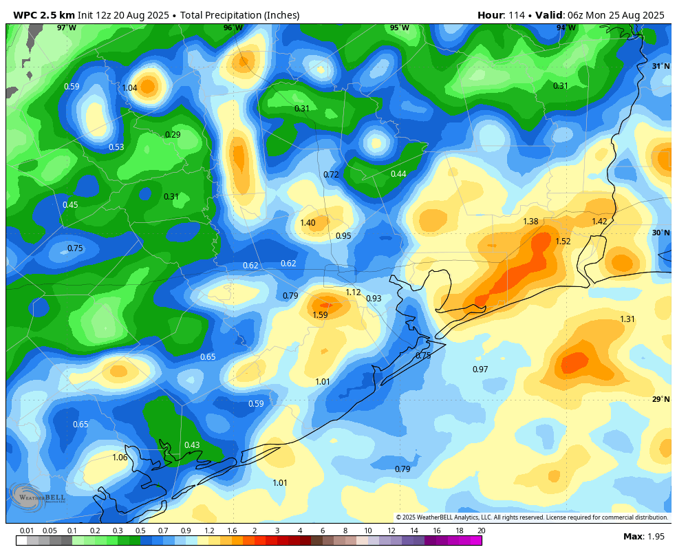
Thursday and Friday
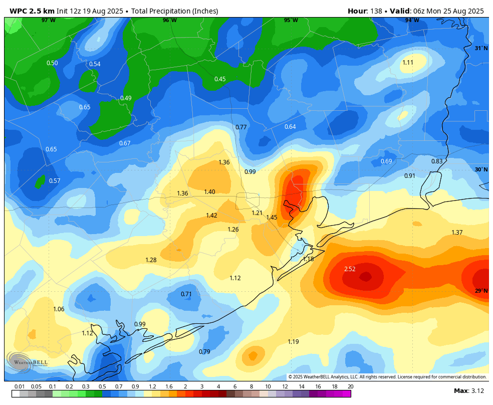
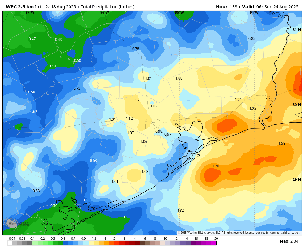
A frontal boundary will ooze into the area to end the work week, and while this won’t provide much in the way of dry air or cooler temperatures, it should be the spark for some fairly widespread showers and thunderstorms. Rain totals will, as is often the case, be highly variable across the region. I expect most of us to receive 0.5 to 1.5 inch, with higher bullseyes perhaps a little more likely south and east of the city. In any case, you should be prepared for downpours to interrupt outdoor activities, but it won’t rain all of the time. Highs should be a little lower, in the low- to mid-90s, with warm, humid nights.
Saturday and Sunday
As high pressure expands from our west this weekend it should slightly dry out the atmosphere and reduce daily rain chances to about 30 percent. These days should, accordingly, be mostly sunny with high temperatures probably in the vicinity of the mid-90s.
Next week
Next week is the final full week of August. Fortunately we look to be ending the month with (for Houston) relatively modest conditions, with highs in the low to mid-90s, and daily rain chances of maybe 20 to 40 percent. Another dying front will approach the area later in the week, but I’m not sure it will have that much sensible impact on our weather. We’ll see.