In brief: Houston will see a pattern this week of typical August temperatures, and daily shower chances. We may also see a few isolated downpours and strong winds each day. By this weekend high pressure should begin to build over the area, pushing temperatures up and rain chances downward.
Pattern overview
High pressure will develop over the Florida region during the next couple of days, and this area will gradually expand westward this week across the Gulf. What this means for Houston is that, through the coming work week, we will see enough “weakness” in the pressure pattern to allow for healthy daily shower chances with a few strong, embedded thunderstorms. This is the kind of weather some areas, such as Sugar Land, experienced on Saturday withy isolated strong storms.
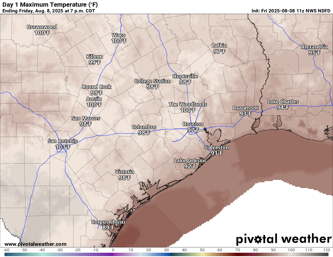
This somewhat unsettled pattern should keep high temperatures this week in the mid-90s, but we could be headed toward hotter temperatures this coming weekend, when the ridge of high pressure expands far enough west to begin directly influencing our weather.
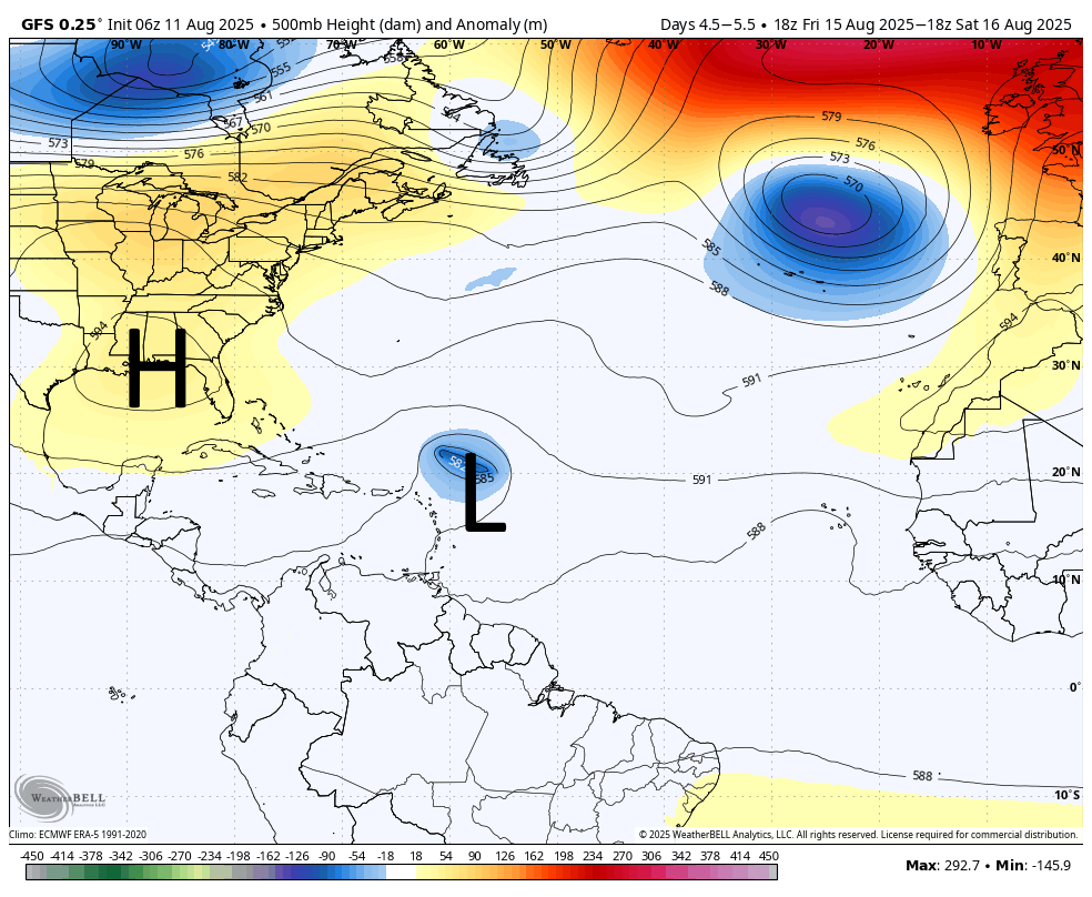
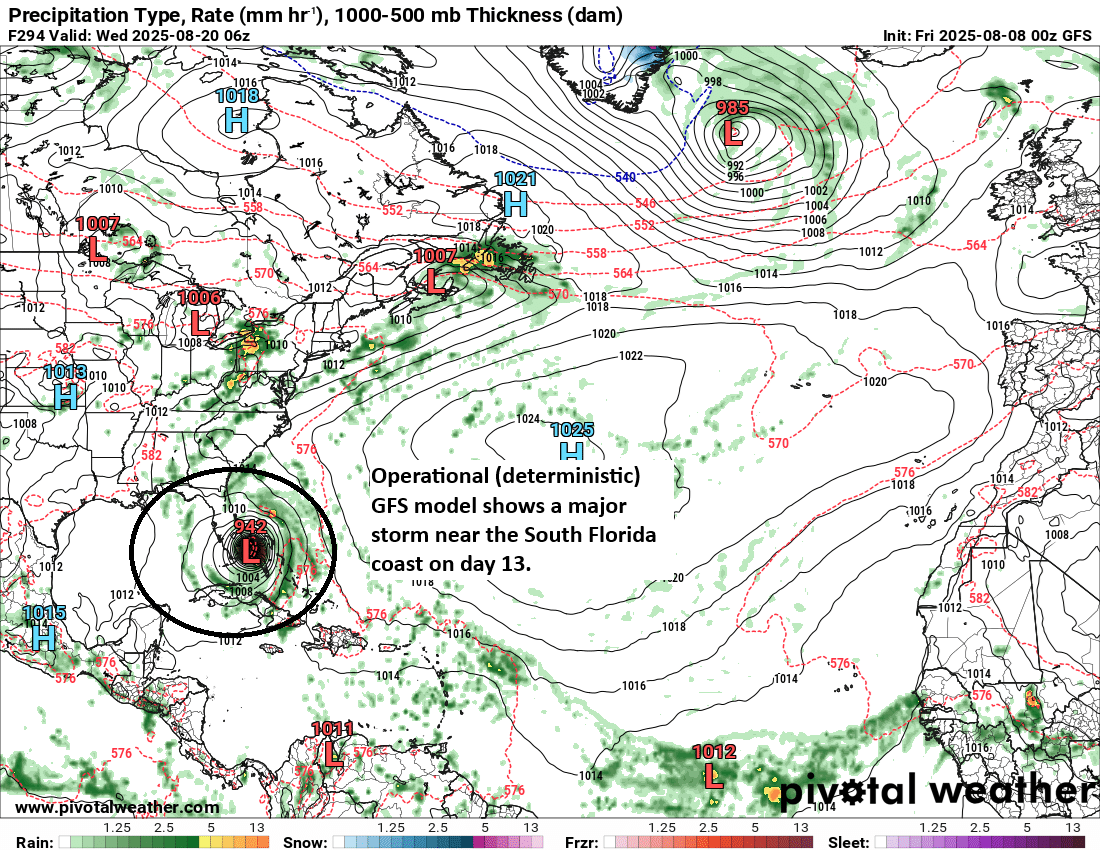
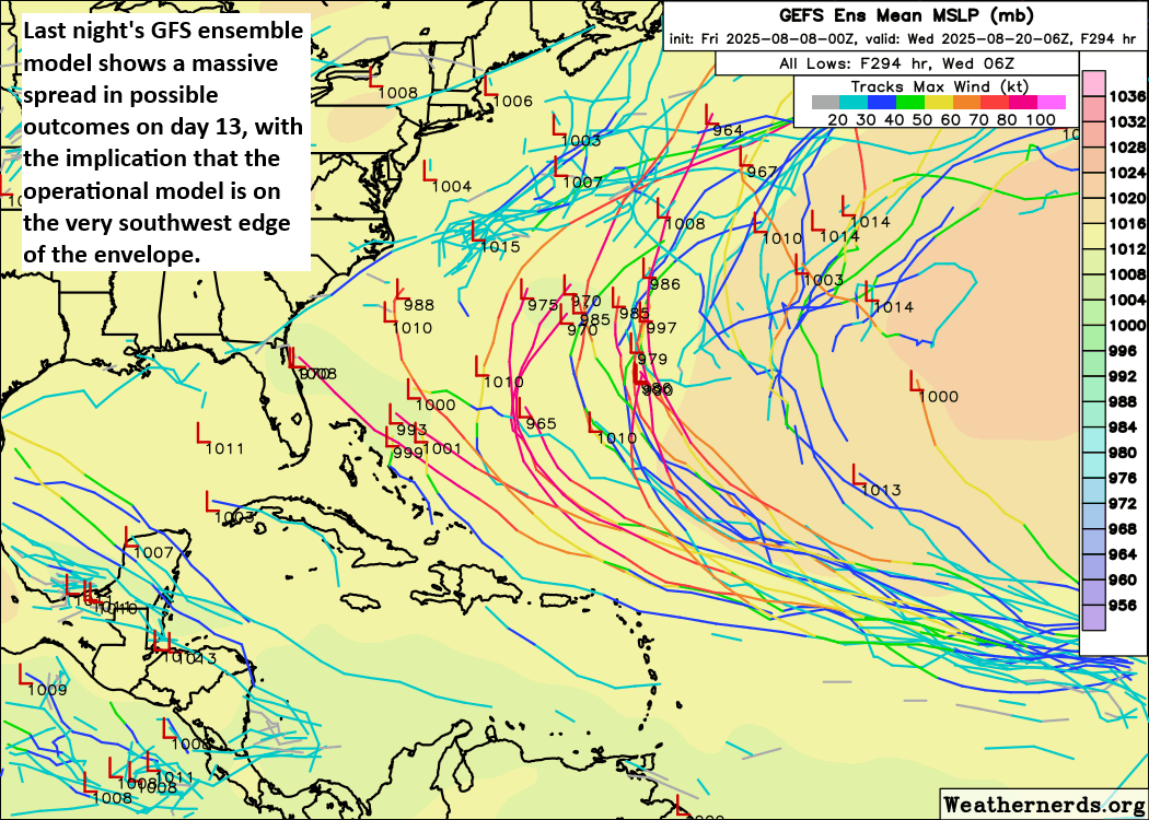
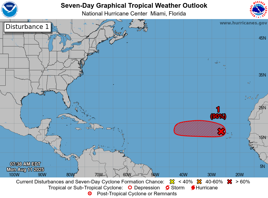
The aforementioned high pressure system’s placement over the Gulf will also play a role in the evolution of a tropical system now known as Invest 97L, but which is likely to become a tropical storm in a couple of days, and later a hurricane. This system is not much of a threat to reach the Gulf, but the placement of the high will help determine whether Invest 97L approaches the eastern United States or remains well offshore.
Monday
A quick look at the radar this morning shows plenty of showers offshore and to the east of the city, and these should gradually spread into the Houston metro area later this morning. As will be the case much of this week, the showers will be hit or miss, with a few embedded thunderstorms. By this afternoon we should see mostly sunny skies with high temperatures in the low- to mid-90s for areas along and south of Interstate 10, and mid- to upper-90s for inland areas. Winds will be fairly light, at 5 to 10 mph, generally from the south. Overnight lows may briefly fall below 80 degrees.
Tuesday through Friday
Our weather for much of the week will basically be rinse and repeat: highs in the mid-90s for most locations, and a decent (think 40 to 50 percent chance) of showers daily. For most of us, the showers will quickly pass, but there could be isolated, heavier downpours. Since we’re in the middle of August it’s going to be plenty humid with very warm nights. Skies will be partly to mostly sunny.
Saturday and Sunday
As high pressure builds heading into the weekend I believe we are likely to see decreasing rain chances and rising temperatures. Expect mostly sunny skies this weekend, with high temperatures generally in the upper 90s for areas away from the coast. If you’ve been waiting for (or dreading) the summer sizzle, it appears to be headed our way.
Next week
If high pressure does start to more directly influence our weather, how long will it last? That’s a question I really cannot answer, but there are at least some small indications that perhaps a rainier, slightly cooler pattern will return by the middle of next week or so. At least that’s the hope I have. We’ll see.
Atlantic tropics
The big storm everyone is watching this week is Invest 97L, which I mentioned in the introduction. I think there’s a good chance this will become the season’s first Atlantic hurricane, but for now it’s eventual forecast remains uncertain. What we can say is that it is almost certainly not a threat to the Gulf, or Texas. Matt will have plenty more information on this system all of this over at The Eyewall.