In brief: In today’s post we take a quick temperature check on TikTok, which seems hot and bothered about the possibility of a hurricane hitting Houston. In the real world, we discuss the forecast for the week ahead, which includes an elevated chance of rain on Friday from a tropical disturbance that is almost certainly going to move into Louisiana.
The TikTok hurricane
On Tuesday evening one of my daughters said “everyone” on TikTok is talking about a hurricane coming to Houston this weekend. At first, I thought it must be a few pot-stirrers, because nothing could be further from the truth. Why? Because:
a) There is no hurricane
b) A tropical system that probably won’t develop much is probably not coming to Texas
c) There is no credible basis on which to make such a forecast right now, like none
So we sat down and she showed me some of the videos. (Full disclosure, I just turned 52 years old, and I have only dabbled on TikTok. It’s just not my thing. If it’s yours, that is totally fine. I am not shaming anyone who likes TikTok or creates content there). I was blown away. The amount of misinformation is staggering, and these videos are being watched 100,000s of thousands of times, with this huge influential reach. It was to the point where my daughter was seriously concerned about the possibility of a hurricane coming to Houston, and asked me what we should do about it.
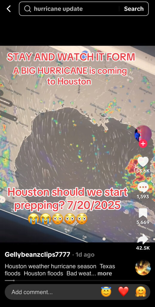


I have no desire to try and take on the Chinese government or ByteDance and its algorithm. I realize that misinformation is rampant across social media, not just TikTok, and that people are knowingly and unknowingly spreading it for various reasons. But it frustrates me because this kind of content spreads anxiety, which for some people is crippling; and the inevitable false alarms will only sow doubt and uncertainty when the time comes to take real forecasts seriously.
So with this post I just wanted to reiterate that Space City Weather will never play these games. We are not chasing clout. We aspire, above all things, to be boring and have boring weather to write about. We also acknowledge that we are far from perfect. We will make mistakes in our effort to predict the future, but they are honest mistakes and believe me, Matt and I agonize over them. In short, we are always going to try and bring you the truth about the weather as we see it. In 2025, that mission seems to be more vital than ever. So we fight on. We will do our utmost. I fear it will not be enough.
Wednesday
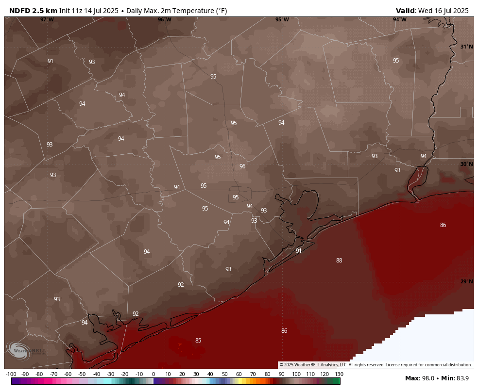
As pressures rise and atmospheric moisture levels fall, today should be mostly sunny in Houston with virtually no chance of rain. Instead it’s going to be a classic mid-July day with plenty of humidity, and high temperatures in the mid-90s. Winds will be light, from the south at 5 to 10 mph with slightly gusty conditions during the afternoon hours. Lows tonight will drop into the upper 70s.
Thursday
A day similar to Wednesday, although there is a slight chance of afternoon showers and thunderstorms along the sea breeze. Chances are 10 to 20 percent.
Friday
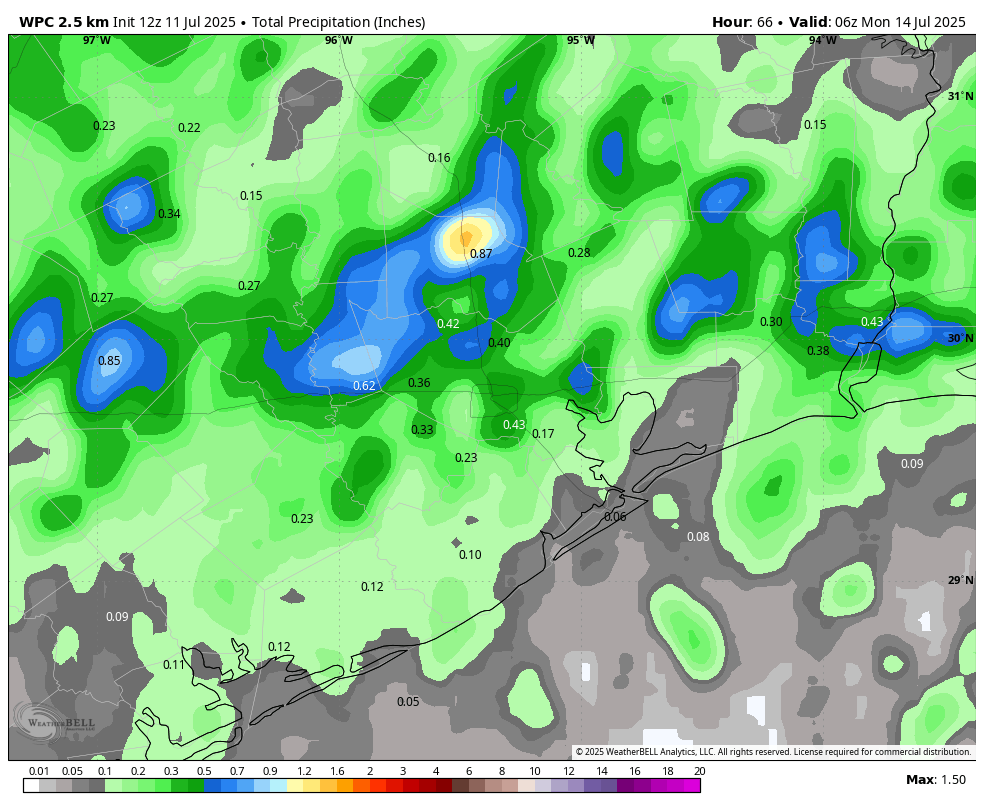
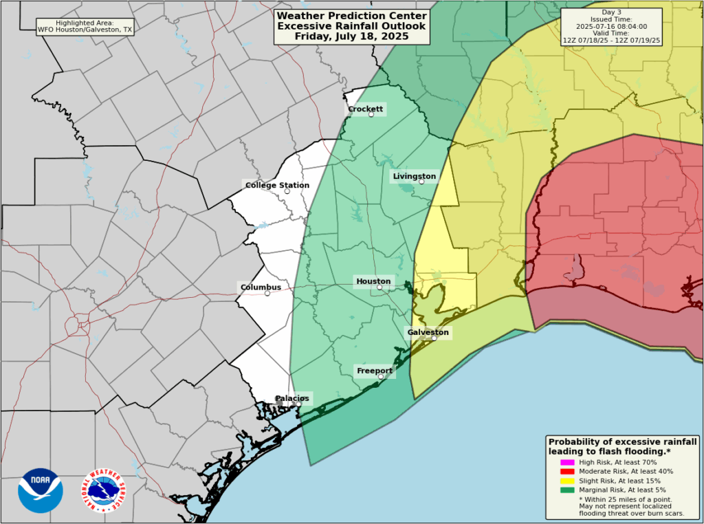
An increase in atmospheric moisture, related to the tropical disturbance in the Gulf, will bring a better chance of rain on Friday. These rains should be concentrated most heavily over Louisiana, and there is likely to be sharp gradient to the west approaching Houston. That is to say, there will be a line west of which rain is unlikely. Where will that line be? Interstate 45 is a decent guess, but the line could also be closer to Beaumont. The map below shows the best guess from NOAA’s Weather Prediction Center. My sense is that areas along and east of Interstate 45 have a decent chance to pick up 0.5 to 1 inch of rain on Friday, with lesser amounts to the west. But this forecast is very much written in pencil right now. Any winds and surge from the tropical system should not be impactful in the greater Houston region. Expect highs of around 90 degrees with mostly cloudy skies.
Saturday and Sunday
A decent chance of showers will linger into Saturday, perhaps about 40 percent, but this day should bring partly sunny skies back into the forecast with highs in the lower 90s. By Sunday high pressure should be taking hold, so rain chances should reach closer to zero, with mostly sunny skies and high temperatures in the mid-90s.
Next week
Most of next week looks hot and sunny, with highs in the mid- to upper-90s. Rain chances will be quite low for much of the week, although the upper air pattern could change toward the end of the week to bring precipitation back into the forecast. We shall see.
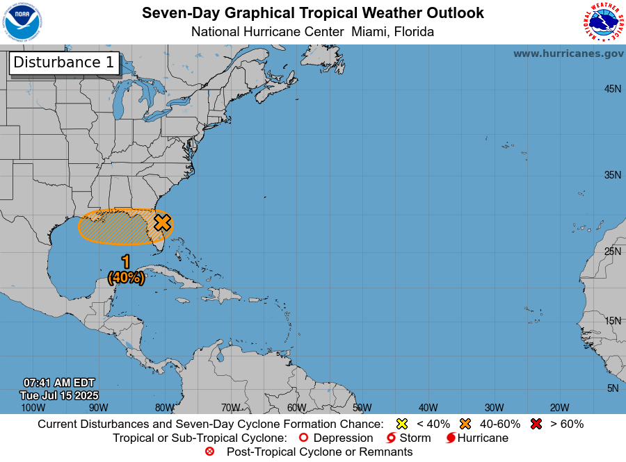
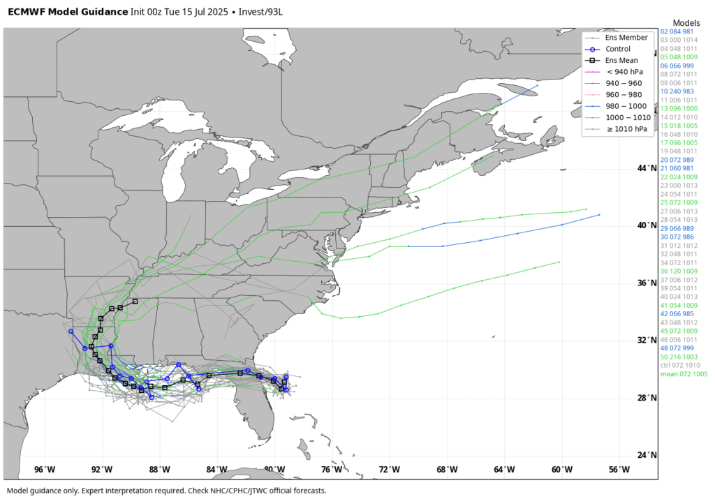
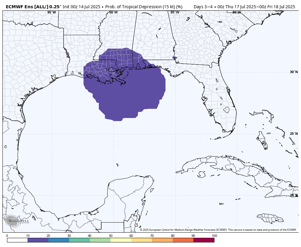
Invest 93L
So what really is happening with the tropical system? Not a whole lot. The ‘center’ has crossed the Florida peninsula, but it remains close to the Florida Panhandle this morning. This proximity to land will not help with any efforts to develop. Over the next day or so the center should remain very close to the northern Gulf coast, limiting development. There is a non-zero chance that some sort of center organizes further south today, and this would allow for more strengthening. However that appears fairly unlikely. Probably, the low pressure system will continue to track more or less west before moving into Louisiana on Thursday night or Friday, bringing an high chance of rain. The National Hurricane Center continues to indicate there is a 40 percent chance of a tropical depression or weak tropical storm forming before landfall.
Some of the models that were advertising extreme rainfall totals in southern Louisiana have backed off some. However, this is still a favorable setup for heavy rainfall so flooding along and south of Interstate 10 in Louisiana is a distinct possibility.
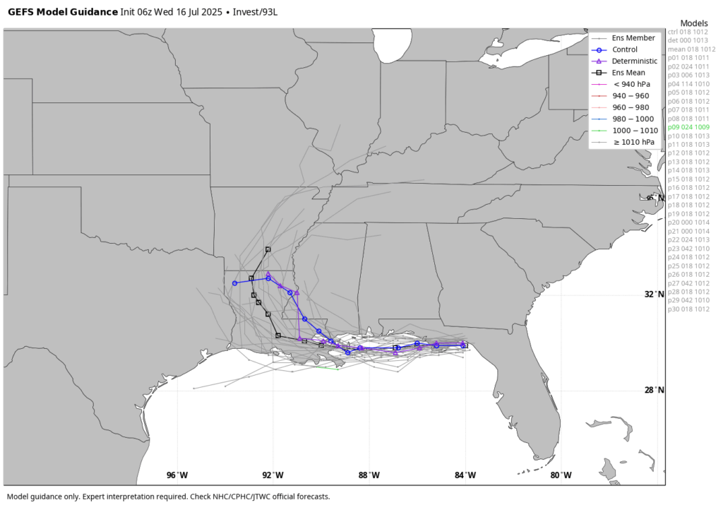
As ever with tropical systems there is inherent unpredictability, especially with systems that have yet to develop a well-defined center of circulation. But time is running out for Invest 93L to surprise us.