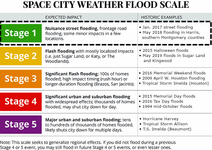
In brief: Houston has no weather concerns today, and most of Thursday should be fine. But beginning Thursday evening, and during the overnight hours, the region faces the threat of heavy rainfall. But for now, it’s only a threat, as our overall confidence is low. We’ve put a Stage 1 flood alert in place for areas along and south of Interstate 10.
Wednesday
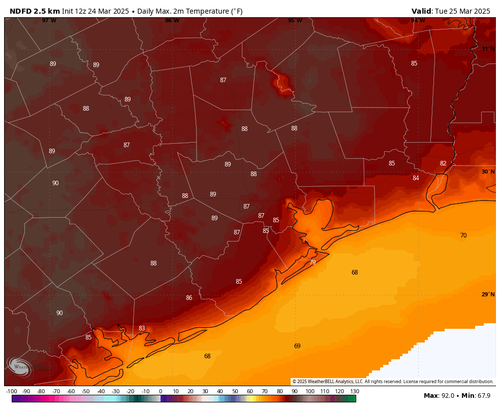
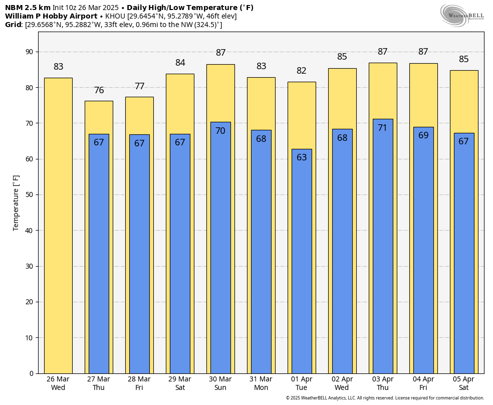
Houston’s high temperature reached 89 degrees on Tuesday at Bush Intercontinental Airport, the city’s official measuring station. Because there will be more clouds today, highs will likely top out in the mid-80s, but with dewpoints in the low 60s it will feel more humid outside. Winds will generally be light, from the southeast. The humidity party continues tonight, when lows will only drop into the upper 60s for most locations. There will also be a slight chance of some rain showers after midnight.
Thursday and Friday
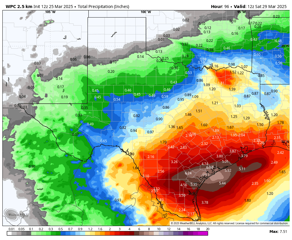
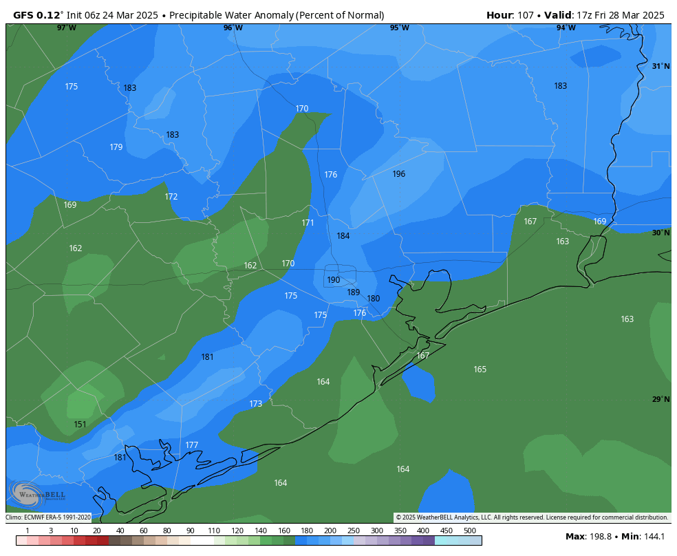
I’d love to provide you with some concrete answers about what to expect with the potential for heavy rainfall to end the work week, but they’re in short supply. Here’s what we do know. Most of Thursday, in Houston, should be fine. If there is heavy rainfall during the daytime, it likely will occur to the southwest of Houston, closer to Matagorda Bay than Houston and its suburbs.
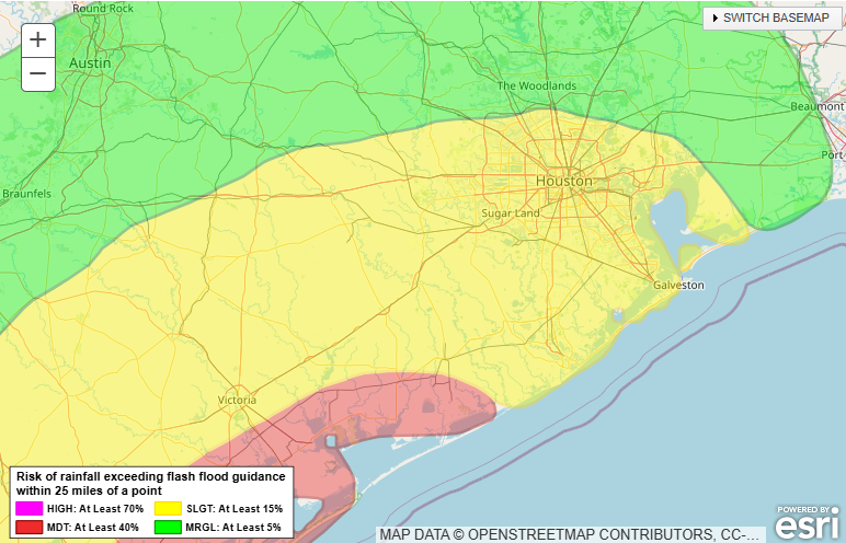
Beginning Thursday evening, and lasting through Friday afternoon, the environment over Houston will become more favorable for heavy rainfall with an atmospheric disturbance and plenty of moisture to work with. But does that mean you’re going to get 4 inches of rain on top of your house? No, it does not. Much of our guidance continues to indicate that the heaviest rains will fall to the west or, more likely, southwest of the Houston region.
We are just now coming into the forecasting range of higher-resolution weather models. These are trending much drier than the global models (which have shown a few inches of rain over the Houston metro area on Thursday night and Friday). By contrast, the higher resolution models are much spottier in terms of showers and accumulations. So which is correct? Well, normally in such situations I would side with the higher-resolution models, but they absolutely missed on Sunday night’s storms that moved through Houston.
The bottom line is that the region faces the potential for heavy rainfall to end the week, but the bust factor is high. Yesterday I called for a total of 1 to 4 inches of rainfall across Houston, and I think that’s still a good forecast range. This type of rain would be enough to cause some street flooding, but not much more. We will continue to watch things closely for you.
Saturday and Sunday
We remain pretty confident that any rain showers, such as they are, should end Friday night or early Saturday. This should leave us with a couple of warmer, at least partly sunny weekend days. Look for highs in the mid-80s with plenty of humidity. Some of the more intrepid among you might try to take that first dip in the pool, even. That’s because nighttime temperatures won’t provide much cooling, dropping only to around 70 degrees.
Next week
Do you like the warmer temperatures and humidity? Well, you’re in luck. After Monday and Tuesday, when a weak front may briefly bring some drier air, most of next week should bring days in the mid- to upper-80s with plenty of humidity. Perhaps we’ll see a stronger front by the following weekend. We’ll see.