In brief: Today’s post discusses the likelihood of widespread rainfall today and Wednesday ahead of the first of several decently strong cold fronts. Speaking of which, there’s the possibility of a freeze over the next 10 days, so we don’t advise planting tender plants just yet.
Winter is not over yet
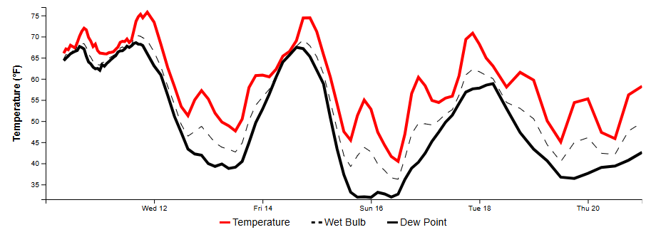
Houston has had an anomalously warm start to February, with an average temperature of 72.1 degrees. This is a shocking 16.2 degrees above normal through the first third of the month. Beginning Wednesday we’re going to enter a cooler, more seasonal pattern. Looking ahead, global models are pointing to the possibility of two stronger cold fronts next week.
The first of these arrives Sunday, and the second possibly by next Thursday or so. One or maybe both of these could drive Houston’s lows into the 30s, and there’s a distinct chance of a light freeze about 10 days from now. I’m not saying it will happen, but it’s definitely possible. So hold off on gardening for a little while longer.
Tuesday
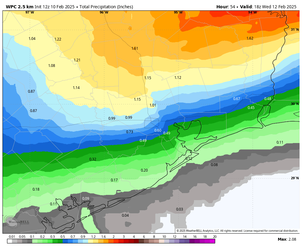
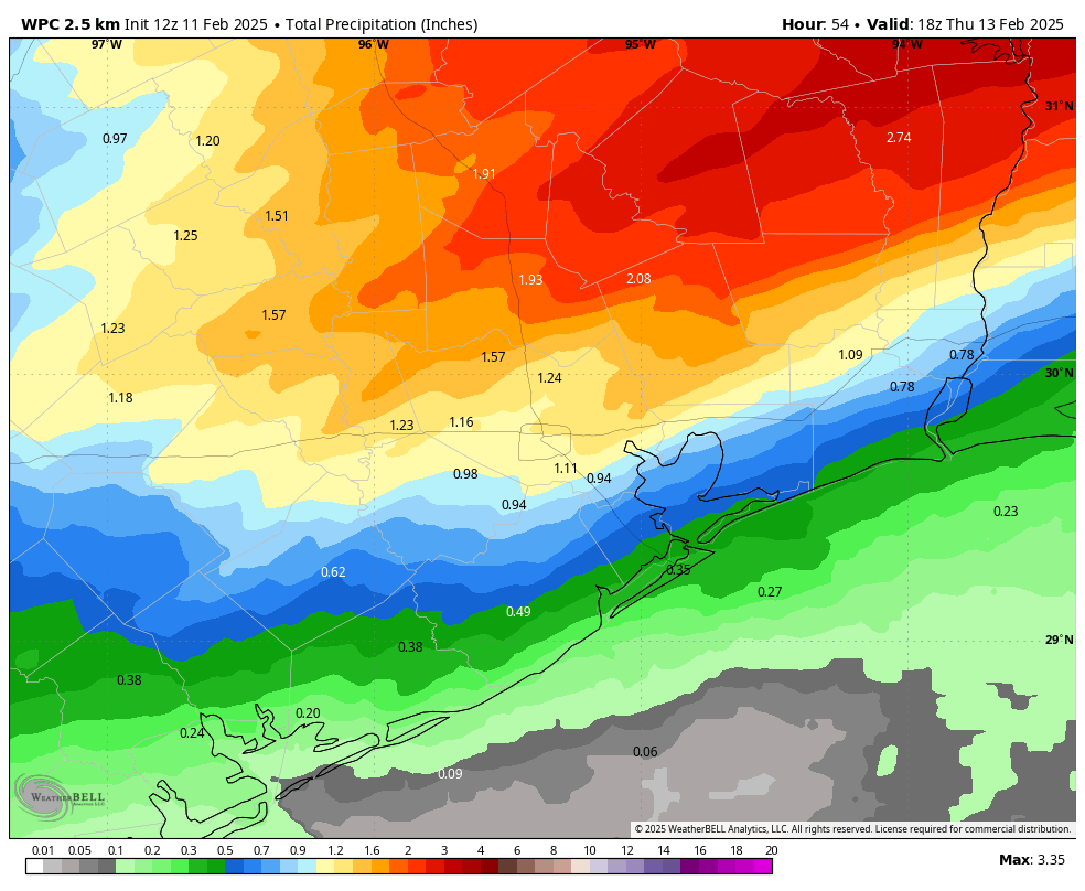
Today is likely to be a fairly wet day. We don’t really have any significant flooding concerns, but streets could pond over amid some of the stronger showers or thunderstorms. The rain will be somewhat scattered this morning before showers become more widespread this afternoon as the atmosphere turns unstable. Showers will likely peak in coverage this afternoon before rain chances diminish somewhat overnight. This won’t be the end of the rain, as we are likely to see another round of showers on Wednesday morning along with the front.
Temperatures this morning are generally in the upper 60s across much of Houston, and they’re going to remain there all day with cloudy skies and the potential for rain. Winds will be gusty, varying from the south, east, and northwest. Lows tonight will only fall into the low- to mid-60s for most locations.
Wednesday
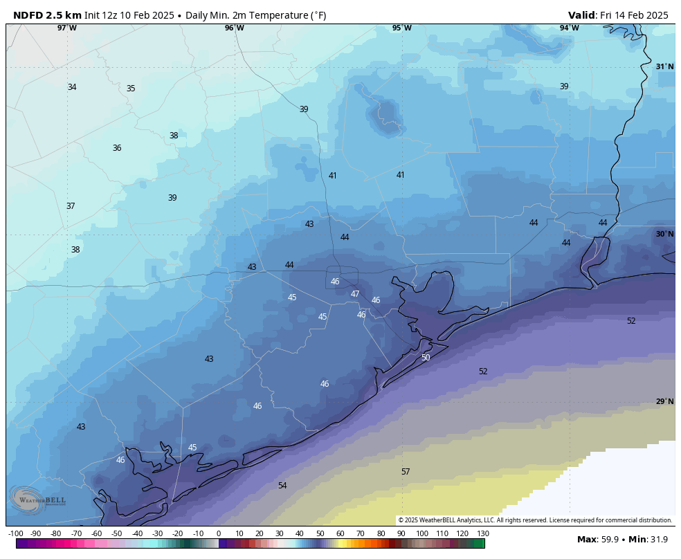
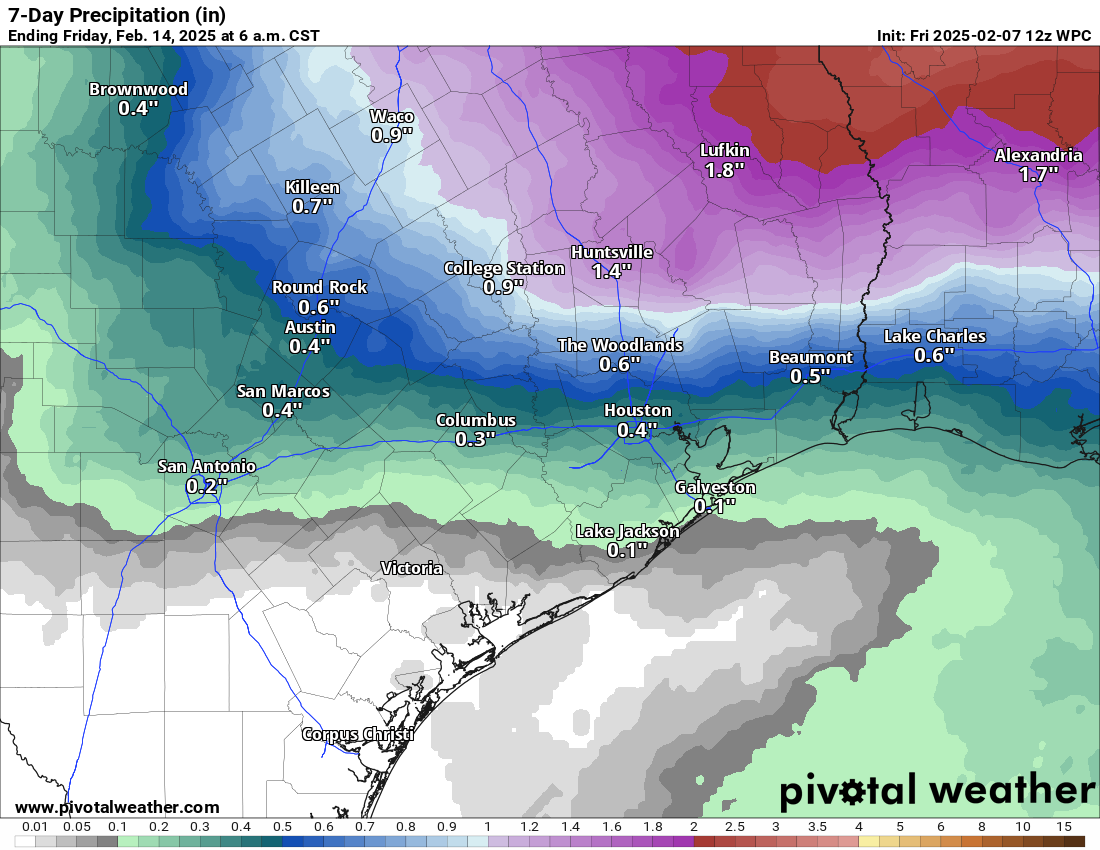
Additional showers are possible on Wednesday morning and into the early afternoon hours, ahead of the actual cool front. Between now and Wednesday afternoon I expect most of Houston to receive 1 to 2 inches of rainfall, although amounts could be a little bit higher for areas well inland, including The Woodlands and points north. Highs on Wednesday will be in the upper 70s for most before drier air moves in during the evening hours. Temperatures will start to fall before midnight, and by early Thursday morning temperatures for most of the area should dip into the upper 40s.
Thursday and Friday
These will be a pair of partly sunny days, with highs in the upper 50s to lower 60s. Thursday will see gusty, northerly winds and Thursday night will be quite chilly, in the low- to mid-40s. Friday night will be a bit warmer, in the 50s, as the flow turns more southerly.
Saturday
A warmer day, with highs in the mid-70s. We’ll again see the potential for some widespread (mostly light?) showers ahead of the next front. Accumulations don’t look overly impressive, but bear in mind the potential for rain if you’re planning outdoor activities. Colder air likely arrives overnight, pushing lows on Sunday morning into the 40s.
Sunday
Sunshine returns for the second half of the weekend, but with a colder, northerly flow high temperatures will likely be in the 50s. Lows on Sunday night could drop into the upper 30s in Houston, give or take. We’ll see.
Next week
Our roller coaster weather rolls on, with highs by the middle of next week likely rebounding into the 70s. However, most of our guidance points toward a fairly strong front for the second half of next week. This is when I think there’s at least a decent chance to see a widespread freeze in Houston.