With talk of invests, depressions, tropical storms, and hurricanes (oh my!), readers have asked about some of the science and processes involved with hurricanes. One question we received this week asked us to look at a hurricane’s structure, and where the worst weather occurs.
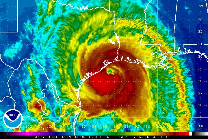
We’re all familiar with the basics—an eye in the center of the storm, and bands of rain and wind rotating around the eye. The eye and rain bands of a hurricane are formed by rising and sinking motion within the dynamic motion of the storm. Wherever air sinks in the storm, you see regions of little to no rain. The wind and rain in a hurricane are most intense near the eye of the storm. The convergence and uplifting of air here is so intense that massive amounts of latent heat energy are produced, creating very strong thunderstorms. This is why meteorologists always warn to never go out in the calm eye, because the worst part of the storm could immediately impact you.
As you move away from the eye, winds weaken and rain intensity decrease. However, this varies from storm to storm. Generally, even if you’re on the fringes of a hurricane landfall, you can still experience intense rain and tropical storm strength winds.
Where is the hurricane strongest?
Hurricanes are more intense on the right side of the storm, relative to the forward motion of the storm. The speed of the storm combines with the wind speed to create a net force, as the diagram below shows:
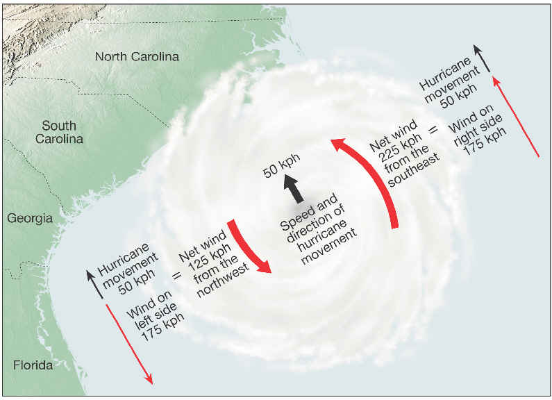
This results in a net increase of force (and, thus, wind speed) on the right side of the storm, and a net decrease of force and wind speed on the left. Since winds are what drive storm surges, “pushing” ocean water toward the shore, we also see the worst storm surges on the right hand side of the storm. You can see this effect on a map of Ike’s storm surge:
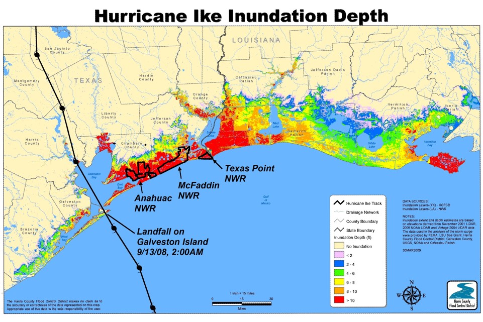
Areas in the right sector of Ike experienced much stronger winds and a stronger storm surge than those in the left sector. This effect is also why many people believe Hurricane Katrina could have been much worse for New Orleans in 2005. Katrina made landfall just east of New Orleans, leaving the city on the left, and therefore weaker, side of the storm. If Katrina had landed just west of New Orleans, meteorologists believe the storm surge flooding would have been much, much worse.
Thank you Braniff very enlightening facts. I never knew the difference was that great from the left to the right side.
Ike went just east of us in FWD. I was
working as a Spaceflight Meteorologist
in Mission Control during the Space
Shuttle era. I also flew nearly 50
Typhoon Penetrations w USAF&5
w NOAA. That was a great description
You gave; thanks
Why do hurricanes spin?
Because of low and high pressure