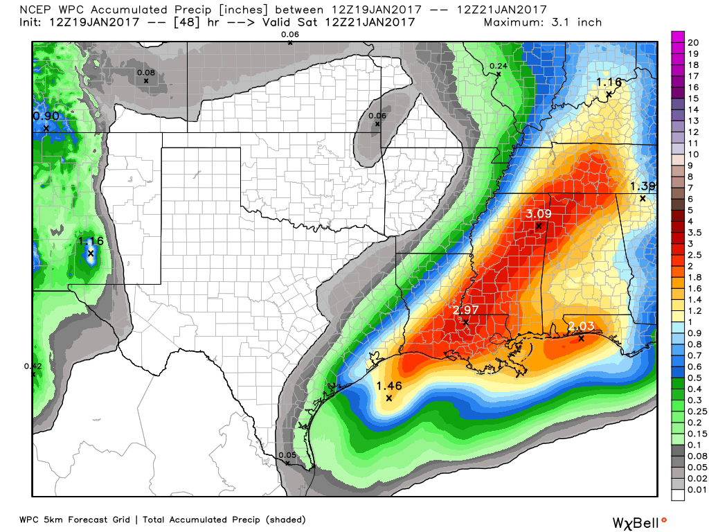
Good morning. Houston will face one more soggy morning before the widespread rain chances die down.
Today
Although the heaviest rain has moved well east of Houston, between Beaumont and Baton Rouge, an upper-level low pressure system moving into the region from the southwest will provide one final round of widespread showers—with a few thunderstorms—this morning. Accumulations for most areas should be 1 inch or less, which is more than manageable for area roadways and bayous. As rain chances fall off late this morning and early afternoon, look for high temperatures in the upper 60s.

Friday and Saturday
More unseasonably warm weather arrives to kick off the weekend, with partly sunny skies and highs in the upper 70s to about 80 degrees. Some rain chances may briefly return on Friday evening and into Saturday morning, but I wouldn’t expect anything too widespread or heavy.
(Space City Weather is sponsored by Westbury Christian School for this month)
Sunday
A moderate front originating from the Pacific (rather than Canada or the Arctic) will move through on Sunday, and as a result winds will blow out of the west, and then northwest throughout the day, gusting above 20 mph possibly. Skies will be sunny and temperatures likely will reach only the upper 60s. Lows Sunday night should fall to around 50, or into the upper 40s for inland areas. Amazingly, it would be Houston’s first night in the 40s since Jan. 9th.
Next week
After another coolish day on Monday, temperatures may warm briefly back into the 70s on Tuesday. However after that time it looks like a second cold front will move through, and this should drive temperatures back down to normal levels for most of the rest of January. What does this mean? Highs in the low- to mid-60s and lows in the 40s for most days. Rain chances should be fairly low, too.
Posted by at 6:45am CT on Thursday by Eric
Red alert Eric:
European model continues to predict sustained winds 20-30 mph with gusts 45-55 mph across a large part of southeast Texas from late Sunday morning to late Sunday afternoon. Peak winds are predicted to be across southern Montgomery and northeast Harris County.
Should we expect some brief power outages with such winds?
Winds at the surface (what you see on the European model is at least 30 feet above the surface, which does make a difference) will be mitigated by friction and are expected to be sustained 15-25 mph, maybe gusting to 30-35 mph at times. Winds over water will be much stronger. Typically, winds of that strength won’t cause major problems. This is windy, yes, but it’s not a major windstorm (unless you’re offshore).
God bless you, Matt!
But Matt, David Paul has reported that the Houston area has moderate chances of power outages on Sunday due to these winds, with the highest chance toward the coast. Do you agree with him?
But Matt, Ch. 11’s David Paul says there are “moderate chances for power outages” in the Houston area on Sunday due to the wind. Surely he’s wrong, based on what you’ve just told me.
All my thoughts on this weekend are here: http://spacecityweather.com/showers-breezy-sunday/