Good morning. Today we’re just going to take a quick look at the weather forecast, and then focus our attention on the tropics, where Invest 99L continues to be a system of interest.
Today
I expect another day like Tuesday, with only isolated to scattered rain chances and highs in the mid-90s (the temperature got to 95 degrees on Tuesday in Houston). Skies will be mostly sunny.
Thursday and beyond
High pressure is going to move off to the east later today or Thursday, and this should bring an increase in cloud cover and rain chances, likely keeping high temperatures to around 90 degrees. I do not anticipat any significant flooding, and most of the area should see only perhaps about an inch or so of rain over the next several days. However that does not preclude the possibility of some locally heavy rain. Essentially, expect our pattern of a cooler, wetter August to continue for most of the rest of the month.
Tropics
For a couple of days we’ve been discussing the possibility of a tropical system known as Invest 99L moving into the Gulf of Mexico, and that remains a distinct possibility. The system is not yet a depression or a tropical storm (it has an 80 percent chance of becoming one in the next five days, says the National Hurricane Center), but as it approaches Puerto Rico today it appears increasingly likely that it will reach Florida by Saturday or Sunday.
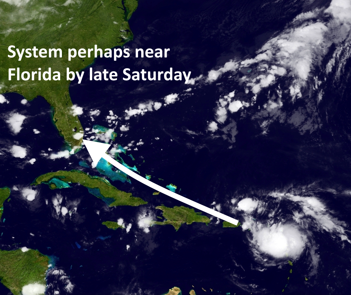
After that time the most logical forecast seems to be that the system would travel more or less due west, across the Florida peninsula, and into the Gulf of Mexico. This is because of a ridge of high pressure over the southeastern United States that would steer it westward.
What happens next is anyone’s guess. There is little sense in trying to pinpoint the details of a storm six or seven days out in the Gulf of Mexico. Even the best forecast models are likely to be hundreds of miles off at this time. The European model ensembles, which forecast a range of probabilities, show the system ending up anywhere from Mexico to the Florida Panhandle. That does mean Texas is in play for this potential hurricane, and it’s something we’ll need to watch for the next week. And we’re going to do just that. I’ll have a new update early this afternoon discussing the system and the latest forecast.
Posted at 7:05am CT on Wednesday by Eric
Thanks for the succinct, no-hype information. Keep it coming.
Thanks for the update,,,for those of us with boats on the Bay,,,,time to make plans..
Definitely have a plan. Don’t need to act on them yet though.
To speculate, if 99L organizes early as in the NE Caribbean, then it would have to contend with land interaction and then go the S Florida route, and the it could be an Eastern gulf state storm. If it waits until it gets to the Bahamas and then organizes,it may be a TX/LA storm.
As you suggested Sir, keep both eyes open now but don’t flip out just yet.
Good morning Eric,
Won’t that front coming in on Friday move over us and draw it to the East? Just wondering.
Thanks for all you do!
There is no front coming into Houston, alas.
Please post when Katy should start to panic.
Expect to see stories on TV soon which incite a run on bottled water and Oreos (and, later, the film of the empty shelves).