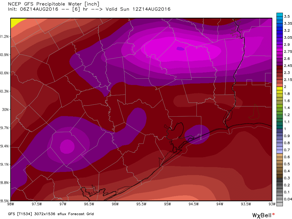
Tropical rains arrived in abundance on Saturday evening across the Houston region, proving that it only takes a matter of hours to go from near-drought like conditions to flooding. The low pressure system that flooded Louisiana on Friday and Saturday, has spread out over east Texas into a broad area of low pressure. At the same time atmospheric moisture levels are extremely high, which will allow for high hourly rainfall rates, possibly in excess of 3 inches per hour in some areas. This all adds up to the potential for ongoing and worsening flooding in Houston.
Today and Monday
The storm system has already flashed its potential this morning by dumping as much as 6 inches of rain to the northwest of Houston, near the Jersey Village area (a flash flood warning is in effect for this area). So far most bayous (including Cypress Creek and White Oak Bayou) are remaining within banks, but they have filled up quickly as the majority of the rain fell within about a three hour period. Fortunately this storm cell is now weakening, but if such an event repeats itself later today over this area, widespread flooding will likely result.

We’re going to see more of the same kinds of isolated very heavy rains today and likely Monday across the metro area, especially due to the slow-moving storms. We could even see some increase in coverage during the daytime hours with heating. The general consensus among forecasters is that most of the Houston metro area should receive an additional 3 to 7 inches of rain today and Monday, with higher isolated totals such as we’ve seen near Jersey Village this morning. We’ll have to watch these areas for street flooding and, eventually, full bayous.
Tuesday through Friday
Atmospheric moisture levels will remain pretty high for the rest of the work week. I’m not sure storms will have quite the punch they will during today and Monday, but it looks as though we’ll see heavy rains closer to the coast in the morning, and spreading further inland during the late morning and afternoon hours with daytime heating.
It is difficult to assess the true concerns about flooding. A total of 10 inches of rain spread out over five or six days won’t cause major problems. However if we get 10 inches in two days, that will definitely cause problems on roadways, and lead to at least some isolated neighborhood flooding.
The upside of all of this mess is cooler temperatures. Lows this morning fell into the mid-70s across much of the area, with highs only climbing into the upper 80s most days.
We’ll update conditions later today.
Posted at 8:10am CT on Sunday by Eric
Got 7.5″ in Copperfield last night. Horsepen Creek nearly top out its banks.
Fortunately it has fallen back some today.
Got over 8″ from Sat & today here near Tomball… Minor road flooding that quickly subsidied…