After a spike in humidity since Tuesday, more refreshing weather will filter into Southeast Texas today. That will set the stage for what should be a pretty quiet weekend.
Today & Weekend
The cold front discussed this week will finally slide through here today. Humidity should still be a bit high this morning, and areas of fog around the region will lift. As the afternoon wears on, we’ll see humidity drop. By later today, dewpoints drop into the mid 60s in most of Southeast Texas.
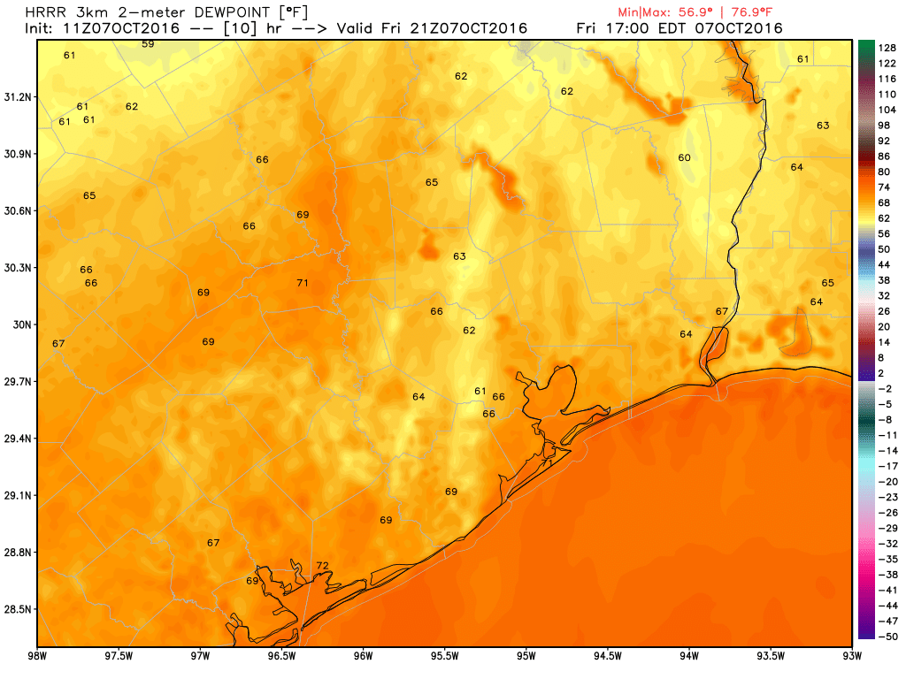
High temperatures today will top off near 90 degrees, so it won’t exactly be suddenly beautiful. Saturday will still be a tinge humid, but high temperatures should be a couple degrees cooler.
Here’s where it gets fun: A secondary cold front pushes through here Saturday night and Sunday morning. Dewpoints will plummet into the 50s and 40s, and that will feel amazing. Lower temperatures will come with that, and expect highs on Sunday to be in the mid 80s. Morning lows by Monday should be in the 50s in the suburbs, 60s in town. Some more autumn for you.
Next Week
I could probably cover this in a simple sentence: Next week looks quiet. But you came here for some details. So the first couple days next week look great. Expect sunshine and pleasant, continued refreshing temperatures, with highs in the mid 80s and lows in the mid 60s. Humidity will slowly creep back in as the week wears on, and I expect dewpoints to get back into the upper 60s or low 70s (unpleasant) by Wednesday and Thursday. Rain chances look minimal through most of next week. High temperatures by late week should be back into the upper 80s again.
Hurricane Matthew
Hurricane Matthew is passing perilously close to the Florida Space Coast this morning.
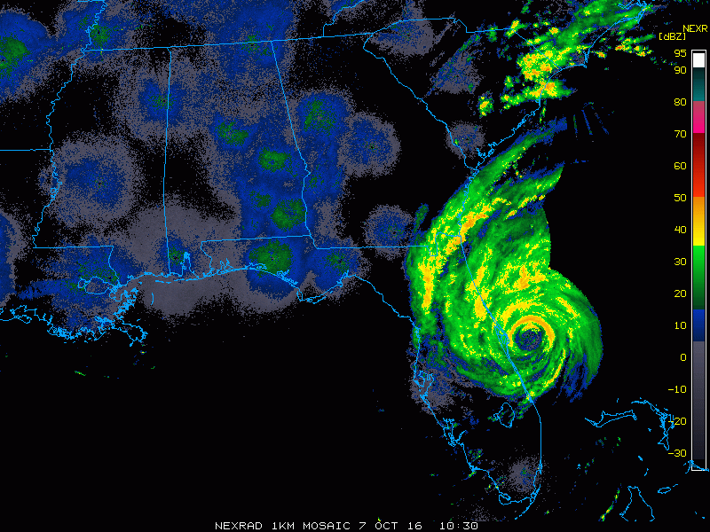
Wind gusts close to 110 mph have occurred near Cape Canaveral this morning, and with the eyewall hugging the coast, strong hurricane gusts will probably continue as it moves toward Daytona and Jacksonville. Matthew has peaked in intensity and will slowly weaken from here on out.
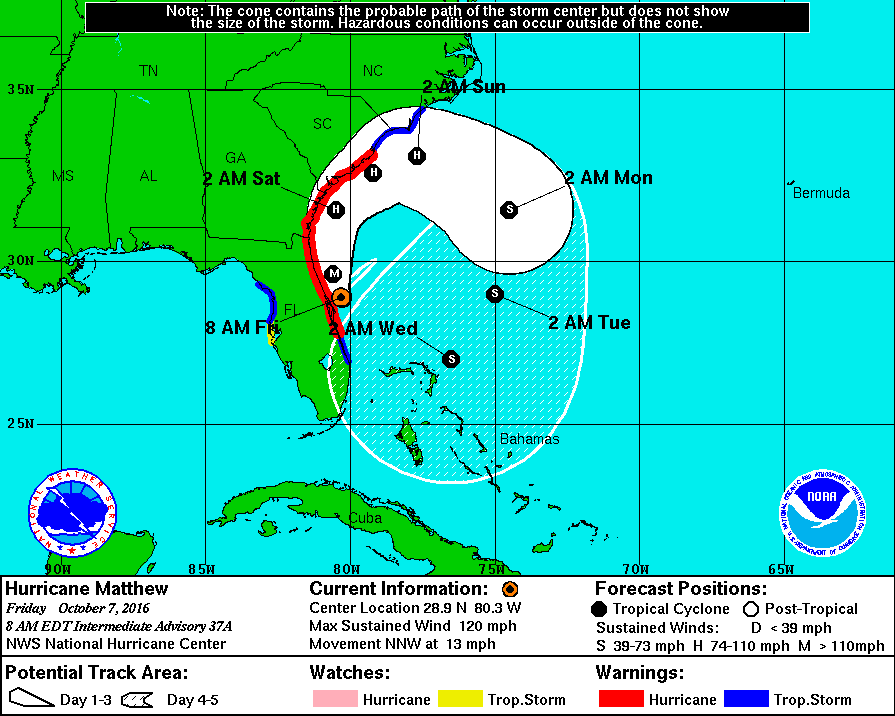
One thing I want to make abundantly clear to folks: There’s been a lot of “chatter” out there about the fact that Matthew will do this loop off Florida: It heads out to sea and then turns south and west back toward Florida again. First, this is a lot more common than people realize. Go back over historic hurricane tracks and you’ll see some doozies of paths taken by storms that seem totally bizarre. Second, even if Matthew does do this loop and comes careening back into Florida, it will be a shell of the storm it is this morning. It will have a more hostile environment, and it will have churned up enough colder water in its wake on the first pass to ensure it doesn’t get strong the second time around. Third, even if this storm somehow makes it into the Gulf, it’s unlikely to amount to anything. It’s also important to note that no reliable weather model shows this happening anyway. So rest easy, Houston, and hope for good news out of Florida today.
Those of us around for Allison are familiar with tropical storm loops.
So nice to hear a reasonable voice when it comes to Matthew.
Hi Eric,
Just curious about Austin and the Austin City Limits Fest this weekend. Do you think the secondary cool front will make it through Austin during the afternoon or at night On Saturday? Just want to prepare for how humid it will be Saturday for the concert. Thanks in advance!
Matt – any long range forecasts for Wings Over Houston in two weeks?
Am thinking we finally turn cooler by then.