Good morning. It’s going to be a busy day across Southeast Texas, especially as we get deeper into it. I’ll update the Facebook page this afternoon if conditions warrant, and look for another post here this evening, once we get just a little more clarity on how things tonight into Wednesday will unfold.
THIS MORNING & AFTERNOON
There should be no serious issues this morning. A few showers will be around, but severe weather should be absent from our area. A few stronger storms could get going east of I-45 by Midday however.
Houston will be in an interesting spot today. The atmosphere is capped at present (meaning there’s basically a “lid” on things that will suppress storms this morning). As the day goes on, that cap will dissipate, and we’ll be able to start generating thunderstorms. What does all this mean in English? It may take some coaxing to get storms going today. That said, once they do get going, it won’t take a lot for them to become strong or severe, so you’ll want to stay on guard today.
So bottom line: Scattered showers and hit/miss thunderstorms today. Rain totals should be manageable outside of the heaviest activity. Most folks should see 0.5″ or less during the daytime today, with isolated higher totals in any more stubborn storms (where up to 2″ or so will be possible).
TONIGHT
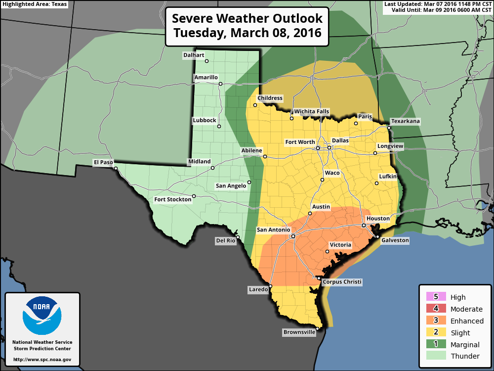
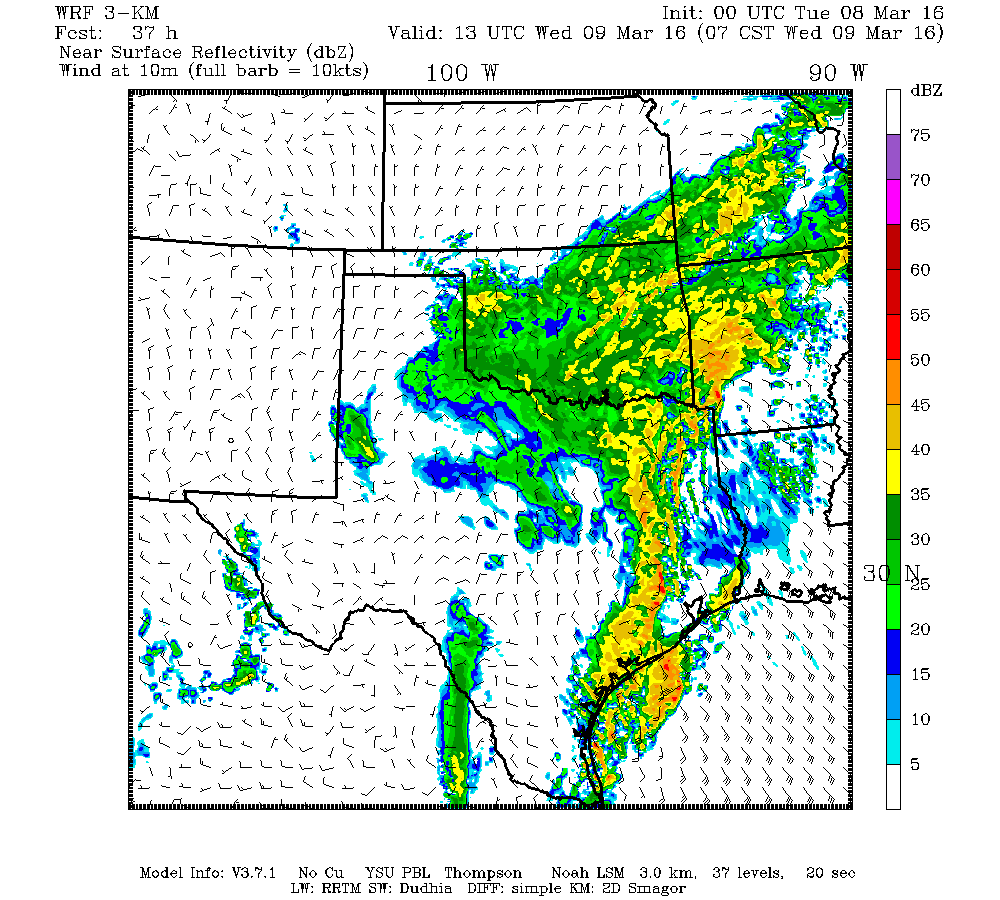
Things get more complicated tonight. We’ll see scattered showers and storms become more numerous. At the same time, a vigorous complex of storms is going to develop south and west of San Antonio. That will press eastward overnight and Wednesday morning, with new storms forming ahead of it. Unfortunately, I think this is going to arrive in Houston right around the AM commute Wednesday. Plan accordingly. There will be a severe weather threat tonight, with all the usual hazards being possible: Strong, damaging winds, some hail, and, yes, a modest tornado risk. The biggest of issues however may be rainfall. We could easily see 2-5″ of rain from just the storms tonight, with some areas likely seeing more (up to 7-8″ in the worst spots). There will be a definite flash flooding risk, and I would anticipate that areas typically prone to flooding will experience issues tonight and Wednesday morning. Again, plan accordingly.
Also, as Eric has emphasized, this setup is different than Memorial Day of last year (particularly the fact that we’ve had very little rain the last couple months). But that aside, you’ll want to respect this event, exercise sound judgment, and heed warnings from the National Weather Service.
WEDNESDAY
No big change in thoughts here. The main event will shift east of Houston during the morning, but rains could continue throughout the day, especially on the east side of the city. There could yet be a third round of storms however Wednesday night coming in off the Gulf. If I had to place bets, I’d say that misses us just barely to the east, but we’ll add more rain. It’s something I’ll be watching and update you on later today. Additional scattered storms will be possible Thursday and Friday as well.
What time is “tonight?” 5 pm? 8 pm? Would be helpful to have a time frame for those of us with plans in the evening.
Hi Eric & Matt, I love the website. Just wondering if you’re going to do an update on tonight’s weather?