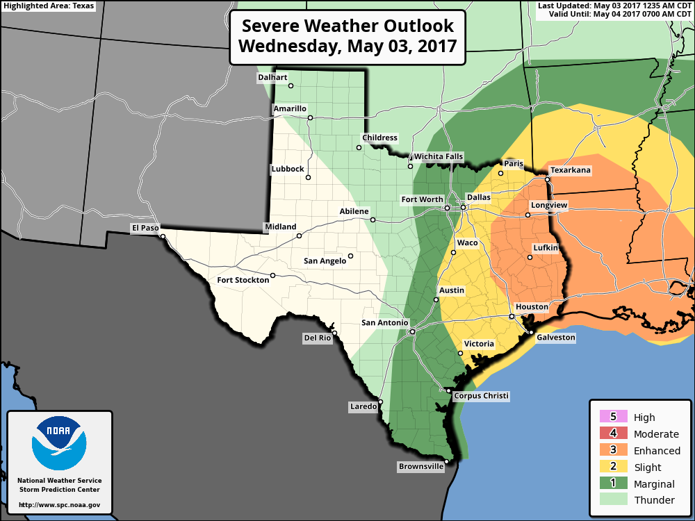
Good morning. Storms are possible this morning and evening in Houston, some possibly severe, before the region sees a great stretch of weather for late spring.
Wednesday
A warm front lifting into Houston from offshore has helped develop some scattered showers and thunderstorms across the area early this morning, and as this system moves off to the northeast it could serve as a focus for additional storms this morning. Most of this activity will probably occur over the eastern half of the Houston area and it should move off to the northeast by later this morning, if not before.

Round two will move into the Houston region later this afternoon and during the evening hours—possibly hitting the city around the evening commute—as a cold front approaches the area. Confidence is increasing in a solid line of showers and thunderstorms, some likely severe, sweeping from northwest to southeast through Houston and off the Gulf coast by around sunset or shortly afterward. Again we’re concerned about hail, winds, and relatively brief periods of heavy rain that may briefly flood low-lying streets. The bottom line is before you head out today, check the radar and any warnings. Fortunately it should all be over later tonight, as a cold front moves through the area, and dries us out pretty quickly.
(Space City Weather is sponsored this month by Jetco Delivery)
Thursday
This is going to be really nice day, with highs only reaching into the mid-70s under mostly sunny skies. The only concern is gusty northwesterly winds, but think of this as Mother Nature battling the humidity—and winning a glorious victory.
Friday through Sunday
Get ready for a spectacular weekend for the month of May. Morning lows will fall into the mid-50s on Friday for most of Houston, and only warm a little bit, to about 60 degrees, by Sunday morning. Meanwhile, afternoon highs should remain in the low 80s, with mostly sunny skies and fairly low humidity. What a weekend. Can’t wait.
Next week
Temperatures are going to slowly climb next week, but I don’t think we’re going to see any major heat (i.e. temperatures of 90 degrees). Also, after today, rain chances will fall off the cliff for pretty much all of the next work week, as the models don’t return any significant chance of rain until May 11 or 12, next Thursday or Friday.
Posted at 6:40am CT on Wednesday by Eric