We just wanted to give a quick update today on the concerns regarding severe weather. We noted yesterday that there was still some uncertainty in details for today. The majority of the area experienced a really, really nice morning. As we march through the afternoon hours, showers or sprinkles are likely to begin developing. Per the National Weather Service and after looking at some near-term model data myself, it’s clear that the Houston area is in a “capped” environment this afternoon. We talk about the cap often, and basically that’s what helps Houston frequently avoid some of the more ballistic severe weather events that occur off to our north and west. So, assuming that the cap is likely to hold through the afternoon, we shouldn’t see much more than a few showers.
The exception to this could be north of I-10, farther from the Gulf and more likely to see the cap erode enough to allow for some heavier showers or storms late this afternoon or evening.
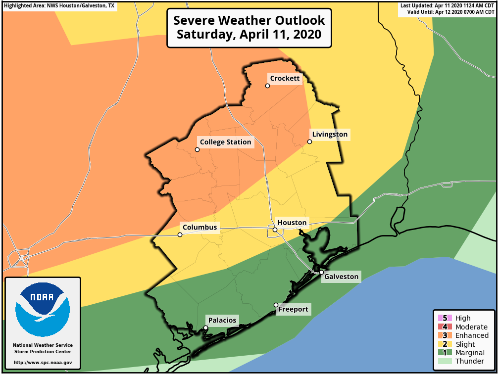
So, with all that in mind, you can see the Storm Prediction Center’s outlook here. The risk for severe weather generally will go up as you go north and west of the Houston metro area. The highest risk through this evening is probably along or northwest of a line between Crockett, College Station, and La Grange. That’s not to say we couldn’t see severe storms pop before midnight farther south and east; it just doesn’t seem super likely right now. So, keep tuned into the weather, but we aren’t real worried right now.
Overnight
Things do change a bit overnight. We enter into a slightly better and more supportive environment for thunderstorms to develop. But even then, I am still seeing some evidence of “capping” in the models over Houston. I think the general rule of thumb will be that we’ll see scattered showers and storms overnight. Most should be under control and many of us won’t see much of anything. As you go north and west of Houston, the chance that one or two of those storms could become severe increases. I would really watch the area west of San Antonio toward Del Rio closely tonight for potential of some pretty significant storms capable of producing large hail or tornadoes during the late evening and early overnight hours.
Those storms west of San Antonio are likely to congeal into a line of storms and move east along and north of I-10 overnight, arriving in the Houston area sometime around or after sunrise tomorrow morning. The main concern as those pass would be strong, gusty winds, but the chance of an embedded tornado is not zero. Again, the rule will be that the farther north you go, the more likely you see stronger storms. Some areas south of Houston may not even see much of anything overnight and Sunday morning. But the time we should be paying closest attention is probably from 5 or 6 AM through 9 AM or so.
Easter Sunday
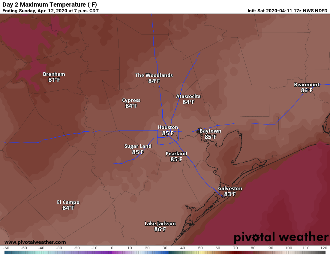
Once the showers pass off to our east on Sunday morning, we should see rapid clearing of skies by midday. Winds are going to begin to crank out of the west at 15 to 20 mph, with higher gusts, especially over the bays and near the coast. Temperatures will surge into the middle or upper-80s as humidity plummets. I wouldn’t rule out 90° tomorrow either for some folks. A windy, hot Easter afternoon.
The cold air arrives Sunday night, and by Monday morning we’ll be back in the 50s, struggling to get to 70 degrees Monday afternoon. More on that Monday.
Southeast severe weather
A quick PSA from us: While we aren’t expecting a lot of significant severe weather in our area tomorrow morning, there is a decent chance that this will be a very serious severe weather outbreak to our east. From northern Louisiana through much of Mississippi and Alabama into Georgia, and possibly Tennessee and the Carolinas, the potential exists for a significant tornado or severe weather outbreak tomorrow and tomorrow night into Monday morning.
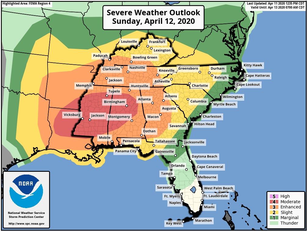
A moderate risk (4 out of 5) is in place for tomorrow’s activity across Louisiana, Mississippi, and Alabama. This could be upgraded to a high risk tomorrow if confidence increases in a potential tornado outbreak. If you have friends or relatives living east of here in any highlighted yellow, orange, or red area on the map above, please make sure they’re following the weather situation in their local area.

Thank you for the weekend update! This is very helpful!
I was hoping to see an update for this weekend today. Thanks for taking the time to do one up, Matt.
We’ve been wondering about the change in the Earth: less pollution, more quiet, less heat being produced during quarantining. Any forecast of that impact on hurricane season? What about the impact of it all starting up again, abruptly?
Thank yoU!
Thank’s for the update!