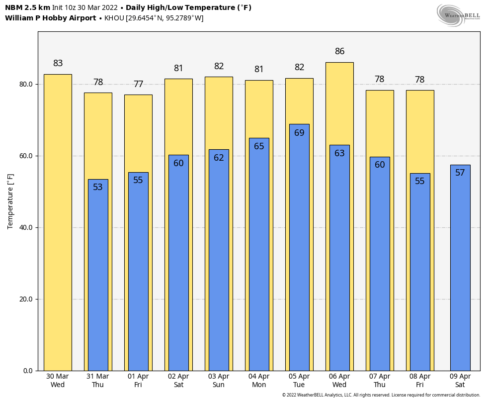
Good morning. A thin line of showers associated with a cool front will move through the region this morning, setting the stage for a breezy afternoon. This will lead to mostly sunny weather for most of the remainder of this week, and a warm weekend.
Wednesday
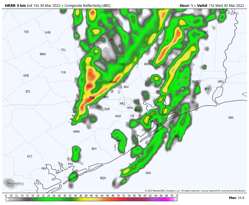
Conditions are warm and muggy in Houston this morning, with lows only falling into the 70s across much of the region. The front should reach central Houston by late morning, and push off the coast by around noon or shortly thereafter. Some showers and and briefly strong thunderstorms may accompany the front’s passage, especially north of Interstate 10, but they will quickly move through. After the front much drier air moves in, and a “red flag” warning is in effect for the area from 1 pm to 7 pm as northwesterly winds gust to 20 or 25 mph. This means that any fires that start will spread quickly, so please take care. Winds will slacken tonight as lows generally drop into the low 50s.
Thursday
A lovely day, with sunny skies, light winds, and highs in the upper 70s. Lows should be similar to Wednesday night, albeit a tad warmer.
Friday
Expect another spring-like day, with mostly sunny skies. There will be a bit more humidity as winds turn easterly, however, and lows Friday night will only drop into the 60s.
Saturday and Sunday
Conditions will be warmer this weekend, with highs generally in the 80s and lows in the low 60s. We’ve still got a few questions about the details, but most likely we’ll see partly to mostly sunny skies to go along with moderate southerly winds.
Next week
As moisture piles up in our atmosphere, humidity levels will increase further early next week, with highs remaining in the in low- to mid-80s. Nights will start to become muggy again. Rain chances increase on Monday night and Tuesday ahead of the next front, which should arrive on Wednesday or so. This will probably push overnight lows back into the 50s.
Attempting to figure out most of the acronyms in the map above;
HOU- Houston (Hobby Airport),
BMT- Beaumont,
ORG- Orange,
SGR- Sugar Land,
VCT- Victoria,
EFD- Ellington Field ?,
IAH- Intercontinental Airport Houston,
Etc.
Most of them seem to be abbreviations for regional airports. See https://www.txdot.gov/inside-txdot/division/aviation/airport-directory-list.html. Don’t know what the ones off the coast are; maybe oil rigs?
Airport codes here: https://en.wikipedia.org/wiki/List_of_airports_in_Texas
Try the Airports option on https://www.airnav.com/. That’ll give you airport info as well as translating the code for you.