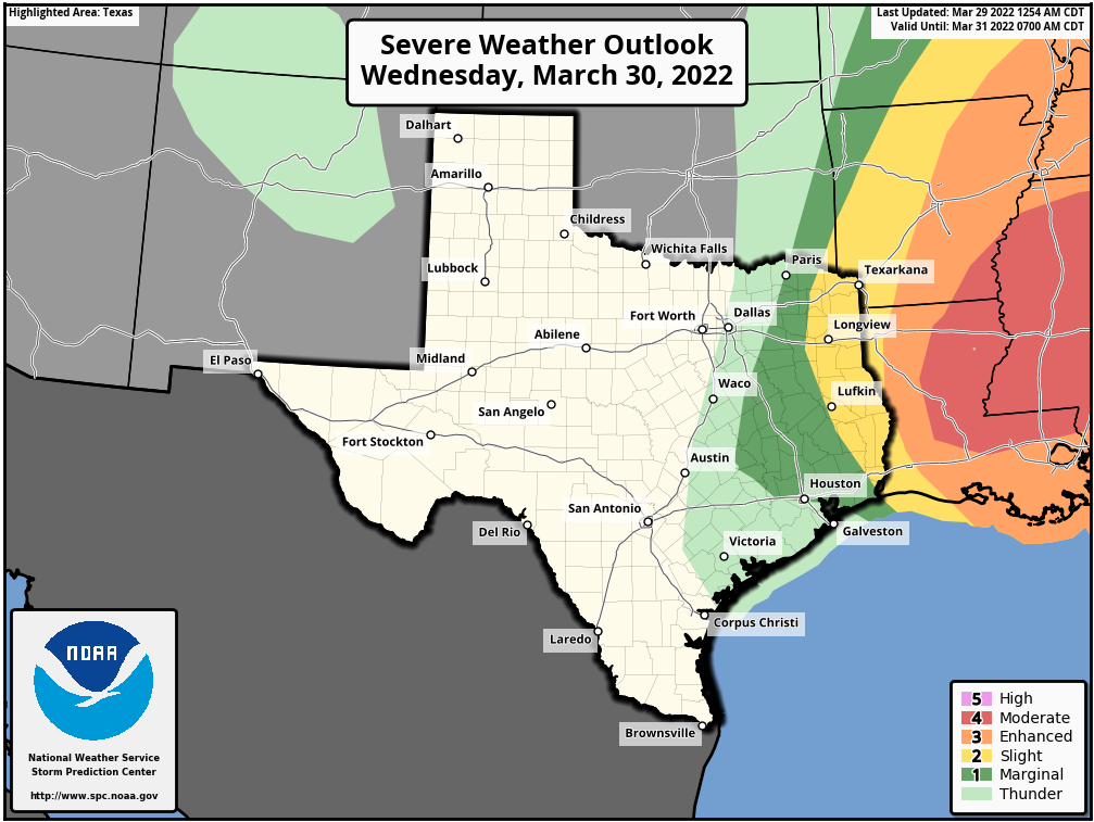
Good morning. Today will see very windy conditions as the onshore flow kicks into high gear, and this will set up a frontal passage on Wednesday morning. This front will bring a thin line of rain showers, which may include a few strong thunderstorms. This will set the stage for mostly sunny, and milder weather for the rest of the week.
Tuesday
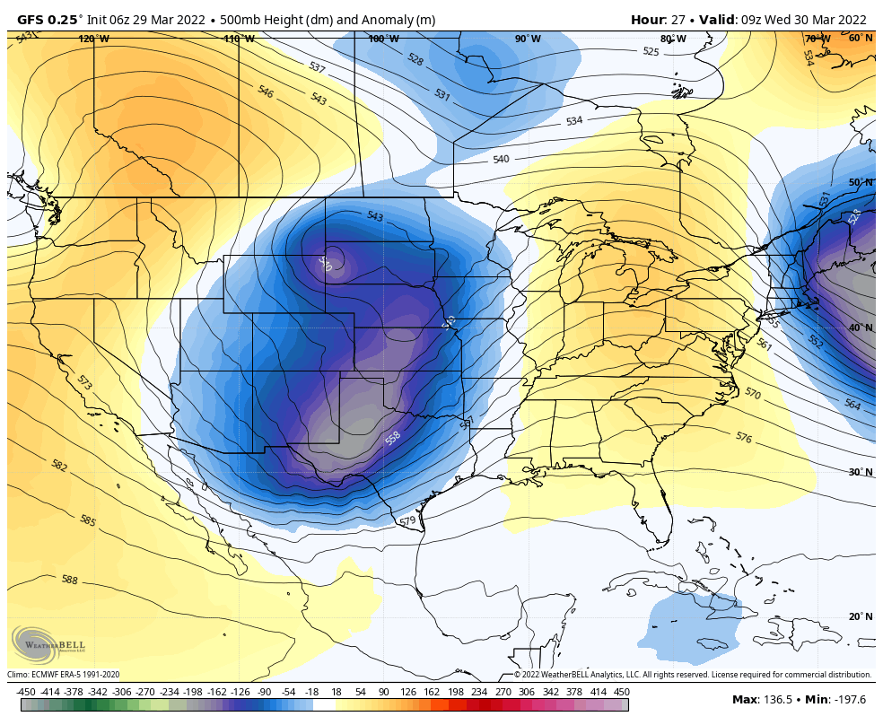
During the spring we get days like this, when there is higher pressure offshore and a potent low pressure system in the middle of the United States. This effectively sets up a tight pressure gradient and strong onshore winds. Intuitively, to me, these kinds of days feel like summer is trying to force its way back into the area after a few months of mostly cooler and drier weather. Anyway, it will feel like that today, with southerly winds gusting as high as 30 to 35 mph this afternoon and overnight. Despite partly to mostly cloudy skies, highs should still get into the low 80s. Dewpoints in the 60s will make it feel fairly humid. Lows tonight may not drop below 70 in parts of Houston.
Wednesday
The aforementioned low pressure system will drive a surface front through the area on Wednesday, likely reaching areas north and west of Houston by around sunrise, reaching the city during the mid-morning hours, and the coast around noon. A line of thin showers and thunderstorms should accompany the front, but overall accumulations will probably only be on the order of a few tenths of an inch of rain. We can’t rule out a few thunderstorms, but by far the better chances for severe weather lie well to our north and east (which you should note if you’re traveling toward Louisiana, Mississippi, or Alabama). Dry air and clearing skies will see temperatures jump up into the mid-80s, or so, during the afternoon hours before lows drop into the low- to mid-50s overnight.
Thursday
As noted yesterday, Thursday’s weather should be superlative. Look for a high near 80, with sunny skies, light winds, and dry air. Lows Thursday night will again drop into the mid 50s.

Friday
Another nice day, although there will be some clouds perhaps, and humidity levels will start to creep up along with the onshore flow. Highs should again be near 80 degrees.
Saturday, Sunday, and beyond
A reinforcing cold front should arrive Friday night or Saturday morning, bringing a low chance of rain back into the forecast. However, this should clear out by the afternoon. Look for highs in the low 80s on Saturday with clearing skies, and around 80 degrees on Sunday with sunny skies. More clouds return Monday, with a healthy chance of rain entering the forecast by Tuesday or so of next week.
Please tell me there will be enough rain to knock down some of this pollen.
I still would like to hear some comment on why the winds have been so much more punishing these past few months.
Winter is finally over!! Good riddance!! I can return to Houston soon!! I’ll probably flee Houston again next winter if we get another awful La Nina!!