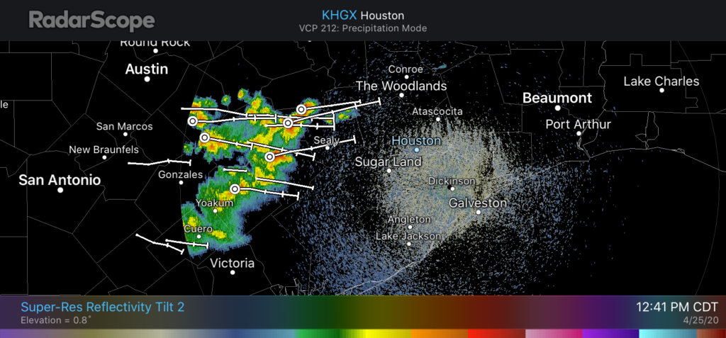
Well, some days Mother Nature can still surprise you.
As late as last night it appeared the atmosphere would dry out at all levels in the wake of Friday night’s cool front. However, that has not happened sufficiently. As a result, a fast-moving kink in the atmosphere will cross Houston from west-to east from around 1pm to 4pm today, and have enough moisture to work with to produce storms. The threat is briefly heavy rainfall and hail.

The storms should clear the area quickly, and we expect mostly sunny weather before and after, with a pleasantly cool evening. Low temperatures on Sunday should drop into the upper 50s for areas north of Houston, and we do expect a fully sunny day for the second half of the weekend.

Sitting here in Columbus now as they pass thru. Saw some sized hail and briefly heavy rain.
Dime sized…
Is this headed for Beaumont, or will it go north of us as the recent storms have?
We just had some dime size hail in Columbus, fortunately not much (12:40 pm).
Sitting here in The Woodlands thinking what an incredible beautiful day. It’s in the mid 70’s and clear skies. It is fascinating to me to see the different weather just around the greater Houston area.
I saw this on the radar and did a little dance at the surprise.
Thanks for the update Eric!
Tryyyyying to rain in Sugar Land…..
In Pecan Grove, we got perhaps 9 fat drops on the sidewalk and a cool breeze. We could really use some rain—but you can keep the hail. 😉
Thank you for the update
Well I wouldn’t agree with the storms clearing quickly like you mentioned. I’m in the spring area. They rolled in around 1pm and it’s almost 8pm and they are still here
Even now (8:45 PM), in Richmond, we are hearing quite a bit of thunder. What an absolutely bizarre day weather-wise
Thunder and rain (!) shortly after 9 PM in Pecan Grove.
Pea sized hail sprang up on us near Round Top amid the sunny skies and the zero non percent chance of rain forecasted!