Good morning. If you were surprised by the widespread nature of showers and storms on Saturday and Saturday evening, you’re not alone. The forecast for Saturday—we expected sunshine and dry air to prevail—was a total bust. Matt did an analysis of the event on Twitter, and summarized the situation as follows, “Yesterday in Houston was one of the most impressive forecasting busts I’ve witnessed & been part of in a long while.” Needless to say, we’ll learn from this.
Monday
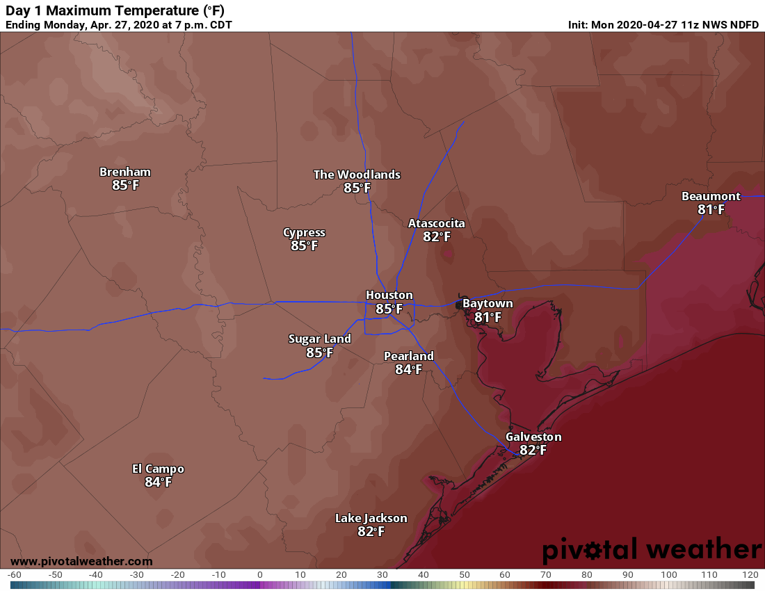
Houston is enjoying a pleasant morning, with lows down near 60 degrees in the city. Today should be another sunny affair, with highs pushing into the mid-80s. Humidity will be much more noticeable, as winds really pick up from the south, possibly gusting to 20mph. As a result of this more southerly flow, clouds should build tonight, and this should help prevent low temperatures from falling much below 70 for the area.
Tuesday
Clouds will remain on Tuesday, but highs will still get into the mid- to upper-80s as a warmer pattern prevails. Winds will still be active, blowing out of the south at about 15mph. A few scattered showers are possible Tuesday, but the better rain chances will probably hold off until the overnight hours.
Tuesday night and Wednesday
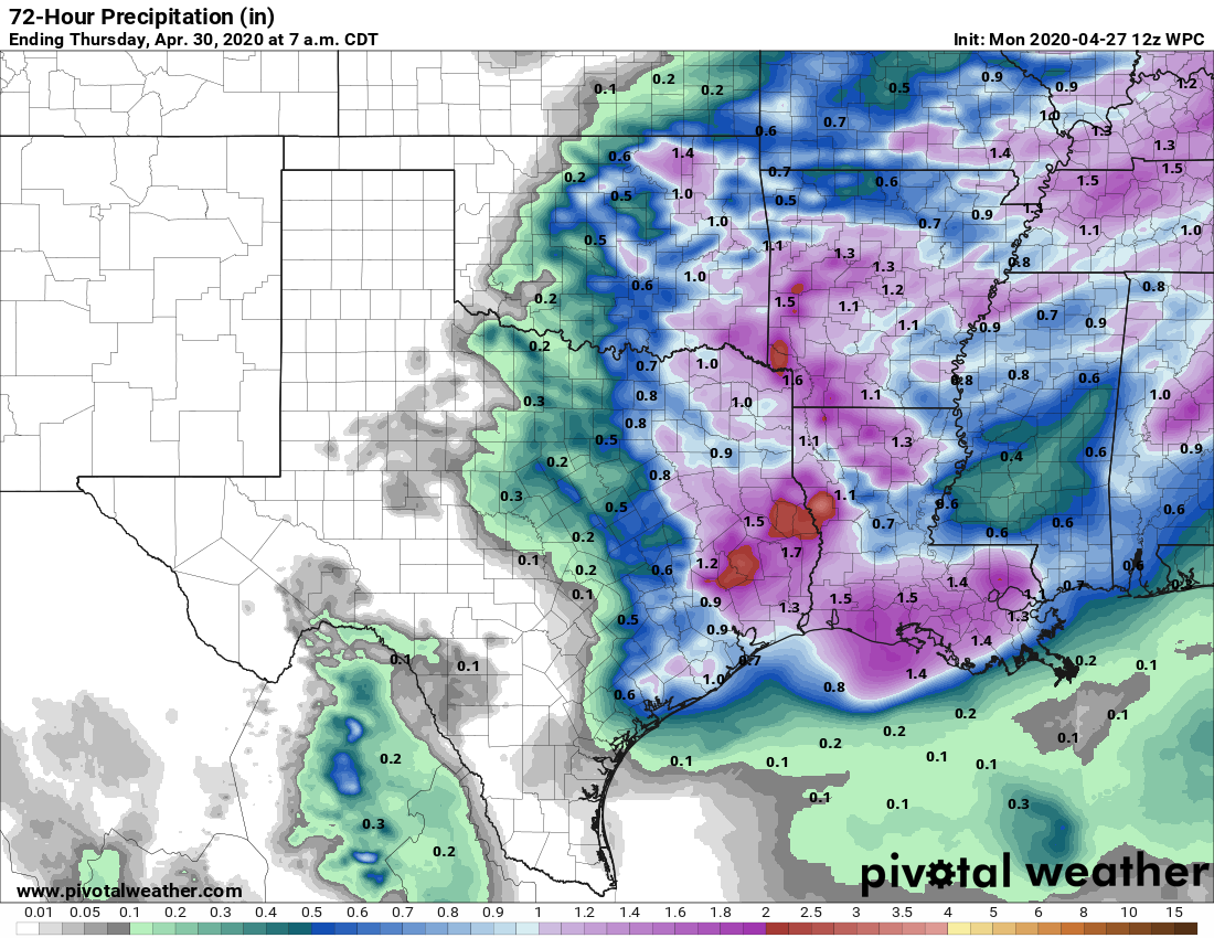
On Tuesday night, likely some time after midnight, a strong system will approach and move through the region. Right now, it appears as though this system will take the form of a fairly strong squall line, advancing through Houston from north to south after midnight and before sunrise on Wednesday. The main threats are damaging winds, and briefly intense thunderstorms. After these storms, we anticipate clearing skies as drier air moves into the region. Wednesday should end up being a nice day, with highs in the mid-80s. Wednesday night will be quite cool in the wake of this system, with drier air allowing temperatures to possibly drop into the upper 50s.
Thursday and Friday
These should be a pair of sunny, pleasant, warm days with highs in the mid-80s. The drier air will begin to wash out by Friday as the southerly flow returns.
Saturday and Sunday
Do you like summer? Because the first weekend of May, 2020, may have the feel of almost summer-like weather. Both days should see highs of around 90 degrees, with partly sunny skies, and plenty of humidity. More details as we get closer.
When will you make the hurricane forecast for this summer?
I would be grateful if you could information on wind speed and direction to you outlooks. As a bike commuter and rider it helps me plan my day.
Got my hopes up this weekend, but alas no significant rain.
Lately it seems like the League City area is missing all these rain events. We haven’t gotten appreciable precipitation in a while. We need it! I hope early Wednesday morning is our chance!
Clear Lake got only a few drops! We need a nice, slow soak
Yes we do. It looks like Wednesday morning could a line of brief, heavy rain, which while not optimal is better than nothing.
The opening description of your “missed” forecast was honest and entertaining. How refreshing! To those of us with no weather forecast training, we find it almost magical that you get it right as often as you do. For you to err…well, it just makes you human! Thanks for your work. I love subscribing to your forecasts. I enjoy great writing as much as I enjoy knowing what weather to expect.
How do we get the weather pattern to shift so that we get some rain south of I-10. The trees are really beginning to suffer.
Indeed, the cool evenings are nice, but not going to last much longer.
Are the very clear skies at all related to the cleaner air due to less driving in the current situation?
The super high cloud base with the saturday storms was cool to observe. Definitely unusual for this part of the world. There was some solid wind at the front edge of the storms as they arrived, presumably due to the evaporation of the rain as it hit the dryer air below the high storms. Was a good chance to explain how that works to my kids.