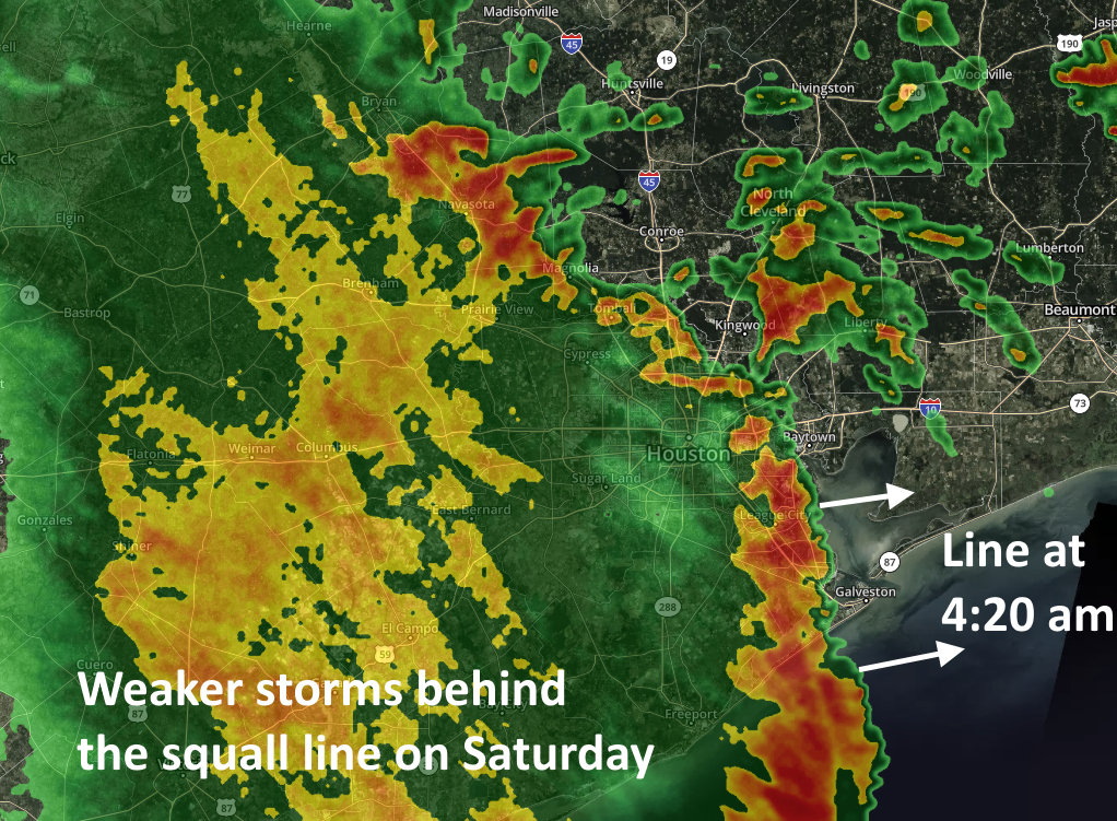
Good morning. After Friday’s unexpectedly widespread storms—with flash flooding in areas such as League City, Seabrook, Kemah, and elsewhere—conditions early Saturday are going more to form. A fairly strong squall line with gusty winds and briefly intense rainfall has pushed through most of the metro area as of 4:30am CT, and it should be well east of the metro area by sunrise. It has generally dropped 0.25 to 0.75 inches of rain.
This should be the worst of the region’s weather, but the upper-level low pressure system we’ve been talking about remains just to the north of our region. This should continue to drive showers and possibly some thunderstorms through the morning hours and into the early afternoon hours. These storms that develop should be weaker and less widespread as they move from west to east. Accumulations following the squall line’s passage should be less than one inch for most parts of the metro area today.

A lesser chance of showers and storms will persist through the overnight hours and into Sunday. The greater likelihood of development will be over Montgomery County and points north, away from the coast and areas hardest hit on Friday. Sunday should see partly sunny skies in addition to the possibility of some occasional light to moderate showers.
By Monday the drier air should take effect leading to sunnier days and clear nights. This should have the effect of dropping lows into the upper 60s, making for quite pleasant evenings and mornings. Our advice is to enjoy the relatively low humidity while it lasts.

Having been woken by the storm around 4:15am, the first thing I did was grab my phone to read your late evening update from yesterday to see what info I had missed. Having a hard time going back to sleep, I saw this emailed update and just wanted to thank you for being there for Houston residents in weather events. You always go above and beyond in keeping us informed in a fun, but intelligent way and I, for one, am grateful for you both. Thank you.
Thx Eric
Great report
Kingwood area got a nice bit of rain with that stall line. That passed over about 4:30am ish.
Love the reports.
All the best
Sometimes we forget just how important Space City is, with Eric and Matt at the helm, but these two are saviors when the Rain Comes.
1.5″ in greater downtown Ellington. Just enough. Thanks!
Thanks for your 0400-ish work…greatly appreciated!
I am a weather enthusiast and was introduced to your work by my daughter only recently. While I am loaded to the gills with weather apps, I find your approach very refreshing and innovative, looking forward to it routinely.
Please keep up the great work!
Thanks Eric and Matt
You guys are the calming voice in the storm ( all storms).
Thanks
Eric,
Can you comment on yesterday afternoon’s storms? Upper air charts showed usual west to east flow yet these storms moved generally east to west against this flow. I’ve never noticed this pattern before, and I’ve been here in Houston since 1980. It’s as if the entire rain event was confined to the lower 5000 ft or so of the atmosphere.
Can you comment on the lightning activity of the Friday evening storm? We’re on the west end of Galveston island and I’ve never seen so much lightning before. It was non-stop for over two hours
The lightening was awesome!! Some of the most beautiful strikes I’ve ever seen! It looked like the sky was fracturing like a mirror! Just spectacular!!
Keep up this weather guys! It’s been a beautiful spring.